


Patrick Vanbellinghen

 Visorando Member
 Premium user
Sign up:
Published route(s)
 Tour of the Waterloo battlefield, 1815
 4.53 mi
 +141 ft
 -138 ft
 2h 10
2h 10
 Easy
Easy
 Departure from Waterloo (Brabant Wallon)
Starting from the 1815 site, this circular route takes you across fields to explore the sweeping landscapes of the Plancenoit and Braine-l’Alleud area, the site of Napoleon’s final battle. Largely along country lanes, you’ll be accompanied by the song of the lark and the call of the pheasant. If you’re lucky, in the early morning you might spot a roe deer coming out to feed. And, for history buffs, there are a few reminders of the battle at the start and end of the route.
A little trip to Paradise starting from Braine-l'Alleud
 4.03 mi
+157 ft
-144 ft
2h 00
Easy
Departure from Braine-l'Alleud (Brabant Wallon)
4.03 mi
+157 ft
-144 ft
2h 00
Easy
Departure from Braine-l'Alleud (Brabant Wallon)
Starting from the Étangs du Paradis, here is a circular route to discover the rural side of Braine-l'Alleud towards Ophain-Bois-Seigneur-Isaac. Les Hayettes, Village No. 1, the ponds and the new swimming pool in Braine are dotted along a very varied route.
Lagorce, starting from the D558 near the Lodges de Coucouzac estate
 3.42 mi
+305 ft
-282 ft
1h 50
Easy
Departure from Lagorce (Ardèche)
3.42 mi
+305 ft
-282 ft
1h 50
Easy
Departure from Lagorce (Ardèche)
From the Ibie Valley, make your way to and explore the little village of Lagorce by a route other than the road, setting foot on the land that nourishes the vineyards and, further on, the fields and meadows. At the end of the day or early in the morning, startle a wild boar rooting around in a field and approach the village gently, making your way up to the church from below and winding your way up the narrow cobbled streets before returning via an old path between the houses.
From the old canals to the new canal between Seneffe and Godarville
 6.71 mi
+184 ft
-174 ft
3h 15
6.71 mi
+184 ft
-174 ft
3h 15
 Moderate
Departure from Seneffe (Hainaut)
Moderate
Departure from Seneffe (Hainaut)
Here is a pleasant circular route mainly along the water’s edge with an unusual point of interest. To explore it properly, bring a torch. You’ll be able to see inside the Godarville boat tunnel, though without actually entering it. Those with a keen eye will spot here and there remnants of times gone by, such as landing stages, bollards or mooring posts, and a variety of birds, including cormorants.
Ittre and the Brussels-Charleroi Canal
 6.25 mi
+472 ft
-453 ft
3h 15
Moderate
Departure from Ittre (Brabant Wallon)
6.25 mi
+472 ft
-453 ft
3h 15
Moderate
Departure from Ittre (Brabant Wallon)
Starting from the pleasant little square in Ittre, a small path quickly leads to unusual places so close to the town. Then there are vast landscapes stretching as far as the eye can see, followed by a pleasant walk through the Bois du Chapitre forest as you continue on your way. This is how this circular route is constructed, with a few streets here and there connecting the paths that take precedence here. And, as the icing on the cake, you pass by the Brussels-Charleroi Canal, discover lock no. 5 and the Ittre marina, and, before setting off again, stroll through the narrow streets of Ittre.
Ittre and the Château de la Tournette golf course
 6.46 mi
+338 ft
-351 ft
3h 15
Moderate
Departure from Ittre (Brabant Wallon)
6.46 mi
+338 ft
-351 ft
3h 15
Moderate
Departure from Ittre (Brabant Wallon)
A circular route almost entirely through the countryside, starting from the centre of Ittre and ending at the Château de la Tournette golf course. Along the way, the Ravel cycle path runs alongside the Ri Ternel river, taking in the sweeping agricultural landscapes on the heights of Haut-Ittre – with, among other things, its beautiful hedgerows allowing nature to flourish – and crossing the golf course, all in an atmosphere of calm and serenity.
In the fields between Ophain, Lillois-Witterzée and Bois-Seigneur-Isaac
 7.12 mi
+210 ft
-194 ft
3h 25
Moderate
Departure from Braine-l'Alleud (Brabant Wallon)
7.12 mi
+210 ft
-194 ft
3h 25
Moderate
Departure from Braine-l'Alleud (Brabant Wallon)
Farmland stretching for over 10 km, sunken lanes, a walk through the Bois des Drapes, and very few houses – this is the setting for this circular walk starting from the Place d’Ophain. The wind blows across the plateaus and the undergrowth remains cool. The path is suitable for pushchairs and bicycles.
Circular route between the 1815 site and Maransart
 8.89 mi
+436 ft
-417 ft
4h 30
Moderate
Departure from Waterloo (Brabant Wallon)
8.89 mi
+436 ft
-417 ft
4h 30
Moderate
Departure from Waterloo (Brabant Wallon)
This is a magnificent walk that can be enjoyed on foot or by mountain bike. It takes place almost entirely in the beautiful countryside of Walloon Brabant, amongst fields, meadows and woodland. The surfaces vary: tarmac, old cobblestones, farm tracks and footpaths. In autumn, pheasants are everywhere and you may be lucky enough to spot a herd of does emerging from beneath the trees at the edge of a wood to feed on fresh grass in a meadow.
Plancenoit – Les Flamandes – Maransart
 6.02 mi
+285 ft
-295 ft
3h 00
Moderate
Departure from Lasne (Brabant Wallon)
6.02 mi
+285 ft
-295 ft
3h 00
Moderate
Departure from Lasne (Brabant Wallon)
Starting from the charming Place de Plancenoit, this circular route takes you on a journey of discovery through the landscapes of Walloon Brabant, across fields and through woods. Most of the paths are natural, whilst others have been developed. Pleasant surprises await walkers, despite a 2 km stretch along the roadside as there are no connecting paths at this point. Sturdy walking boots may be useful, especially if it has rained in the days leading up to your walk. The route is not recommended for pushchairs or people with reduced mobility (narrow, sometimes muddy paths; crossing a field).
From Pen Castel to the covered walkway at Arzon along the shores of the Gulf of Morbihan
 6.27 mi
+102 ft
-102 ft
3h 00
Moderate
Departure from France
6.27 mi
+102 ft
-102 ft
3h 00
Moderate
Departure from France
From the Pen Castel tidal mill, this circular walk follows the coastal path all the way along the Saint-Nicolas, Kerners and La Palisse headlands until it joins another path heading inland to reach the Grah Niol covered walkway. The return journey follows paths cutting across the last two headlands to reach the Pointe de Saint-Nicolas and its superb coastal path, lined with spectacular trees that are just waiting to be admired once more before reaching the Pen Castel mill.
A short walk in Ransbeck
 1.89 mi
+135 ft
-164 ft
1h 00
Easy
Departure from Lasne (Brabant Wallon)
1.89 mi
+135 ft
-164 ft
1h 00
Easy
Departure from Lasne (Brabant Wallon)
Here’s a short, circular walk to enjoy when you’re looking to unwind and don’t have much time. After a stretch of cobblestones, the path turns into a dirt track, then a sunken lane, before crossing the Royal Waterloo Golf Course. Another sunken lane leads us to a cobbled road, bringing the route to a close.
Panoramic views in Ittre
 5.93 mi
+358 ft
-367 ft
3h 00
Easy
Departure from Ittre (Brabant Wallon)
5.93 mi
+358 ft
-367 ft
3h 00
Easy
Departure from Ittre (Brabant Wallon)
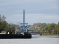
Starting from the heights of Ittre, a short footpath followed by a stretch of road leads to the first panoramic view, stretching all the way to the tower of the Ronquières inclined plane on the Brussels–Charleroi Canal. Your journey will take you as far as this canal, taking in a succession of other panoramic views, each as beautiful as the last, before descending to join the Ravel cycle route along the water’s edge.
The climb back up takes you through the fields, always with the Ronquières Tower in view. After bidding it farewell, there’s a short break on the plateau and another panoramic view of the route you took on the way there, before you descend into the Ri de Fauquez valley, from where you climb back up to rejoin the original route. The icing on the cake is that you might just be greeted by a llama in a meadow...
Panoramic views around Plasne
 3.95 mi
+367 ft
-374 ft
2h 10
Moderate
Departure from Plasne (Jura)
3.95 mi
+367 ft
-374 ft
2h 10
Moderate
Departure from Plasne (Jura)
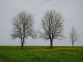
This is a beautiful circular route starting from the unusual church in Plasne and leading to the crest of the first Jura plateau, from where you can see for miles, as far as the snow-capped Alps when the weather is clear. These immense panoramas are what you will discover here, walking sometimes on small country roads, sometimes on farm tracks. And if you get up early and know how to walk quietly and without making any noise, you may encounter some chamois. This circular route alternates with theGR®59- "Échappée jurassienne"
Three villages on a Jura circular route
 6.10 mi
+62 ft
-62 ft
2h 50
Moderate
Departure from Le Fied (Jura)
6.10 mi
+62 ft
-62 ft
2h 50
Moderate
Departure from Le Fied (Jura)
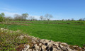
Le Fied, Fay-en-Montagne and Picarreau: three villages in the Jura on the first Jura plateau. These three villages on the heights of Poligny are brought together here for a nature walk exploring the shared natural environment that surrounds them. This natural environment consists of the meadows lining the paths, sometimes bordered by very old dry-stone walls, typical of the region.
Country walk to the "Vieux Manands"
 3.44 mi
+171 ft
-171 ft
1h 45
Easy
Departure from Genappe (Brabant Wallon)
3.44 mi
+171 ft
-171 ft
1h 45
Easy
Departure from Genappe (Brabant Wallon)
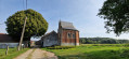
Starting from the historic site of "Napoleon's last headquarters", this walk will introduce you to a region that is too often overlooked. You will take a quiet road, a dirt track and then paths over a small river before climbing up to a road that you will quickly cross to find another path at the bottom of the garden... And there you are in the centre of Plancenoit for a short while. Very quickly, your steps will take you back to crossroads combining tarmac (a little) and natural ground to cross the river again, then pastures and a historic farm, ending up on a very, very quiet road.
 Complete tour of Texel Island
 38.10 mi
+75 ft
-66 ft
7 hrs
38.10 mi
+75 ft
-66 ft
7 hrs
 Difficult
Departure from Netherlands
Difficult
Departure from Netherlands
This circular route starts from the nature centre in the municipality of De Waal, in the centre of Texel. After passing through the Waal in Burg Polder Nature Reserve, it reaches the east coast via small country lanes, just below the town of Oosterend. A cycle path running alongside the sea leads to the harbour at Oudeschild and continues to the southern tip of the island at ‘t Horntje. A series of well-maintained cycle paths takes you to the town of Den Horn, then runs parallel to the west coast, passing through a forest, amongst other things, to reach the town of De Koog. Further on, the cycle path first runs alongside the high dunes and then crosses them before reaching the lighthouse at the northern tip of the island. The return journey is always via well-maintained cycle paths or quiet country lanes to the town of De Coscksdorp. Shortly afterwards, the route turns away from the sea to reach the Waal en Burg polder via a long, straight road.
Ibie valley, Lagorce loop, Vallon-Pont-d'Arc
 9.25 mi
+433 ft
-449 ft
1.5 hrs
Easy
Departure from Lagorce (Ardèche)
9.25 mi
+433 ft
-449 ft
1.5 hrs
Easy
Departure from Lagorce (Ardèche)
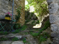
Leaving from the centre of the small village of Lagorce (Ardèche), we set off along the usual roads to the entrance to Vallon Pont d'Arc. The return journey is a pleasant one, through the countryside of the Ardèche, on a small road with no (or almost no) vehicles, along farm tracks, stony or slightly rocky, to arrive on the other side of the village.
Sigaud summit and ridge from Lagorce
 6.94 mi
+1,096 ft
-1,138 ft
4h 10
Moderate
Departure from Lagorce (Ardèche)
6.94 mi
+1,096 ft
-1,138 ft
4h 10
Moderate
Departure from Lagorce (Ardèche)
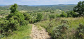
Following small roads and tracks through the Ardèche countryside, at the foot of the village of Lagorce, we join a path that goes deep into the trees to climb to the summit of Sigaud. We then continue to link the various summits of the Ranc, sometimes on footpaths, sometimes on forest tracks. The view of this superb region of the Ardèche opens up regularly from one side to the other. After a steep, stony descent of around 200 m, we return to small roads and country lanes. In spring, all this is amply covered with a multitude of varied flowers.
On the heights of Braine-le-Château
 3.47 mi
+246 ft
-269 ft
1h 50
Easy
Departure from Braine-le-Château (Brabant Wallon)
3.47 mi
+246 ft
-269 ft
1h 50
Easy
Departure from Braine-le-Château (Brabant Wallon)
A beautiful little hike, mainly on trails interspersed with a few short stretches on quiet roads, offering beautiful panoramic views and some magnificent trees. You may be lucky enough to spot a deer or two, a fox or a badger as you pass through one of the shady corners of the walk. Take the time to soak up the serenity of the undergrowth and stop at the foot of the remarkable trees.
Coqueréaumont – Pecq
14.89 mi
+686 ft
-801 ft
7h 25
Difficult
Departure from Frasnes-lez-Anvaing (Hainaut)
With this fourth stage, it’s time to tackle the westernmost part of the Tour de Wallonie as you head towards the Scheldt, but not before climbing the area’s toughest hill, Mont-Saint-Aubert.
Tournai – Wiers
 14.22 mi
+171 ft
-226 ft
6h 40
Difficult
Departure from Tournai (Hainaut)
14.22 mi
+171 ft
-226 ft
6h 40
Difficult
Departure from Tournai (Hainaut)
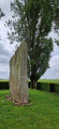
Setting off to explore the Pierre Brunehaut, an imposing menhir in the Hollain area, requires a detour; but for enthusiasts of megalithic sites, it is a detour well worth taking. To reach it, the walk follows the old Tournai–Cambrai Roman road, then crosses a small section of French territory to reach Belgium at Wiers.
Braine-le-Comte – Meslin-l’Evèque
 16.43 mi
+230 ft
-417 ft
7h 45
Difficult
Departure from Braine-le-Comte (Hainaut)
16.43 mi
+230 ft
-417 ft
7h 45
Difficult
Departure from Braine-le-Comte (Hainaut)
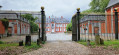
The second stage of the Tour de Wallonie takes us today from the town of Braine-le-Comte to Meslin-l’Evèque, a small village in the municipality of Ath to the north-east. We will mainly be walking along small country lanes as we cross this beautiful, gently rolling Hainaut countryside, passing through a few small villages and other hamlets such as Horrues. A short detour of a few metres to view Thoricourt Castle from behind its gates before crossing part of the infamous Ghislenghien industrial estate.
Pecq – Tournai
 7.19 mi
+115 ft
-30 ft
3h 25
Moderate
Departure from Pecq (Hainaut)
7.19 mi
+115 ft
-30 ft
3h 25
Moderate
Departure from Pecq (Hainaut)
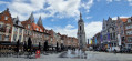
The fifth stage is short and straightforward to describe. Starting from Pecq, it runs to Tournai, following the Scheldt. It is by no means monotonous, however, as the river lies on one side, whilst the scenery on the other side is ever-changing. And the centre of Tournai is well worth a visit.
Wiers – Belœil
 10.17 mi
+325 ft
-151 ft
4h 55
Moderate
Departure from Péruwelz (Hainaut)
10.17 mi
+325 ft
-151 ft
4h 55
Moderate
Departure from Péruwelz (Hainaut)
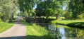
Starting from the random point given at the end of the previous stage, we will explore the Belgian-French border region in southern Hainaut, moving back and forth between France and Belgium, including the curious town of Bon-Secours with its cathedral situated right on the border. This stage ends in the municipality of Belœil at a holiday let booked for the occasion.
Ciply – Erquelinnes
 14.22 mi
+443 ft
-243 ft
6h 55
Difficult
Departure from Mons (Belgique) (Hainaut)
14.22 mi
+443 ft
-243 ft
6h 55
Difficult
Departure from Mons (Belgique) (Hainaut)
Here is a ninth stage that is the complete opposite of the previous one: lots of small roads and, above all, country lanes far from the hustle and bustle and noise. The finish point is flexible. The walk starts in Ciply and ends in Erquelinnes.
Erquelines – Soumoy
 20.24 mi
+1,178 ft
-886 ft
10h 20
Difficult
Departure from Erquelinnes (Hainaut)
20.24 mi
+1,178 ft
-886 ft
10h 20
Difficult
Departure from Erquelinnes (Hainaut)
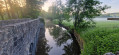
Here is a stage whose first section may put some people off. It covers the 12 kilometres along the N40 to Beaumont.
The scenery along the route changes gradually as you approach the Eau d’Heure lakes. The slopes become steeper as you get closer to your destination, the little village of Soumoy. The arrival point – and the starting point for the following day – is chosen at random.
Soumoy – Olloy-sur-Viroin
 15.31 mi
+1,020 ft
-1,220 ft
7h 55
Difficult
Departure from Cerfontaine (Belgique) (Province de Namur)
15.31 mi
+1,020 ft
-1,220 ft
7h 55
Difficult
Departure from Cerfontaine (Belgique) (Province de Namur)
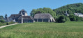
Here is the eleventh stage in a very beautiful region combining woods, fields and meadows. Steep ascents and descents, spectacular farmhouses and stunning landscapes form the backdrop to this walk.
Fumay – Vresse-sur-Semois
 20.55 mi
+1,867 ft
-1,657 ft
5h 30
20.55 mi
+1,867 ft
-1,657 ft
5h 30
 Very difficult
Departure from Fumay (Ardennes)
Very difficult
Departure from Fumay (Ardennes)
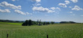
From the French Meuse at Fumay to the Belgian Semois at Vresse-sur-Semois, this is a stage featuring significant elevation changes, both uphill and downhill. The paths are very varied, ranging from tarmac roads to well-marked farm tracks, forest tracks generally in good condition, and footpaths that are more or less well marked. It is a long stage, tiring due to its steep climbs followed by equally steep descents, and takes place mainly through woodland. The arrival point and end of the stage are not fixed, as I am staying with a local resident.
Rochehaut – Bouillon
 7.89 mi
+1,168 ft
-1,270 ft
4h 40
Moderate
Departure from Bouillon (Belgique) (Province de Luxembourg)
7.89 mi
+1,168 ft
-1,270 ft
4h 40
Moderate
Departure from Bouillon (Belgique) (Province de Luxembourg)
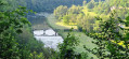
The starting point, the Rochehaut viewpoint, is one of the region’s most beautiful spots, offering a bird’s-eye view of a circular bend in the River Semois and the little village of Frahant. As for the finishing point, it is one of the most popular tourist attractions, with its superb fortified castle perched above the town. In between, along the way, there are forests, steep ascents and descents, and magnificent scenery. Accommodation at the Youth Hostel.
Bouillon – Florenville
 16.41 mi
+1,529 ft
-1,470 ft
8h 55
Very difficult
Departure from Bouillon (Belgique) (Province de Luxembourg)
16.41 mi
+1,529 ft
-1,470 ft
8h 55
Very difficult
Departure from Bouillon (Belgique) (Province de Luxembourg)
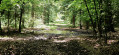
Leaving Bouillon and its castle to reach Florenville means linking the two ends of the Semois by crossing the plateau and its forests rather than following the river’s course and meanders; it is therefore a long climb followed by a gradual descent; it also means leaving a town on tarmac, travelling along stony paths and dirt tracks, crossing two fords, and returning to tarmac to reach the town again. And it’s a long walk of over 26 kilometres. The accommodation I’ve chosen in Florenville is the campsite.
Florenville – Meix-devant-Virton
12.75 mi
+719 ft
-896 ft
6h 30
Difficult
Departure from Florenville (Province de Luxembourg)
From Florenville to Meix-devant-Virton, our path will take us along a succession of forest tracks and paths and gravel roads. It also means leaving the gentle riverbank behind to venture deep into the steeply wooded massif on the southern slope of the Semois.
Meix-devant-Virton – Halanzy
 15.11 mi
+889 ft
-814 ft
7h 45
Difficult
Departure from Meix-devant-Virton (Province de Luxembourg)
15.11 mi
+889 ft
-814 ft
7h 45
Difficult
Departure from Meix-devant-Virton (Province de Luxembourg)
Leaving Meix-devant-Virton via roads with light to moderate traffic and arriving in Halanzy via similar roads does not mean the entire route is like this. No, there are quiet country lanes with beautiful views, farm tracks that turn into woodland paths, and a steep downhill stretch through a neighbourhood of holiday homes. And then there’s the River Ton, which sets the tone in its valley, along with more unexpected and unlikely paths and tracks. As I’m staying with a local, my stopping point is open to chance.
Halanzy – Habay-la-Neuve
 14.09 mi
+991 ft
-568 ft
7h 20
Difficult
Departure from Aubange (Province de Luxembourg)
14.09 mi
+991 ft
-568 ft
7h 20
Difficult
Departure from Aubange (Province de Luxembourg)
As the weather is set to be rainy with thunderstorms all day, I’m sticking to the main roads – even the major routes – to get to my destination for the day, Habay-la-Neuve, as quickly as possible. I’m staying in a hotel in the town. The stop (E) is therefore at my discretion.
Habay-la-Neuve – Tintange
 13.79 mi
+1,204 ft
-1,073 ft
7h 25
Difficult
Departure from Habay (Province de Luxembourg)
13.79 mi
+1,204 ft
-1,073 ft
7h 25
Difficult
Departure from Habay (Province de Luxembourg)
After reaching the Château du Pont d’Oye, the walk begins with a pleasant route through the woodland, skirting the ponds before moving away from them to join a secondary gravel road. This takes us over hill and dale through the forest up to the heights of Martelange, a border town between Belgium and the Grand Duchy of Luxembourg.
Tintange – Benonchamps
 12.12 mi
+1,339 ft
-1,394 ft
6h 45
Difficult
Departure from Fauvillers (Province de Luxembourg)
12.12 mi
+1,339 ft
-1,394 ft
6h 45
Difficult
Departure from Fauvillers (Province de Luxembourg)
Today, I’m inviting you on a short trip through the Grand Duchy of Luxembourg, travelling from one Belgian village to another. The route takes in roads, paths and forest trails, and, if you’re lucky, you might spot roe deer or fallow deer in the undergrowth.
Benonchamps – Sterpigny
 15.60 mi
+1,020 ft
-1,040 ft
8h 05
Difficult
Departure from Bastogne (Province de Luxembourg)
15.60 mi
+1,020 ft
-1,040 ft
8h 05
Difficult
Departure from Bastogne (Province de Luxembourg)
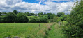
This route takes us through wide open landscapes alternating with paths and tracks through the woodland. The surfaces are either tarmac or dirt, and the paths are often still overgrown with grass given the time of year and the fact that they are probably not used very often. That’s the charm of these moments spent in direct contact with nature.
Sterpigny – Rodt Sankt-Vith
 14.25 mi
+840 ft
-587 ft
7h 15
Difficult
Departure from Gouvy (Province de Luxembourg)
14.25 mi
+840 ft
-587 ft
7h 15
Difficult
Departure from Gouvy (Province de Luxembourg)
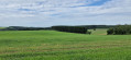
Here we are in the Eastern Cantons. This region isn’t part of Wallonia, but I’ve included it in my ‘Parkin’son tour of Wallonia’ all the same. Through a succession of climbs, some of which are quite steep, as are the descents, we gradually make our way towards the highest altitudes in Belgium. Mainly via paths, tracks and back roads, we link up the various villages and small towns situated between Sterpigny and Rodt, namely Gouvy, Aldringen, Maldingen and Crombach.
Rodt Sank Vith – Losheimergraben
 16.19 mi
+994 ft
-459 ft
8h 20
Very difficult
Departure from Sankt Vith (Province de Liège)
16.19 mi
+994 ft
-459 ft
8h 20
Very difficult
Departure from Sankt Vith (Province de Liège)
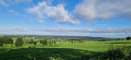
On this twenty-third stage, we’ll head to the German border – the easternmost point of my tour of Wallonia – as the village of Losheimergraben lies on the border. In reality, it isn’t really a village but rather a hamlet that’s ideal as a starting point for hikes or cross-country skiing trips. So you’ll have no trouble finding somewhere to stay there. The lowest point on the route is at an altitude of 500 m, and the highest at 682 m. We are therefore in the highest region of Belgium, to some extent. The first third of the day is spent in the countryside, and the rest in the woods.
Nidrum – Eupen
 18.26 mi
+869 ft
-1,732 ft
9h 10
Difficult
Departure from Bütgenbach (Province de Liège)
18.26 mi
+869 ft
-1,732 ft
9h 10
Difficult
Departure from Bütgenbach (Province de Liège)
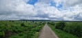
Here is another remarkable stage. It begins in the meadows of the Belgian highlands and then ‘flirts’ with Belgium’s highest elevations in the Hautes Fagnes, reaching a peak of 638 m; from there, the path descends steadily to Eupen and the Vesdre at an altitude of 263 m. It’s a route that also has a few surprises in store, particularly along the stretch beside the River Helle (Hill in German), where the path zigzags between wooden duckboards and muddy, mostly rocky ground – an environment it seeks to avoid by veering off upwards to… well, I’ll let you discover that for yourselves. A bit of suspense never hurt anyone.
Losheimergraben – Nidrum
 10.42 mi
+456 ft
-814 ft
5h 10
Moderate
Departure from Belgium
10.42 mi
+456 ft
-814 ft
5h 10
Moderate
Departure from Belgium
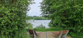
This24th stage takes us from the tranquillity of the forests of the Eastern Cantons to the livelier atmosphere of the shores of Lake Bütgenbach, before returning to the countryside in Nidrum. For your feet, it means switching from forest paths with ‘natural’ surfaces to the tarmac of small country roads, town streets and the Ravel. A complete change of scenery is guaranteed.
Eupen – Remersdael
 15.97 mi
+1,079 ft
-1,243 ft
8h 15
Difficult
Departure from Eupen (Province de Liège)
15.97 mi
+1,079 ft
-1,243 ft
8h 15
Difficult
Departure from Eupen (Province de Liège)
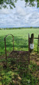
This route takes you from the German-speaking region of the Eastern Cantons in Eupen to the Flemish region of the Voer in Remerdael, following a mainly rural route with plenty of paths and tracks that sometimes hold a few surprises in store. I’ll leave you to discover them for yourselves as you explore these paths that I’ve enjoyed so much.
Remersdael – Mortroux
 6.76 mi
+456 ft
-948 ft
3h 30
Moderate
Departure from Voeren (Province de Limbourg)
6.76 mi
+456 ft
-948 ft
3h 30
Moderate
Departure from Voeren (Province de Limbourg)
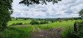
A short walk for this27th stage, but one packed with beautiful sights: buildings, panoramic views and landscapes. A stage where you really get a feel for what a steep climb or descent is like. They aren’t long, but your quadriceps will certainly feel the strain. It’s also a stage that gives pride of place to country lanes and footpaths.
Mortroux - Oupeye
 7.34 mi
+367 ft
-299 ft
3h 40
Moderate
Departure from Dalhem (Province de Liège)
7.34 mi
+367 ft
-299 ft
3h 40
Moderate
Departure from Dalhem (Province de Liège)
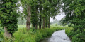
The28th stage will surprise many, myself included. Due to bridge repairs, I had to head for Visé rather than take the direct route. It turned out to be a good decision, as I discovered a multitude of paths and trails, which made the journey into town take a little longer. The same was true at the end of the route.
Hanneffe – Avin – Hannut
 12.39 mi
+282 ft
-308 ft
5h 55
Difficult
Departure from Donceel (Province de Liège)
12.39 mi
+282 ft
-308 ft
5h 55
Difficult
Departure from Donceel (Province de Liège)
The route winds its way from village to village along narrow country lanes; large Hesbaye farms dot the landscape here and there, drawing the eye and inviting you to pause for a moment’s contemplation. And when the sun is shining, how can one resist the scenery that unfolds before our eyes? And for those who find inspiration in small villages, with their old houses sitting alongside newer homes – sometimes more harmoniously than others – this thirtieth stage has everything to make them happy.
Avin Hannut – Thorembais-Saint-Trond
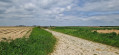 15.36 mi
+148 ft
-148 ft
7h 10
Difficult
Departure from Hannut (Province de Liège)
15.36 mi
+148 ft
-148 ft
7h 10
Difficult
Departure from Hannut (Province de Liège)
This31st stage is a gentle stroll through the countryside, with distance being the only real challenge. No significant elevation gain, no meadows to cross. Small country lanes with very little traffic, apart from a long climb over old cobblestones – just enough to rouse the walker from any lethargy. And the scenery is as beautiful as ever for those who love the countryside – though, of course, this depends on the season and the weather. Once again, I prefer the countryside to the city, and there are very few villages along the way.
Thorembais-Saint-Trond – Louvain-la-Neuve
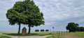 9.44 mi
+138 ft
-246 ft
4h 30
Moderate
Departure from Perwez (Brabant Wallon)
9.44 mi
+138 ft
-246 ft
4h 30
Moderate
Departure from Perwez (Brabant Wallon)
A point of transition. Moving from the tranquillity of the countryside to the bustling life of a university town, from buildings that are sometimes very old to the modernity of a city built in the20th century. From quiet country lanes with little traffic to the approach to one of the region’s busiest motorways, and then on to the pedestrianised centre of the university campus – some will miss the former, whilst others will revel in the atmosphere of the new town.
Louvain-la-Neuve – Braine-l’Alleud
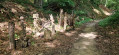 12.22 mi
+581 ft
-535 ft
6h 10
Moderate
Departure from Ottignies-Louvain-la-Neuve (Brabant Wallon)
12.22 mi
+581 ft
-535 ft
6h 10
Moderate
Departure from Ottignies-Louvain-la-Neuve (Brabant Wallon)
From town to town, this final stage takes us from Louvain-la-Neuve to Braine-l’Alleud, once again favouring country roads and lanes as well as the little-known paths of Walloon Brabant. A thoroughly enjoyable and surprising final stage that is an absolute must-see.
Tour de Wallonie
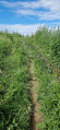 456.86 mi
+25,620 ft
-26,109 ft
33 days
Difficult
Departure from Waterloo (Brabant Wallon)
456.86 mi
+25,620 ft
-26,109 ft
33 days
Difficult
Departure from Waterloo (Brabant Wallon)
This walking tour of Wallonia, which includes the German-speaking part of Belgium, is a circular route that generally follows the borders as closely as possible, whether linguistic or territorial. This sometimes involves forays into neighbouring territories – France, the Grand Duchy of Luxembourg and the Flemish Region. Occasionally, the route also deviates from this due to accommodation requirements or because suitable accommodation could not be found close to the borders, whilst still adhering to various constraints.
Ghislenghien - Coqueréaumont
 16.24 mi
+430 ft
-374 ft
7h 50
Difficult
Departure from Lessines (Hainaut)
16.24 mi
+430 ft
-374 ft
7h 50
Difficult
Departure from Lessines (Hainaut)
This third stage links two small villages in northern Hainaut: Ghislenghien and Coqueréaumont. It passes through Ath, where there are sports shops. This walk allows you to discover the two Dendre rivers, the eastern one flowing into the western one within the town, and to walk along the Way of St James. The route then heads back into the countryside, which is very hilly, heading westwards.
Circular route from Braine-l'Alleud to Haut-Ittre
17.12 mi
+1,079 ft
-1,073 ft
8h 50
Very difficult
Departure from Waterloo (Brabant Wallon)
For once, here is a long 27 km circular hike through the rolling countryside of this corner of Walloon Brabant. Starting from the Butte du Lion - site 1815 - it first crosses the town of Braine-l'Alleud before returning to the countryside, which the hike hardly leaves until it returns to the foot of the Butte du Lion.