Country:

 City:
City:



N675 / Südstrasse in Rodt Sank Vith.
(S) Head east towards the motorway, staying on the N675 until you reach the roundabout. Carry on straight ahead, go over the motorway and continue to the roundabout in the centre of Hünningen.
(1) Carry on straight ahead along Maas-Rhein Strasse until you reach a T-junction. Turn left, heading over the Ravel. Take the next road on the right. Just before the bend, first turn left then right into Keppelborn.
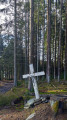
(2) Go up the first street on the left – still in Keppelborn – and pass the first cross on the left with a hiking shelter. At the next cross, hiking junction 37, turn left. At the ‘Y’ junction, follow the road to the left. It leads into the forest. Continue to the first crossroads.
(3) Turn right and carry on straight ahead until you reach hiking node 73. Continue straight ahead, passing hiking nodes 64 and 71. At the junction following this hiking node, carry on straight ahead along the forest track, continuing straight on. Further on, the path becomes a forest track again. It leads to a road.
(4) Follow the road to the right until you reach the first forest track on the left. At the next junction – hiking node 54 – turn right, then take the first path on the left.
(5) At the ‘Y’ junction, continue to the left, going straight on at all the following junctions – including hiking node 35 – until you reach a tarmac road.
(6) Turn left, ignoring two tracks coming from the left.
(7) At the four-way junction that follows – with a wooden building – take the path straight ahead on the right. Continue straight ahead until you reach hiking junction points 33 (path coming from the rear right) and 32.
(8) Carry on straight ahead, cross the first path, join the next one coming from the right and, at the ‘Y’ junction immediately after, turn right – follow the GR®56 and 56V markings. Cross another path and leave the forest.
(9) At the ‘Y’ junction, continue along the small road to the right, following the GR® markings whilst continuing straight on until you reach hiking node 81
(10) Carry on straight ahead, ignoring two paths on the right and then one on the left. At the ‘T’ junction, turn right and then immediately left until you reach the edge of the forest.
(11) Take the road on the right until you reach a main road. Follow this to the right to cross the forest. Turn right at the ‘Y’ junction.
(12) Follow the side track to the left, passing over the Ravel. At hiking junction 68, take the track on the right – GR®56 – until you reach hiking junction 69 after a sharp bend.
(13) Turn right twice, ignoring two paths on the right. At the ‘T’ junction, turn left. The climb that follows is long and steep. You’ll reach the N632. Turn right until you reach the roundabout. (E)
 Tourism professional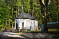
 Easy
Easy  Visorando Member
 Difficult
 Moderate