Country:
 City:
City:




Car park in the centre of Haneffe.
(S) Turn your back on the car park and take Rue Tombeux on the right. Cross the next junction and go past the street on the left. Junction with two side roads on the left.
(1) Turn left and take the road on the right. Road towards Seraing-le-Château.
(2) Carry on straight ahead. Turn right, then left. At the end of the bend, take the path on the right – GR®121 – until you reach Rue de Huy (Chapon-Seraing). Cross it and continue straight ahead until you reach Rue de Borlez in Borset.
(3) First turn right then left, then veer right at the next junction. Follow the boundary of Borset Castle. At the next junction, turn right towards the centre of Vaux-et-Borset and a large farmhouse-castle on the right.
(4) Turn left. Pass two streets on the left and then one on the right. Off-centre crossroads.
(5) Continue straight on along Rue du Vieux-Waleffe. At the next junction, go straight on, then turn left until you reach a large farmhouse in Vieux-Waleffe.
(6) Carry on straight ahead along the main road, ignoring the streets coming from the left. You’ll reach the N64
(7) Cross it and take the path opposite. At the next junction, stay on the same route by taking the path opposite. Continue until you reach a road.
(8) Turn left. Carry on straight ahead until you reach a large farm at a junction and a bend; pass another large farm. The road bends left then right. On the left, there is a bridge over the Ravel.
(9) Cross the bridge. Follow the small road, ignoring the side roads, until you reach a main road. Turn left, then right at the next junction. Go straight on at the next junction and continue until you reach the entrance to Ville-en-Hesbaye, a T-junction.
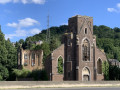
(10) Take the street on the right, then take the second left – Rue du Bolland. Follow this road to the church. Turn left and continue to the next junction before Heptia Castle.
(11) Turn right. Continue to a five-way junction. Take thesecond right (Rue de la Havée), ignore a road on the right, then take Rue de la Dîme on the right. At the ‘Y’ junction, turn left and continue to a wide junction.
(12) Take the street at right angles (second on the right) – Rue Grande. At the first junction, keep left, cross the next street and join Rue de Namur at Avin – Ciplet (E).
 Tourist office
 Easy
Easy  Visorando Member
 Average