Country:

 City:
City:





Roundabout at Rue E. Baudrux / Rue de la Creux.
(S) Take Rue Émile Baudrux until just past the right-hand bend.
(1) Turn left onto Rue du Châtelet.
(2) Cross the car park on the right to Building No. 2. Take the path on the left. Cross over the River Rulles and follow the path running alongside the Châtelet pond. Once you’ve reached the end of the pond, take the first path. Then turn right onto the ‘Sentier des Forgerons’. Head towards the Château du Pont d’Oye. Join Rue du Pont d’Oye.
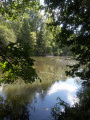
(3) Turn left, pass the end of the pond and continue along the path towards ‘Les forges du Pont d’Oye’. It runs alongside the pond. At the far end, cross the bridge between the two ponds.
(4) Take the path branching off to the right after the bend. Cross a small ford.
(5) Carry on straight ahead until you reach a tarmac road.
(6) Turn right and follow it straight ahead for a good while. Cross the Rue de Habay. As you leave the forest, the road bends to the right. Ignore the paths on both the left and right and carry on until you reach the ‘Y’ junction.
(7) Take Rue d’Anlier on the right towards Radelange. The descent towards the village is steep (carry on until you reach a path on the left, like a passageway between two houses (8 and 6A).
(8) Take this path to the left, then continue to the end via a footpath leading to Rue de Champs. Turn right.
(9) On Rue de Neuchâteau, turn left, then cross the bridge over the Sûre on the right.
(10) At the next junction, take Rue de la Croix on the left. After the bend, continue along it to the right until you reach Route de Bastogne.
(11) Turn left.
(12) Go under the motorway on the right, then turn right again once you’ve passed it. Take the first road on the left.
(13) At the T-junction in Martelwée, turn left. Ignore a path leading off to the right.
(14) Take the Route de Warnach on the right towards Tintange. After a steep climb, you’ll reach the village at the junction with Rue des Deux Fontaines. Accommodation is available on a first-come, first-served basis (private accommodation (E). (See the section: Practical Information).
 Visorando Member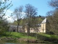
 Moderate
 AONB
AONB Easy
Easy