Country:
 City:
City:



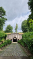
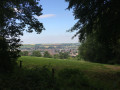
Start at the Barrière roundabout in Oupeye
(S) Take Rue Visé-Voie. Follow it straight on until it becomes a track, cycle junction 25. Turn right. Follow this track until you reach the end of a street (Rue du Garage). Continue along this street until you reach a T-junction with Rue de Herstal.
(1) Turn right. At the next junction, carry on straight ahead until you reach a Y-junction.
(2) Turn left onto Rue Haie Martin. Continue along this road, keeping it straight ahead, passing cycle junction 23 and the Hermée cemetery, then, much further on, over the A601, cycle junction 22.
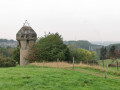
(3) Turn right onto Rue du Fort de Liers. When the road bends sharply to the left, follow it. Pass in front of the Fort de Liers and go under the motorway. Continue to the second street on the left, Rue Provinciale.
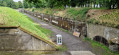
(4) Turn left. Go through the underpass beneath the railway lines, take the pavement on the right, cross over Rue Provinciale and follow the tunnel exit. Continue to the right into Rue Léopold Thonon. Join Chaussée Brunehaut.
(5) Turn right. Do not take the Ravel but take the path that branches off to the left – the military road. Follow this path straight on until you reach the N20 at Lantin.
(6) Cross it and follow Rue des Acacias opposite. Pass in front of Fort de Lantin. Take the street opposite (Rue du Haut Cornillon). Cut across Rue de la Chapelle. Continue to Chaussée de Liège.
(7) Cross the road and follow the road opposite – a military road – passing by the Alleur sports grounds. Continue straight on, crossing the next two streets you come to: Rue de la Résistance and Rue de la Vallée.
(8) Pass two residential areas on your right. At the junction, turn right onto Rue du Cheval d’Or.
(9) Further on, it becomes a footpath and joins the Drève de Waroux. Turn left, then left again at the T-junction. At the next junction, take Rue de Bruxelles N3
(10) Turn right. Continue to the first junction. Turn left, carry on straight ahead, crossing over the E40 motorway. Carry on straight ahead to the centre of Awans, with Place Communale on your right.
(11) First turn right then left across the square to take Rue Édouard Bovroux. Leave this street on your left, then the streets on your right as you round a bend. You’ll arrive at Fond du Chenay, next to the cemetery.
(12) Turn left, crossing over the various railway lines. At the roundabout, take the first exit onto Rue de la Gare. Follow this road until you reach Chaussée d’Hannut.
(13) Turn right. Take the second street on the left. Carry straight on at the first junction, turn left immediately after, then carry straight on at the offset junction and the next one until you reach a crossroads in the middle of a field.
(14) First turn right then left. Continue straight on, crossing the entire village of Roloux.
(15) Just before the last houses, turn left onto the small country road. At the first junction, veer right, then go straight on at the next junction until you reach the N614.
(16) Turn left, then take the first right. Keep going straight ahead through Jeneffe until you reach a junction in Donceel.
(17) Take the left-hand lane. Carry on straight ahead to the centre of Haneffe (Donceel) and a car park (E).
 Visorando Member
 Easy
Easy  Local authority
 Average