Country:
 City:


Start from the free car park at ‘La Placette’.
(S/E) Head towards the castle on Rue de la Montagne and continue along the left-hand pavement until you reach a flight of steps, just before No. 11.
(1) Climb the steps and follow the path to a turnstile leading into a meadow. Then follow the path through the meadow near the edge of the woodland. A narrow passage leads to the next meadow; stay at the top of the meadow to reach the clearing between the two woodlands. Follow this and stay at the edge of the woodland, then along a hedge. You leave the meadows via the designated path, marked with red and white GR® signs; you are now on the Via Brabantica Halle-Nivelles (Way of St James). You’ll reach a field, which you follow on the right, and soon come to a road (Rue D’hurbize).
(2) This is a farm track; follow it to the left, then left again at the Fork in the road, until you reach a junction.
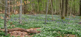
(3) Cross the road (Rue Auguste Latour) and head straight on along the path that leads into the Bois du Chapitre (please note: Natura 2000 area). Continue along the main path straight ahead until it becomes a tarmac road.
(4) At the end of Chemin du Bois Chapitre, stay on the cycle path to the right, then cross quickly to take the first street on the left below the embankment – signposted ‘marina’ – Rue du Sart. Between numbers 34 and 36, turn right down the Sentier du Facteur, trail no. 65. A little further on, at the junction, head down to the left along it until you reach the end. Turn left and join the end of the Sentier de Nizelle.
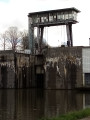
(5) At the junction, head down to the right (Rue du Sart) until you reach lock no. 5. Carry on straight ahead along the towpath to Ittre marina and continue to the first bridge.
(6) About fifty metres before the bridge, turn left and head up Rue du Vieux Pavé d’Hasquemont. Ignore all the roads and paths branching off to the left; further on, take Rue des Moulins, which slopes down to the right, and you’ll come out onto a busy road.
(7) Watch out for traffic; cross the road with care – there is no pedestrian crossing! – Follow the road to the left until you reach the roundabout. Take the first exit, Rue de Huleu, and head uphill until, on the left after a farm, you come to a sunken lane: Rue d’Hourdenge.
(8) Follow this track up to the junction with a wayside cross on the plateau. Turn right and follow the farm track. Cross a road and continue along the Chemin de la Chapelle Sainte-Marie.
(9) At the junction, near the chapel, take a sharp left onto Rue du Pérou. Cross the stream and then head uphill until you reach a bend to the left. Continue along the main road; the street is now called Rue de Basse-Hollande.
(10) At the four-way junction, take the Chemin de Ronquires straight ahead; further on, take a sharp left-hand bend and keep heading towards the plateau ahead of you, ignoring the paths to the right and left, until you reach the entrance to the golf course.
(11) Take Chemin de la Tournette straight ahead, cross the golf course of the same name and, at the other end, you’ll arrive at the Chapelle du Bon Dieu qui Croque.
(12) Turn off onto the sunken lane on the left, pass the Rue d’Eve on your left and take the footpath starting about fifty metres further on to the right, heading towards Les Arbres en Haut. Walk up between two fields and, when you reach the trees, follow them to your left, between the trees and fields. The path ends in a sunken lane.
(13) At the cobbled street (Rue de la Ferme du Pré), turn sharply to the left. At the first junction, carry on straight ahead (Rue du Patriote). Further on, turn right at a right angle and continue along the tarmac road. Walk downhill until you reach the Ri Ternel stream.
(14) Cross the bridge and take the Sentier des Longs Prés on the left (Ravel). Follow it, ignoring all roads, until it ends (Rue de Gaesbeck).
(15) First turn left then right, and take Rue Jean Jolly. Pass the sports facilities, turn right and head for the Parking de la Placette (S/E).


 Visorando Member

 Moderate

 Easy