Country:

 City:
City:


Start at the junction between the Route de Mons and Rue Reine Astrid.
(S) Follow the N40. The route to Beaumont is straightforward (12 kilometres) but extremely dangerous during the day. If you’ re on your own , you have to walk facing the traffic – on the left-hand side – and most of the time there’s neither a pavement nor a cycle path. In a group, you have to walk on the right-hand side, and the situation is the same.
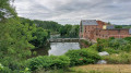
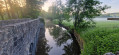
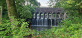
(1) On the descent towards La Hante, before crossing the bridge, take Chemin des Sciences on the right, towards “the Roman bridge”. This allows you to avoid the steep climb on the N40 before Montignie-Saint-Christophe. And the bridge itself is a lovely spot. Cross the bridge and continue straight ahead. At the junction, turn right onto Rue Victor Baudour.
(2) Take the sharp left-hand bend onto Rue Victor Baudson, then first turn left then right to join the N40 on the right. At the next roundabout, continue straight ahead.
(3) At the roundabout at the entrance to Beaumont, take the first exit onto Rue de Binche. Cross the road at the pedestrian crossing and take the path leading up the steps on the left. At the top, turn left and follow Boulevard du Général Jacques. Go round the park on the left and turn left onto Chaussée Fernand Deliège.
(4) Once you’ve crossed the bridge over the Ravel, turn immediately left to join it. Turn left to go under the bridge. Stay on the Ravel for a long stretch. Cross over the Hante and take the next exit. Join the GR® 129 and follow it to the left. After crossing over the Hante again, turn immediately right onto the road leading to Solre-Saint-Géry.
(5) At the “Y” junction, turn left, then immediately left again onto Rue Lambot. After the first junction, where you should continue straight ahead, it becomes Rue Basimont. At the “T” junction, turn right onto Rue de la Vilette. At the next junction, stay on and follow Rue Sainte-Anne to the left until you reach Rue de Plagne.
(6) Carry on straight ahead (left-hand branch) along Rue Plagne or Route de Solre-Saint-Géry. It turns left then right after Barbesignau. Follow it as far as Barbençon. At the “T” junction, turn right and cross the village via Rue de l’Eglise. Then take the first right (Rue des Marbriers). At the “Y” junction, turn right onto Rue des Trous.
(7) Pass two streets on your right and, at the next bend, carry on straight ahead along Rue des Trous / Chemin de Vergnies. At the “Y” junction, keep left (straight ahead).
(8) Turn left onto Rue Croix Courbain. Continue straight ahead until you reach the GR®129 (T-junction). Follow it to the left, then turn right at the start of the bend that follows. At the ‘Y’ junction, keep left until you reach Rue de la Fontaine au Bois. First turn left then right; then, much further on, at the end of the street, do the reverse – a right then left – to take the Route de la Plate-Taille as far as the dam.
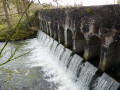
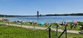
(9) A footpath leads to the lakeside before the dam. Cross the car park towards the buildings and join the road that runs over the Plate-Taille dam. Cross the dam.
(10) On the other side of the dam, walking along the paved verge of the road, continue along the N589 until you reach the N978. Turn left, go over the Eau d’Heure dam and continue until the second road on the right.
(11) Turn right onto Rue Rognac until you reach the entrance to Soumoy. At the ‘Y’ junction, take the right-hand branch, Rue Bauwy, until you reach the junction with Rue Nicodème (E).
 Visorando Member
 Moderate
 Easy
Easy  AONB
AONB