Country:

 City:
City:


‘Eglise Notre-Dame’ bus stop in Sterpigny.
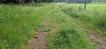
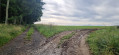
(S) Walk down the main street to the first street on the right (an old farmhouse on the corner). Take this street and pass the path you came along the previous day. Stay on the path, which turns into a dirt and gravel track. Continue straight on until you reach a tarmac road.
(1) Follow it to the right. After the bend, it becomes a country lane and then a forest track. In the woods, ignore all side paths, cross a river and, at the upcoming three-way junction, turn left. You’ll reach Rue de la Croix du Chêneux.
(2) Turn right, then take the first left onto the Ruelles leading to Gouvy. At the Y-junction, turn left, join the N838 and continue straight on until the next junction.
(3) Turn right onto Rue d’Houffalize, then take the first left onto Rue du Thiers.
(4) After the bend, carry on straight ahead along Rue de Crombé, passing the Gouvy cemetery, and follow the Gros-Thier housing estate whilst continuing straight ahead along the road, which changes name frequently: Rue du Naneux and then Rue d’Houffalize. At the Y-junction, keep to the right and join the N827 just before a bridge.
(5) Cross the bridge over the railway line, turn right onto Rue de la Gare and follow it until just past the bend. At the ‘Y’ junction, continue straight ahead/to the left onto Rue du Beho. This road leaves Gouvy and heads into the countryside, then, after a bend, enters the forest. When it emerges from the forest but remains on the edge of it, a footpath branches off straight ahead.
(6) Take the footpath. It leads to a track which you follow to the left (cycle route 24-65). At Route de Luxembourg, take a slight left/right to continue along the track straight ahead to junction 24, amongst a few houses. Continue to the right, towards Zur Burgstatt, to junction 179 in Aldringen.
(7) Turn left, then right at the Y-junction and carry on until you reach the edge of a small wood. At the Y-junction, take the path on the left, then the one on the left again to join the N827. Turn right towards Maldingen church.
(8) Turn left, then immediately right. At the T-junction, take the path on the right, then go straight on. Follow the dirt track to the corner of a pond. First turn right then left, and follow the road, ignoring a road on the right and cutting across two other roads until you reach a main road at a third junction.
(9) Carry on straight ahead along Crombacher Strasse until you reach a cluster of houses (bus stop). Turn left towards the river, go under the bridge and, immediately afterwards, take the path crossing over the river to the right. Follow this path straight on, with the pond on your left, until you reach a road. Follow this road to the right.
(10) (See practical information). Carry on along the road, and turn left twice.
(11) Turn left if you’re coming from the footpath, or carry on straight ahead if you’ve taken the road. Cross the bridge. Take the first street on the right and follow it straight ahead until you reach the N675 at Rodt. Random stop – accommodation available to rent. (E)
 Visorando Member
 Moderate
 Easy
Easy