Country:
 City:
City:




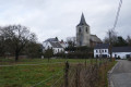
Start at the car park situated along the Route de l’Etat between the road leading to Aywiers Abbey and Rue d’Anogrune.
(S/E) Head towards the abbey. Immediately after crossing over the Lasne, enter the meadow on the left via the turnstile. Cross the entire meadow. After a small stone bridge, follow the right-hand side of the meadow. Pass through the turnstile. Follow the path uphill until it joins a track. On the right is private property. Turn left until you reach Rue du Village and its T-junction. Then turn right.
(1) Take the first street on the left, Rue des Genêts. It continues as a path between fields and gardens. The path leads to Rue de la Chapelle Saint-Germain. After house number 8, take the Chapelle Saint-Germain path (path no. 25) between the entrances to the houses and the access road, which is closed off by a gate leading to a property. The path joins this access road for a few metres and continues along it.
(2) At the corner of the property, take path no. 24 on the right, the ‘Sentier du Champ de Couture’, which continues as the ‘Sentier du Champ du Saule’ (no. 78). After a flight of wide steps, it joins a street. Turn right until you reach a T-junction with a street coming from the left.
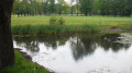
(3) Opposite this junction, head down to the right along the Chemin de la Marnière (No. 19). This leads to the end of Rue des Vallées de Wavre. Follow this straight on until you reach Rue du Village. At the T-junction where the two streets meet, take the left-hand branch and follow Rue Pavée de la Croix Roland straight ahead. Walk down this street until you reach a pond.
(4) Carry on straight ahead to the right, then go straight on at the junction onto Rue à l’Eau.
(5) At the junction, take Rue de Colinet on the right until you reach the main road. Cross it carefully, minding the traffic, and head down Rue à Fossant on the opposite side.
(6) At the bottom, turn right and take the second street on the left (Rue de la Claudine), which goes uphill to join Rue d’Hubermont, a cobbled road. Walk down it to the right until you reach the Route de l’Etat at Maransart.
(7) Cross carefully and follow the pavement opposite to the left to reach the car park after the bend (S/E).


 s and gardens!
 Visorando Member
 Moderate
 Association / Club / Walk leader