Country:

 City:
City:






Start at the junction of Rue Nicodème and Rue Bauwy.
(S) Cross the bridge over the Ruisseau de Soumoy and turn left onto Rue de la Tannerie towards the cemetery. Follow this road until you reach the entrance to Senzeille.
(1) At the T-junction, turn right into Rue de l’Horloge, then left into Rue du Culot Massin. At the next crossroads, continue straight on along Rue du Pont Rouge. At the Y-junction, keep left and take Rue du Chêneux. Cross the Ruisseau des Vaux, ignore a path on the left and cut across the N978.
(2) Take the first path on the left into the woods (walking route 124). Follow the signposts for a while, ignoring any side paths. Take care at the crossroads of four paths on the edge of the forest: two are private paths; take the one on the left, still following the signposts for walking route 124. Leave this route at the Chemin du Tienne aux Ronces.
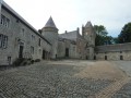
(3) Take the path on the left, cross over the N5 and continue along Rue du Fraity. This road first turns left then right at the Fraity pond and reaches Roly at a beautiful farmhouse-castle.
(4) Turn right and follow Rue de la Bowe to Fagnolle.
(5) Cross Rue du Quairiat and join Rue du Calvaire on the opposite side. Carry on straight ahead until the next bend, on Rue de Fagnolle. At the ‘Y’ junction, take the path on the right (part of the GR®12 and walk 124). Carry on straight ahead until you reach Rue du Bailli. Turn right onto Rue du Centre Physique and follow it to Dourbes.
(6) At the ‘Y’ junction, take the left-hand branch onto Rue du Fayt. Follow the path to the Viroin. The path and the GR®124 leave the Viroin to climb the slope on the left. Keep following them straight ahead until you rejoin the river at Olloy. Be careful: the end of the descent is steep and rocky, and a stake blocks the exit before the road. You’ll arrive at the car park along the Route du Viroin. (E).
 Visorando Member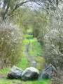
 Moderate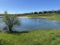
 Easy
Easy 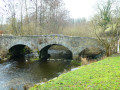
 Association / Club / Walk leader