Country:
 City:
City:


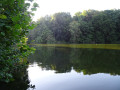

Car park: at the Seven Fountains Ponds
(S/E) Walk along the large pond, passing the restaurants. When the road bends between two ponds, take the path that starts on the right in a meadow.
(1) Stay along the edge of the woodland and soon enter it. Take the path that branches off to the left along the edge of the pond. At the junction with the road, turn right. Follow this road until it emerges from the woodland at the top of a hill.
(2) Take Chemin Lazard on the right and stay on the road until you reach the football ground. Walk along its short side. At the corner of the ground, take the path on the left leading to Rilroheidestraat. Follow it to the right and then to the left until you reach a junction;
(3) Take the sharp left-hand bend, then keep left to follow the Kampendaal. At the car park, take the first path on the right and continue straight ahead until you reach a small bridge. Please note: the descent after the bend is steep and deeply rutted in the centre. Cross the bridge and head uphill to the T-junction. Turn left. At the two Y-junctions, turn right. At the junction on the edge of the woods, turn left and stay under the trees until the next junction.
(4) Turn right and follow Rue du Bois de Hal (Hallerbosstraat) straight on until you reach the bottom of the sunken lane. Take the path on the right which runs between the forest and the meadow before heading into the undergrowth. Follow it straight ahead until you come out onto a road. Turn left twice and cross the river.
(5) Take the path on the right, ignoring the various options to the right. After skirting a pond, the path continues straight ahead, veering slightly to the left at the edge of the woods. It comes out onto Kerkstraat (Church Street).
(6) Turn right, walk behind the church and carry on in the same direction until the street bends to the left. Continue straight ahead along Esselveld for about ten metres.
(7) Take the path leading down to the left ahead. Where it joins Deuveressenweg, first turn left then right and continue along Zevenbronnenstraat (Rue des 7 Fontaines). At the T-junction, turn right onto Hof te Helderingenbaan.
(8) At the next junction, continue along the path straight ahead. Keep following it straight ahead at each junction. It leads out opposite the ponds. Turn left and head towards the car park (S/E).
 Visorando Member
 Easy
Easy