


 Country:

 City:
City:


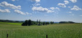
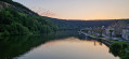
Fumay (France), at the top of Rue du Château.
(S) Head down Rue du Château, cross the bridge over the Meuse. Follow the D7 to the first street on the right (Chemin de l’Espérance). Take the third street on the right (Rue des Mésanges). After the recycling centre, turn right into Impasse des Merles. At the three-way junction, take Rue des Grives on the right.
(1) At the junction, turn sharp right onto Rue Madame de Cormont and follow it for about 7 km until you reach a T-junction with the D989. Turn right onto the D989 and follow it until you reach the D989A, which branches off diagonally to the rear left. Follow the parallel gravel track on the right-hand side until it ends.
(2) Take the path that starts diagonally to the front right. You will enter the Source du Ruisseau de l’Ours Biological Reserve. Please note: stay on the paths and keep dogs on a lead. Shortly after entering the woods, you’ll come to a junction with five possible routes. Follow the path straight ahead on the right. At the second junction, you’ll reach a firebreak.
(3) Take the path along the firebreak to the left until you reach a stony track. Follow this straight on until you come to a few bends. At the Y-junction, continue straight on along the forest track. Shortly afterwards, another pleasant forest track starts on the left and crosses the border.
(4) Follow it for about 200 metres and take the track branching off to the rear right. This leads to a tarmac road and the Croix Scaille, the start of the Sentier des Monts d’Ardennes, signposted with SMA signs. Pass the Tour du Millénaire and follow the SMA signs onto the first stony track descending to the right. Continue down the slope, following the SMA signs, until you reach a road.
(5) Take Rue de la Forge on the right. Leave the SMA. Cross the border. Take a path on the left leading to the banks of the Ruisseau de Saint-Jean. Cross it (bridge) and turn left, then very quickly right (hairpin bend) up the hill. Carry on to a pond. Keep to the right at the next junction, then turn left at the next Y-junction and go straight on at the following junction. Ignore a path on the left. At the next two junctions, turn left and then carry on straight ahead until you cross the border and join the BVW (see practical information) and the GR®126.
(6) Follow them to the right along the border until you reach a tarmac road, La Barrière. Continue to the right along this road. At the Barrière de Mointerme, carry on straight ahead. The BVW and GR®126 branch off to the left. At the next road junction, head straight on towards the hamlet of Conrad.
(7) Follow this road until you reach a right-hand bend. At the end of the bend, the road continues at a right angle to the left. At the junction with a path taken by the BVW and the GR®126, do not follow them. Continue straight ahead to the Chapelle du Flachis. Turn right onto the GR®16, the Semois trail. Leave these at the next junction, continuing straight ahead along the path which becomes Rue de la Chapelle.
(8) At the Chemin des Blaireaux, take Rue de la Chapelle to the right, then turn left towards the centre of Vresse-sur-Semois via Rue Albert Petit (N914). Accommodation with a local resident. Arrival at the junction with the N914/N943 is variable (E).


 Association / Club / Walk leader
 Difficult
  Visorando Member
 Moderate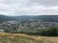
 Easy
Easy 
