


Complete tour of Texel Island

This circular route starts from the nature centre in the municipality of De Waal, in the centre of Texel. After passing through the Waal in Burg Polder Nature Reserve, it reaches the east coast via small country lanes, just below the town of Oosterend. A cycle path running alongside the sea leads to the harbour at Oudeschild and continues to the southern tip of the island at ‘t Horntje. A series of well-maintained cycle paths takes you to the town of Den Horn, then runs parallel to the west coast, passing through a forest, amongst other things, to reach the town of De Koog. Further on, the cycle path first runs alongside the high dunes and then crosses them before reaching the lighthouse at the northern tip of the island. The return journey is always via well-maintained cycle paths or quiet country lanes to the town of De Coscksdorp. Shortly afterwards, the route turns away from the sea to reach the Waal en Burg polder via a long, straight road.

Details

64748183
Creation:
Last update:
Last review:
  • Mountain biking
    Activity: Mountain biking
  • ↔
    Distance: 38.10 mi
  • ◔
    Duration according to the author: 7 hrs 
  • ▲
    Difficulty: Difficult

  • ⚐
    Back to start: Yes
  • ↗
    Ascent: + 75 ft
  • ↘
    Descent: - 66 ft

  • ▲
    Highest point: 43 ft
  • ▼
    Lowest point: -16 ft
  • ⚐ Country: Netherlands
  • ⚑
    Start/End: N 53.092667° / E 4.80433°

  • ◶
    Type of surface:
  •  
     
     47% Road  53% Byway
  • ⇧
    Bike carrying: Not specified
  • ▲
    Difficulty: Easy
  • Hour-by-hour weather

Photos

Description of the route

Start at “De Marel”, the visitor centre for the “Polder Waal en Burg” Nature Reserve, which is situated a short distance off the Nieuwlanderweg.

(S/E) Join the “Loopie Waalenburg”, a cycle path that continues from the access road to the visitor centre. Stay on the cycle path until you reach a road. Cross it and continue straight ahead until you reach another junction.

(1) Turn left onto the Waalder Weg, the road linking Den Burg to Oosterend. Turn left onto the cycle path. At the roundabout, head straight ahead and, shortly afterwards, take the road on the right, Spanger Weg. At point 57, turn right onto Spanger Weg and continue to point 59.

(2) Take the road on the left – Dijkmanshuizen – to point 37.

(3) Join the cycle path on the other side of the sea wall, on the sea side. Turn right and head to point 38, located at the port of Oudeschild.

(4) Follow the cycle path along the seafront, on the other side of the harbour. Pass point 40 to reach point 25.

(5) Turn left, still following the cycle path, until you reach ‘T Horntje. Turn right and head for point 01.

(6) Head towards point 06, following the road leading to Den Hoorn. Cross the road fairly quickly at the traffic lights, which have a push-button system accessible to cyclists. Continue straight ahead and turn right at the next cycle path junction.

(7) At point 06, leave the road and follow the cycle path to the left until you reach point 08.

(8) Turn right. At the entrance to Den Hoorn, take the first street on the left to reach point 09.

(9) Continue to the left until you reach the next junction, point 10.

(10) Turn right and follow the cycle path. At point 11, go straight on to reach point 05.

(11) Turn left, enter the woods, then take thesecond road on the right. Ignore all paths on both the left and right and you’ll arrive at a small restaurant. Carry on to the next junction.

(12) Carry on straight ahead to reach point 15, staying on the main road at all times (incorrectly positioned on the OSM map).

(13) Turn left and continue along this road. At point 16, turn left, leave the woods and reach point 17.

(14) Carry on straight ahead. The small road soon runs alongside a woodland and, further on, a cycle path lies just behind the first trees; it’s easy to join it. Carry on straight ahead until you reach point 20.

(15) Turn right, then take thefirst road on the left to avoid the campsite and the golf course. At point 21, head straight on to reach point 22.

(16) Leave the road and follow the cycle path which climbs to the left, into the dunes. Follow it straight on to point 31, passing points 27, 28 and 29.

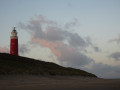
(17) Before continuing to the right, head to the lighthouse on the left, at the tip of the island.

(18) Return to point 31 via the same route.

(17) Carry on straight ahead along the lower road. At the crossroads, turn left.

(19) Carry on along the road below the sea wall until you reach point 32.

(20) Head along the road opposite, following a canal on your right, until you reach the first junction.

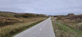
(21) Turn right onto the Hoofdweg and follow the long road straight ahead. After about 7 km, you’ll reach a cycle path at a T-junction.

(22) Leave the road and take the cycle path on the right. At the roundabout, turn left, then left again, and head for the visitor centre of the “Polder Waal en Burg” Nature Reserve (S/E).


Waypoints

  1. S/E : mi 0 - alt. -3 ft - Marel Nature Centre - Natuurcentrum de Marel
  2. 1 : mi 2.03 - alt. -7 ft - Cycle path on the left
  3. 2 : mi 4.82 - alt. -7 ft - Cycling point 59
  4. 3 : mi 5.59 - alt. 3 ft - Cycling Point 37
  5. 4 : mi 7.8 - alt. 13 ft - Cycling Point 38 – Oudeschild
  6. 5 : mi 9.53 - alt. -3 ft - Cycling point 25
  7. 6 : mi 12.14 - alt. 16 ft - Cycling point 01
  8. 7 : mi 12.89 - alt. 0 ft - Cycling Point 06
  9. 8 : mi 13.86 - alt. 0 ft - Cycling Point 08
  10. 9 : mi 14.78 - alt. 10 ft - Cycling point 09
  11. 10 : mi 15.02 - alt. 7 ft - Cycling point 10
  12. 11 : mi 16.19 - alt. 10 ft - Cycling point 05
  13. 12 : mi 17.6 - alt. 39 ft - Small restaurant
  14. 13 : mi 18.19 - alt. 33 ft - Cycling point 15
  15. 14 : mi 19.69 - alt. 13 ft - Cycling point 17
  16. 15 : mi 21.33 - alt. 23 ft - Cycling Point 20
  17. 16 : mi 22.51 - alt. 3 ft - Cycling point 22
  18. 17 : mi 28.7 - alt. 16 ft - Cycling point 31
  19. 18 : mi 28.93 - alt. 39 ft - Lighthouse
  20. 19 : mi 30.43 - alt. 3 ft - Option to walk along the sea wall
  21. 20 : mi 30.92 - alt. 10 ft - Cycling Point 32 – from Cocksdorp
  22. 21 : mi 31.72 - alt. -7 ft - Hoofdweg
  23. 22 : mi 36.31 - alt. 0 ft - Cycle path, on the right
  24. S/E : mi 38.1 - alt. -3 ft - Marel Nature Centre - Natuurcentrum de Marel

Notes

This route partly follows the northern circular route of the island, with a modification at the end of the route. – (Northern circular route of Texel, no. 64880762).

(4) Oudeschild: catering facilities available. Accessible toilets at the museum on the main street, on the left.

(7) Use the push-button to change the traffic lights.

(9) Den Hoorn: places to eat.

(15) De Koog: places to eat.

(16) You’ll join the island’s northern route (Texel Island Circular Route No. 64880762). Follow it in the opposite direction by turning left.
Alternatively, you can continue in the direction described – i.e. straight ahead – to complete only the southern loop of the island.

(19) You can also follow the northern route in the opposite direction by heading up onto the sea wall. This replaces the end of the main route and makes the walk longer but more enjoyable. Please note: after the harbour, rejoin the cycle path between the sea and the sea wall.

(20) Toilets (when they’re open...).

(22) Another way to reach the Marel Nature Centre: turn left, then right, and take the cycle path leading into the Waal en Burg Polder until you rejoin the original path, which you should then follow in the opposite direction.

Depending on the prevailing wind, choose one direction or the other, bearing in mind that the route on the western side of the island runs further inland and is more sheltered. If the wind is from the south or south-east, do the route in the opposite direction. If extending the route using the option described above, start with the ‘Circular Loop of Texel’ section (no. 64880762) up to (16), then follow the main route in the opposite direction.

Worth a visit

(S/E) De Waal: ‘De Marel’ Nature Centre.

(4) Oudeschild: Kaap Skil Museum and the harbour.

(15) De Koop: Écomare, seal rescue centre; ‘Duinen van Texel’ National Park.

(20) De Cocksdorp: Texel Aviation and War Museum.

Reviews and comments

5 / 5
Based on 2 reviews

Reliability of the description
5 / 5
Ease of following the route
5 / 5
Route interest
5 / 5
Patrick Vanbellinghen

Thank you for that helpful summary.

Machine-translated

User 28467072

Overall rating : 5 / 5

Date of your route : Jun 15, 2026
Reliability of the description : ★★★★★ Very good
Ease of following the route : ★★★★★ Very good
Route interest : ★★★★★ Very good
Very busy route : No

A 3-star route (or 5 on Visorando) offering a glimpse of the island’s unspoilt natural environment, its farming and livestock industries, and its urban areas. No particular difficulty, barring possible wind and rain…

Machine-translated

Patrick Vanbellinghen

Thank you for following up. If I remember correctly, on my side it was foggy and windy most of the time, but the pleasure of doing it...

Machine-translated

bessefr
bessefr

Overall rating : 5 / 5

Date of your route : Sep 24, 2025
Reliability of the description : ★★★★★ Very good
Ease of following the route : ★★★★★ Very good
Route interest : ★★★★★ Very good
Very busy route : Yes

Tour completed in 3 hours under beautiful sunshine but with quite strong winds... very pleasant but more difficult with the wind against us!

Machine-translated

For more walks, use our search engine .

The GPS track and description are the property of this route's author. Please do not copy them without permission.

