Tour of the grounds of La Hulpe Castle

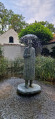
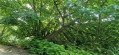
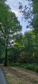
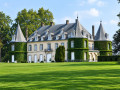
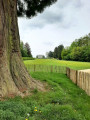
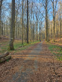
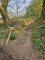
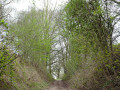
Starting from the estate’s car park on the forest side (Gaillemarde), this walk quickly leaves the estate itself to join the GR® 126, which you follow for part of the way. The landscape is that of the Forest of Soignes, with magnificent tall trees, mainly beech and oak. Beautiful avenues and forest paths lead to the Étang Solvay and the large grassy areas surrounded by rhododendrons and azaleas – which are superb when in bloom – leading up to the château. Not to mention the Folon Museum.

Details

104736296
Creation:
Last update:
Last review:
  • Walking
    Activity: Walking
  • ↔
    Distance: 4.72 mi
  • ◔
    Average duration: 2h 25 
  • ▲
    Difficulty: Easy

  • ⚐
    Back to start: Yes
  • ↗
    Ascent: + 285 ft
  • ↘
    Descent: - 289 ft

  • ▲
    Highest point: 453 ft
  • ▼
    Lowest point: 217 ft

Photos

Description of the walk

Car park on the Soignes Forest side of the estate (Gaillemarde).

(S/E) Enter the estate

(1) Take the first path on the left

(2) Then turn left onto Chemin Parmentier

(3) At Drève Joséphine (GR®126), continue straight ahead.

(4) Turn right at the T-junction. Do not take the two paths that branch off to the right. These are for horse riders (thefirst) and cyclists (thesecond).

(5) The GR®126 splits into two. Carry on straight ahead, then turn right.

(6) At the perpendicular lane, take the first path on the right, then follow the first path on the left

(7) Take the third path leading downhill to the right.

(8) Follow the lane (road) to the right.

(9) Go down the path on the right, with your back to the Chemin du Droit Tienne, then head right until you reach the tip of Solvay Pond. Turn immediately left along the pond.

(10) Follow the road to the right.

(11) At the T-junction, take the left-hand branch. Follow the signs for “Musée Folon”. Keep to the right, passing a building on your right. Walk down to the courtyard of the old farm and the Musée Folon. Cross the courtyard and walk up the road opposite.

(12) Continue straight ahead until you reach the junction you passed on the way there.

(1) Keep going straight ahead (S/E).

Waypoints

  1. S/E : mi 0 - alt. 289 ft - Car park
  2. 1 : mi 0.11 - alt. 276 ft - Path
  3. 2 : mi 0.25 - alt. 246 ft - Chemin Parmentier
  4. 3 : mi 0.9 - alt. 341 ft - Drève Joséphine
  5. 4 : mi 1.2 - alt. 344 ft - Fork in the road
  6. 5 : mi 1.44 - alt. 371 ft - GR126 junction
  7. 6 : mi 1.92 - alt. 443 ft - Perpendicular path
  8. 7 : mi 2.42 - alt. 420 ft - Downhill path
  9. 8 : mi 2.56 - alt. 381 ft - Road
  10. 9 : mi 3.25 - alt. 335 ft - Path leading downwards
  11. 10 : mi 3.78 - alt. 246 ft - Crossroads
  12. 11 : mi 3.92 - alt. 243 ft - Fork in the road
  13. 12 : mi 4.28 - alt. 246 ft - Parking musée Folon
  14. S/E : mi 4.72 - alt. 289 ft - Car park

Notes

(12) Toilets and the restaurant “La taverne de l’homme bleu”.

The château and gardens were the setting for the film “Le maître de musique”

Worth a visit

The large meadow stretching from Solvay Pond towards the rear of the château whilst the rhododendrons and azaleas are in bloom.

Between (11) and (S/E), there is a beautiful tree on the right: a Virginia blackthorn

Always be cautious and plan ahead when you're outdoors. Visorando and the author of this route cannot be held responsible for any accidents occurring on this route.

The GR® and PR® markings are the intellectual property of the Fédération Française de Randonnée Pédestre.

Other walks in the area

For more walks, use our search engine .

The GPS track and description are the property of this route's author. Please do not copy them without permission.