Country:


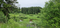
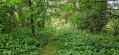
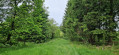
Losheimergraben roundabout.
(S) Take the N632, leaving the Shröder Hotel on your right. Turn left down the first forest track (following the previous day’s route in the opposite direction) to the junction near the river. Turn right and continue to a ‘T’ junction. Turn left and rejoin the road. (End of yesterday’s route).
(1) Junction 69 and the GR®56. Follow the road to the right. After crossing a river and coming out of a left-hand bend, stay on the road until you reach a ‘Y’ junction (junction 76)
(2) Take the path on the left – leaving the GR®56 – and continue along the main path, ignoring any side tracks, until you reach junction 52, a large crossroads on the edge of the forest.
(3) Take the road on the left. Continue straight ahead until you reach a large crossroads with trees in the centre.
(4) Turn left, passing the cemetery; ignore a road on the left; at the end of the bend, pass waypoint 53 and take the next road on the left leading to a farm. Cross the farm.
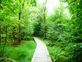
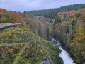
(5) ‘Y’ junction and waypoint 20. Take the left-hand branch. At the next ‘Y’ junction, turn right. Meadow, then the edge of the woods, followed by a walk through the woods and the descent towards the Warche.
(6) The path disappears into the vegetation and you need to be very careful to follow its course (as I did) and rejoin the path leading to the bridge over the river. On the other side, the path climbs back up to a road at waypoint 16. Turn right, passing over the Ravel. Continue to Büllingen (Bullange). (See practical information).
(7) Take the first road on the right. At the roundabout, continue straight ahead until just before the bridge over the Ravel. Turn left straight ahead, then follow the path immediately on the right leading to the Ravel.
(8) Follow the Ravel on the left until you reach the entrance to Bütgenbach at junction 45.
(9) Leave the Ravel. Head up the street on the left which runs between a hotel and a restaurant – Seestrasse – until you reach a roundabout. Take the first exit. At the Marktplatz, keep to the right and join the shopping street Monschauer Strasse.
(10) Turn right. The road leads downhill, passing under the Ravel – a very high bridge – then over the Warche.
(11) Take the road on the left towards ‘Recypark’ and Nidrum. After Recypark, there is a signposted path running parallel to the road which climbs. This path only follows the road for the first bend – unfortunately – then it’s the road all the way to the centre of Nidrum. Accommodation available to rent – stop as required. (E)
 Visorando Member
 Easy
Easy 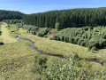

 Difficult