Country:

 City:
City:


(S) Junction of Rue Firmin Lepage and Rue de la Trembloie. Turn your back on the latter and take Rue des Vieux Sarts to the N88. Turn left.
(1) Turn left onto Rue Grand-Moulin. Follow the GRP®162 route. Pass La Chevratte and then the railway line. Turn right onto Rue Grand-Moulin.
(2) At the ‘Y’ junction, take the continuation of Rue Grand-Moulin to the right. At the Berchiwé crossroads – a beautiful building – continue left until you reach the entrance to Robelmont. Turn right onto Rue de la Colline. Continue straight on until you reach Avenue de la Grange au Bois (N875).
(3) Turn left, then immediately right onto the road that passes under the N87. At the second junction – the first one in the forest – continue straight ahead along the forest track until you reach a ‘Y’ junction.
(4) Carry on to the left, then keep going straight ahead. Just after the first junction, carry on straight ahead to the left. It becomes a footpath, then a track again further on, and leads into a housing estate. Go down the steep road. Turn right and carry on straight ahead immediately afterwards to join the N82.
(5) Turn left towards Belmont, where the road becomes Rue du Rabais. Pass Rue de Bohez and take the footpath that descends to the right between two houses. The slope is steep. Continue to the bridge over the Ton. Cross the bridge and go past the fence.
Please remember to close the gate behind you, and follow the river to the left. The path passes under a bridge – another gate to open and then close.
(6) Continue along the riverside path, which leaves the riverbank further on and joins a Ravel cycle route. (See practical information) Follow this route uphill straight ahead. At the next junction, carry on straight ahead; at the following junction, turn left (Rue de Latour) until you reach Rue de Fusillés. First turn right then left to take the road towards Gevimont (Rue de Bleid). It passes through the countryside and then runs alongside the woods. At the bend in the woods, there is a ‘Y’-junction
(7) Take the path on the right, running alongside the woodland and then into the woodland, keeping the woodland straight ahead of you. Join the road coming from Chevimont, then, on the right, the road leading to Bleid. Turn right and head towards Bleid.
(8) Stay on the main road, which has a circular route that curves sharply to the left, and follow it to Mussy-le-Ville. At the first junction, keep left, then go straight on twice – Rue Late. At number 21, turn right onto Rue Étienne Lenoir, which runs between numbers 19 and 17. Cut across the next street, then turn left onto Rue de la Haie de Dieu.
(9) At the junction with Rue du Buau, head diagonally up to the right onto Rue du Moulin – GRP®162. Continue straight ahead – following the GRP® route – until you reach the N88 at the entrance to Baranzy. Follow the N88 to the left, then take the second right onto Rue de la Fontaine. Follow this road until you reach the bridge over the river. Cross the bridge.
(10) Turn left onto Rue de France. It runs parallel to the N88. Keep going straight on until you rejoin the N88 – Rue de la Gaume. Take the second street on the left, then turn left again onto Rue des Ateliers.
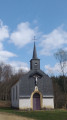
(11) Before number 10, take the path – the entrance is hard to spot – on the right. At the back of the gardens, it leads to Rue de Nickbas. Continue to the right, then follow Rue Orban to the left until you reach the church. Walk round it. Final leg unspecified (accommodation with a local resident) (E).
 Visorando Member
 Easy
Easy 
 Moderate