Rochehaut – Bouillon

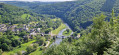
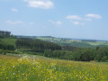
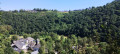
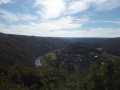
The starting point, the Rochehaut viewpoint, is one of the region’s most beautiful spots, offering a bird’s-eye view of a circular bend in the River Semois and the little village of Frahant. As for the finishing point, it is one of the most popular tourist attractions, with its superb fortified castle perched above the town. In between, along the way, there are forests, steep ascents and descents, and magnificent scenery. Accommodation at the Youth Hostel.

This walk is part of a multi-day hike: Tour de Wallonie

Details

90713505
Creation:
Last update:
Last review:
  • Walking
    Activity: Walking
  • ↔
    Distance: 7.89 mi
  • ◔
    Average duration: 4h 40 
  • ▲
    Difficulty: Moderate

  • ⚐
    Back to start: No
  • ↗
    Ascent: + 1,168 ft
  • ↘
    Descent: - 1,270 ft

  • ▲
    Highest point: 1,280 ft
  • ▼
    Lowest point: 636 ft

Photos

Description of the walk

Start on the N 819 at the Rochehaut viewpoint.

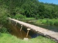
(S) With your back to the view, follow the N 819 to the left (towards Vresse-sur-Semois) for about ten metres. Take the first road on the left. Follow the signs for GR®16 – BVW. At the junction where several paths meet, turn left. Follow this path to the footbridge over the Semois.

(1) Cross the bridge and take Rue de la Passerelle in Frahan opposite.

(2) At the T-junction, turn left onto Rue des Crêtes. Follow this road until it joins the N893 at a hairpin bend.

(3) Take the path leading uphill opposite, between the two branches of the ‘Y’. The climb is steep as far as the ‘Chaire à Prêcher’ (take a short detour to enjoy the magnificent view over Poupehan). Continue uphill a little further to reach the road ‘La Croix de Poupehan’. Follow it to the right until you reach Rue de la Bourdoise in Corbion.

(4) Turn sharply left into Ruelle Lolette and cut across Rue du Boulet.

(5) At the “Y” junction, leave the hiking trails and take the path on the left.

(6) At the crossroads, cross over and take the path leading down opposite. It joins the Ruisseau des Curnais and leads out onto the Semois and the GR®14.

(7) Cross the small bridge on the right

Isn’t there a mistake here?

and follow the path that runs upstream alongthe river to the road passing through the tunnel at the entrance to Bouillon.

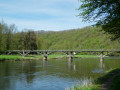
(8) Continue along the river to the bridge crossing the Semois. Turn right onto Rue de la Poulie, which goes uphill.

(9) At the next junction, head straight on into Rue du Nord and then immediately turn left into Ruelle du Passage. At the end of this, on Rue du Brutz, turn right and carry on until you reach a bend. Turn right onto Grand-Rue, then left, and cross the Pont de Liège.

(10) At the roundabout at Place Saint-Arnould, take the third exit onto Rue des Hautes Voies. After the hairpin bend, it becomes Rue du Christ, where you’ll find the Youth Hostel (E)

Waypoints

  1. S : mi 0 - alt. 1,047 ft - N 819, Rochehaut viewpoint - Semoy (rivière)
  2. 1 : mi 0.54 - alt. 676 ft - Footbridge over the - Semoy (rivière)
  3. 2 : mi 0.76 - alt. 725 ft - Frahan, Rue des Crêtes - Semoy (rivière)
  4. 3 : mi 2.43 - alt. 741 ft - N883
  5. 4 : mi 3.81 - alt. 1,155 ft - Corbion – Ruelle Lolette passage
  6. 5 : mi 4.23 - alt. 1,260 ft - Fork in the road (path/track)
  7. 6 : mi 4.53 - alt. 1,093 ft - Signpost, crossroads
  8. 7 : mi 5.46 - alt. 728 ft - GR14 - Semoy (rivière)
  9. 8 : mi 6.78 - alt. 732 ft - Tunnel - Semoy (rivière)
  10. 9 : mi 7.09 - alt. 778 ft - Crossroads
  11. 10 : mi 7.33 - alt. 722 ft - Rue des Hautes Voies - Château de Bouillon
  12. E : mi 7.89 - alt. 945 ft - Youth Hostel - Château de Bouillon

Worth a visit

Bouillon Castle

Always be cautious and plan ahead when you're outdoors. Visorando and the author of this route cannot be held responsible for any accidents occurring on this route.

The GR® and PR® markings are the intellectual property of the Fédération Française de Randonnée Pédestre.

Other walks in the area

For more walks, use our search engine .

The GPS track and description are the property of this route's author. Please do not copy them without permission.