Country:
 City:
City:



Nidrum town centre
(S) Take Dellenstrasse to the ‘Y’ junction at an ‘open’ crossroads, then turn left onto Vennstrasse until you reach another ‘Y’ junction.
(1) Turn left onto Vennstrasse, which splits into two roads of the same name. Follow this small country lane as it winds its way down towards two ponds, ignoring the side roads. It then climbs back up towards a few houses.
(2) Hiking junction 24; first turn left then right towards the main road – Sourbrodter Straße – At the ‘Y’ junction, stay on the main road and turn left immediately after a side road. Cut across the next road. Continue until you reach a road branching off to the right at an acute angle.
(3) Turn right. At the edge of a copse – with a cross – take the path leading off to the left. Join a wider road. Turn right. Cross a small copse and then a bridge. Multi-way junction.
(4) Take the middle lane, straight ahead. This path becomes a road further on. Ignore any side paths to the right or left until you reach the edge of the Sourbrodt sports ground.
(5) Turn right, then take the first street on the left. Follow this until you reach a main road – the N647.
(6) First turn right then left and take Rue de Bosfagne. Continue straight on, crossing over the Petite Rour, and carry on until you reach a ‘Y’ junction with a country lane.
(7) Turn slightly right, carry on straight ahead at the next junction until you reach the edge of a wood – a ‘Y’ junction.
(8) Take the left-hand branch and carry on straight up the hill through the forest. Follow the forest track until you reach a ‘T’ junction on the plateau – a cross.
(9) Turn right – GR®14 GR®56 – At the top, join the forest track via a zigzag. Altitude 638 m.
(10) Turn left and continue until you reach a left-hand bend. Carry on straight ahead along a path leading downwards at the edge of the forest.
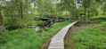
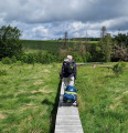
(11) The path continues over narrow wooden walkways.
(12) After the bridge over the Helle-Hill, head right along a succession of wooden walkways and muddy, rocky and root-strewn paths until you find yourself slightly above the river.
(13) A faint path climbs the steep slope to the left, heading towards the base of a large tree. Climb this to reach a plateau. The path continues through the undergrowth, occasionally interspersed with wooden walkways. Keep heading straight on as there are no signposts. Ignore all side paths. After a bend to the left, it joins a track. End of the wooden walkways
(14) Carry on straight ahead along this track. The descent begins. Ignore a track on the left, carry on straight ahead at the junction and continue to the ‘Y’ junction where two tracks meet.
(15) Take the left-hand lane. Follow it for a long way, continuing downhill and ignoring any side paths at the various junctions; keep going straight ahead. The gradient steepens; the lane becomes a road and takes a sharp bend to the left, then a right-angle turn to the right, descending even more steeply to the confluence of the Helle-Hill and the Soor.
(16) Carry on straight ahead, crossing over the Soor, and follow the path that runs alongside the Helle-Hill whilst moving away from it as the river curves. Continue to a ‘Y’ junction and hiking point 9.
(17) Turn right to follow the river. A little further on, you’ll enter Eupen. After the swimming pool, cross the river. At the ‘Y’ junction, keep left. Join the N67.
(18) Follow it to the left, cross the bridge over the Vesdre and reach a roundabout.
(19) Take the road opposite, pass one road on the right, another on the left, and take the pedestrian path on the right – the GR®56 trail – which ends in a flight of steps leading onto a road. Follow this road to the right and immediately turn left onto a path through the woods. At the top, you’ll come to a junction of paths.
(20) Turn left to reach the car park at the Kaleo Youth Hostel. (E)
 Visorando Member
 Easy
Easy 
 Average