Country:
 City:
City:


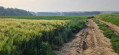

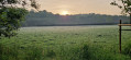
(S) At the junction between the street and the Monte-en-Peine cobbled path in Ciply (Hyon). Take the cobbled path and, very soon after, take the Sentier des Rogneaux on the left into the woods. This leads onto Rue des Robiniers.
(1) Turn right onto the road and continue straight on until you reach the motorway – the R5. It becomes Rue de Binche.
(2) At the junction with the N6 (Rue Émile Wauquier), make the first turn right then left to take the continuation of Rue de Binche opposite, which becomes Route de Binche. At the first junction, turn right and follow the road. It becomes a country lane a little further on.
(3) Cross Rue du Comte and take Rue Notre-Dame de Tongres opposite. Ignore the first road on the right and take the path on the right at the start of the bend. Pass the chapel and turn right again onto the first path. This continues as Chemin de Spiennes.
(4) Cross Route d’Harmignies and continue straight ahead onto Chemin de Givry. This leads to Rue des Pâturages (N546).
(5) Follow it to the left and, at the entrance to Givry, take the footpath that starts on the right between houses numbered 101 and 99. At the junction with the GR® 129, follow it to the left (Sentier des Hauts-Pays) and leave it a little further on, continuing straight ahead along Rue de la Petite Cavée.
(6) At Rue d’Esquerbion, carry on straight ahead and do the same at the next street. When the street bends to the left, take Rue du Vert Galant on the right and, at the next T-junction, take Rue du Moulin on the right, then take the first left to cross the Trouille and turn right again onto Rue du Castiau. Carry on until you reach the N563 (Chaussée de Brunehaut).
(7) Follow it to the left, then take the first right (Chemin de la Vallière). Keep to the right at the Y-junction and follow the GR®129 and the Chemin de Saint-Jacques de Compostelle. The road gives way to a farm track. Ignore all side tracks until you reach a road, Rue Sainte-Barbe
(8) Turn left onto the “Petit Paris”, then take the first right, following the GR® and the Way of St James. At the T-junction, first turn right then left to continue straight ahead on the GR® (leaving the Way of St James). Carry on straight ahead at every junction (leaving the GR®) until the path turns sharply left and then takes a wide bend to the right.
(9) Take the Ravel on the right and follow it to Rue du Bois Gilles. Follow this road to the right until you reach Rue Paul Pastur.
(10) Turn left and go under the N54, then continue straight ahead to a Y-junction. Take the left-hand branch (Rue des Viviers). Ignore one path and take the next one on the right (Chemin de Grand Reng/Rue des Viviers).
(11) At the next junction, take the first turn left then right to take Rue Bon opposite. Follow Rue Bon until you reach a T-junction with Rue Triboulette. Turn right, then take the first left (Rue du Quartier). At the junction with Rue Madame (N561), continue straight on (Rue de Merbes).
(12) At the roundabout, turn right onto Route de Mons (N40) and cross the Sambre. Finish the walk at the junction of the N40 with Rue Jeanne (on the right) and Rue Aublaine (on the left) (E).
 Visorando Member
 Easy
Easy