Country:
 City:
City:


Departure from the Kaleo Youth Hostel.
(S) Take Judenstrasse and cross the car park. At the T-junction, turn right, pass between the sports fields and join the N68.
(1) Turn left. Follow this road until the second street on the right – Kaperberg – A footpath runs above the school, skirting it. Continue to hiking junction 92.
(2) Turn left onto Rue In de Stepen. Follow it to the right until you reach a larger road – a small square – Couvenplatz – then first turn left then right onto Heidgasse. Pass two junctions on the right. You’ll come to a Fork in the road.
(3) Take the street on the right, going over the railway line. Pass a road on the right. At the next two junctions, turn right. Continue to number 21.
(4) Turn left onto a footpath between numbers 20 and 22. Follow it until you reach a road. Follow this road until you reach a four-way junction.
(5) First turn right then left to take the road opposite. Cross the N68. Continue to a roundabout. Go round it to take the farm track opposite, which becomes a footpath leading to a meadow gate at the foot of a tree.
(6) Next to the gate is a ‘leg-breaker’ footbridge for livestock. Cross the obstacle and continue straight ahead, then diagonally towards a house and on to a road, reaching hiking junction 87 a little further on to the right.
(7) Turn left, cross over the railway line and the E40 motorway. At hiking junction 26, continue straight ahead to hiking junction 65. Turn right and head for hiking junction 59 at the next junction.
(8) Turn left, cross over some more railway lines and arrive at the entrance to Lontzen. Continue straight on along the same road. Pass a church. Arrive at a junction, hiking junction 11.
(9) Turn right onto this main road. Cross over the Lontzenerbach river. Continue to a square on the left, Lindenplatz.
(10) Cross this square diagonally to the right to find the path leading to Maria-Theresia Strasse. Follow it to the right, then straight on. It crosses the countryside to join another road and, a little further on, hiking junction 69 at the edge of a wood.
(11) Turn left. At hiking node 41, there is a Fork in the road, continue straight on (to the left), cross back over the river and reach hiking node 65.
(12) Turn sharply right. The road becomes a track/path at the first bend. At the next junction, hiking node 80, continue straight ahead. After leaving the river, at the Fork in the road keep left until you reach a five-way junction, hiking node 36.
(13) Continue straight ahead along the edge of a small wood. At hiking node 43, a Y-junction, turn left and follow this path to the N3.
(14) Turn left until you reach the roundabout. Turn right. Further on, cross over the Ravel cycle route, cross the railway line and continue to the centre of Montzen, the village square.
(15) Take the street on the left round the corner of the square. At the first Y-junction, turn left onto the side road; at the second fork, turn right. The street slopes down, passes a few houses on the right and comes to a ‘private property’ sign and another sign indicating the local footpath.
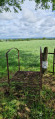
(16) Turn right along the small hedge of trees, following what appears to be a path. Shortly after crossing a stream via a makeshift bridge, you’ll come to a marvellous new gate designed to prevent livestock from escaping, at the entrance to a meadow. Go through it and walk up the meadow along the “path” towards another identical gate at the far end of the meadow. Go through it and you’ll reach a road and a few houses. Turn left until you reach a wider road.
(17) First turn left then right to take the path leading up towards a wood. Take the path on the left at the edge of the wood. Further on, the path enters the wood proper; leave the path that goes in but stay at the edge. On emerging from the wood, you’ll join another path. Continue straight ahead. At the Y-junction, carry on straight ahead, taking the left-hand branch, and continue in the same direction until you reach Rue d’Aubel in the centre of Hombourg (N608).
(18) Turn left, then immediately take the pedestrian crossing on the right at the start of a car park. The path veers right then left to join Rue de la Station. Walk down the street to the left. Turn right, then left. Immediately afterwards, take the path on the right to rejoin the same road after a third bend. Continue down the street to the right until you reach the entrance to the old station.
(19) Carry on straight ahead, then turn right onto Rue de Remersdael. Take the first road going uphill on the left, Chemin de Berlieren, until you reach Ravel line 38.
(20) Take the Ravel to the right until the end of a long left-hand bend. Take the path leading down to the right to join a street. Follow it to the right until you reach a junction at the start of a bend.
(21) Continue along the road to the left. You’ll reach Remersdael. Turn left, then take the first road on the right. This joins another road. Carry on to the right and take the first left.
(22) The road becomes a rocky, sunken track that climbs ever more steeply until it joins a road, and from there, the main road, the N648. Turn right and walk alongside the campsite until you reach its entrance (E). Take care here: this is a busy road with no space for pedestrians.
 Visorando Member
 Average