







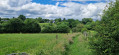
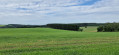

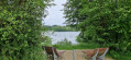
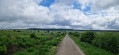
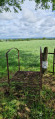
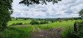



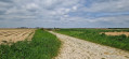

I undertook this tour of Wallonia as part of the ‘Parkin’son Tour de Wallonie’, during which my accommodation was, at least in part, provided by private individuals. In other cases, these were holiday rentals which I do not wish to publicise – not because they did not suit me, but to comply with Visorando’s guidelines, amongst other things. In all cases, except for campsites and youth hostels, the start and end points have therefore been changed. They are randomly placed in locations that allow for easy travel from one stage to the next (E) and (S). It is up to each person to find the accommodation that best suits them for the rest of the route.
Tour de Wallonie


This walking tour of Wallonia, which includes the German-speaking part of Belgium, is a circular route that generally follows the borders as closely as possible, whether linguistic or territorial. This sometimes involves forays into neighbouring territories – France, the Grand Duchy of Luxembourg and the Flemish Region. Occasionally, the route also deviates from this due to accommodation requirements or because suitable accommodation could not be found close to the borders, whilst still adhering to various constraints.
Details
Creation:
Last update:
Last review:
–
–
-
 Activity: Walking
 -
 Distance: 456.86 mi
 -
 Average duration: 33 days
 -
 Difficulty: Difficult
 -
-
 Back to start: No
 -
 Ascent: + 25,620 ft
 -
 Descent: - 26,109 ft
 -
-
 Highest point: 2,241 ft
 -
 Lowest point: 30 ft
-
 Country:
Belgium
Country:
Belgium
-
 Area: Massif des Ardennes
 -
 City:
Waterloo
City:
Waterloo -
 Start: N 50.680397° / E 4.403599°
 -
 End: N 50.68106° / E 4.40188°
 -


 Hour-by-hour weather
Photos

Stages of the route
This route needs several days, find the details below:
Notes
Other walks in the area
Tour de Wallonie Stage 1 Braine-l'Alleud - Braine-le-Comte
 Visorando Member
 16.34 mi
+2,425 ft
-2,549 ft
9h 40
Difficult
Departure from Waterloo (Brabant Wallon)
16.34 mi
+2,425 ft
-2,549 ft
9h 40
Difficult
Departure from Waterloo (Brabant Wallon)
Starting from the 1815 site, this first stage of my tour of Wallonia connects two towns named Braine – Braine-l’Alleud and Braine-le-Comte – whilst prioritising routes away from towns and villages as much as possible. But that doesn’t necessarily mean they are farm tracks or footpaths. Where possible, yes; otherwise, mostly small country roads.
Grand Tour of Braine-l'Alleud
 23.27 mi
+951 ft
-925 ft
11h 30
23.27 mi
+951 ft
-925 ft
11h 30
 Very difficult
Departure from Waterloo (Brabant Wallon)
Very difficult
Departure from Waterloo (Brabant Wallon)
Here is a long and challenging circular route, with numerous ascents and descents, through woodland or open countryside, taking in tarmac roads, cobbled streets, gravel paths, dirt tracks and sandy terrain. All this whilst avoiding built-up areas as much as possible and staying in the countryside.
Circular route between the 1815 site and Maransart
 8.89 mi
+436 ft
-417 ft
4h 30
8.89 mi
+436 ft
-417 ft
4h 30
 Moderate
Departure from Waterloo (Brabant Wallon)
Moderate
Departure from Waterloo (Brabant Wallon)
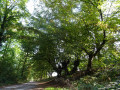
This is a magnificent walk that can be enjoyed on foot or by mountain bike. It takes place almost entirely in the beautiful countryside of Walloon Brabant, amongst fields, meadows and woodland. The surfaces vary: tarmac, old cobblestones, farm tracks and footpaths. In autumn, pheasants are everywhere and you may be lucky enough to spot a herd of does emerging from beneath the trees at the edge of a wood to feed on fresh grass in a meadow.
Tour of the Waterloo battlefield, 1815
 4.53 mi
+141 ft
-138 ft
2h 10
4.53 mi
+141 ft
-138 ft
2h 10
 Easy
Departure from Waterloo (Brabant Wallon)
Easy
Departure from Waterloo (Brabant Wallon)
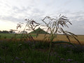
Starting from the 1815 site, this circular route takes you across fields to explore the sweeping landscapes of the Plancenoit and Braine-l’Alleud area, the site of Napoleon’s final battle. Largely along country lanes, you’ll be accompanied by the song of the lark and the call of the pheasant. If you’re lucky, in the early morning you might spot a roe deer coming out to feed. And, for history buffs, there are a few reminders of the battle at the start and end of the route.
Circular route from Braine-l'Alleud to Haut-Ittre
17.12 mi
+1,079 ft
-1,073 ft
8h 50
Very difficult
Departure from Waterloo (Brabant Wallon)
For once, here is a long 27 km circular hike through the rolling countryside of this corner of Walloon Brabant. Starting from the Butte du Lion - site 1815 - it first crosses the town of Braine-l'Alleud before returning to the countryside, which the hike hardly leaves until it returns to the foot of the Butte du Lion.
Circular route to Couture-Saint-Germain and La Lasne
 5.88 mi
+492 ft
-479 ft
3h 10
Moderate
Departure from Lasne (Brabant Wallon)
5.88 mi
+492 ft
-479 ft
3h 10
Moderate
Departure from Lasne (Brabant Wallon)
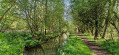
Here is a circular walk allowing you to discover the beautiful spots of the Lasne - Couture-Saint-Germain area, sometimes completely surrounded by nature, sometimes passing through the pretty neighbourhoods of this area. It involves a lot of ups and downs: the walk is in the "Brabant double 'v'allon" and the views are superb.
A little trip to Paradise starting from Braine-l'Alleud
 4.03 mi
+157 ft
-144 ft
2h 00
Easy
Departure from Braine-l'Alleud (Brabant Wallon)
4.03 mi
+157 ft
-144 ft
2h 00
Easy
Departure from Braine-l'Alleud (Brabant Wallon)
Starting from the Étangs du Paradis, here is a circular route to discover the rural side of Braine-l'Alleud towards Ophain-Bois-Seigneur-Isaac. Les Hayettes, Village No. 1, the ponds and the new swimming pool in Braine are dotted along a very varied route.
Magnificent landscapes between Plancenoit and Maransart
 4.16 mi
+246 ft
-240 ft
2h 10
Moderate
Departure from Lasne (Brabant Wallon)
4.16 mi
+246 ft
-240 ft
2h 10
Moderate
Departure from Lasne (Brabant Wallon)
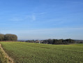
A very beautiful circular walk with varied landscapes. As there are not many shaded areas, this walk is best avoided when it is hot and the sun is beating down. Magnificent in autumn, also nice in winter, but you can hear the N5 more as the trees are bare.
For more walks, use our search engine .
The GPS track and description are the property of this route's author. Please do not copy them without permission.

