Country:

 City:
City:


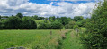
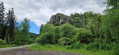
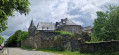
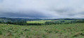
Benonchamps: N821, at the bottom of Rue du Cimetière.
(S) Opposite this street, follow the N821 to the right until you reach the first junction. Turn left onto the road towards Bourcy. It climbs through countryside to a junction near a quarry – N874.
(1) Carry on straight ahead towards Arloncourt. At the first ‘Y’ junction, follow the main road to the right and then straight on. Pass three junctions to reach a second ‘Y’ junction.
(2) Take the side road on the right towards the Michamps Agri-Food Centre. Walk straight through it.
(3) At the back, a path leads through the woods. It comes out onto a farm track. Turn left. Head towards the centre of the village of Michamps.
(4) Take the road opposite – the N838 – until you reach the first junction with a minor road.
(5) Turn right. At the first junction, carry on straight ahead; at the second, turn left until just before the bridge.
(6) Take the road on the right.
(7) Join the Ravel L163 and follow it to the right until you reach a ‘Y’ junction of Ravels.
(8) Follow the Ravel L613 to the left until you reach the road.
(9) Turn right onto the Route de Bourcy (N838). Follow it to Bœur, ignoring all side roads.
(10) Drive through the whole village on the main road.
(11) At the ‘Y’ junction, turn left onto the side road and follow it to Wandebourcy.
(12) At the junction/small square, carry on straight ahead.
(13) At the junction in the middle of the fields, take the main road on the right towards Tavigny.
(14) At the open crossroads, turn left then immediately turn right. Follow the main road, which first turns right then left and leaves the village.
(15) At the ‘Y’ junction before the woods, carry straight on. The road curves in an ‘S’ shape, first turning right then left.
(16) At the ‘Y’ junction, take the left-hand branch and enter Cetturu.
(17) At the left-hand bend and the ‘Y’ junction, keep left.
(18) At the ‘Y’ junction and the right-hand bend, follow this road.
(19) At the ‘Y’ junction, continue to the left.
(20) Take the path on the right. It leads into the woods. At the ‘Y’ junction, continue to the right. At the crossroads, continue straight ahead.
(21) T-junction. Follow the GR®57 to the road to Rettigny and the Bastin rock.
(22) Turn right at the foot of the rocks, then immediately follow the path which climbs to the left. It continues much further along a road.
(23) At the ‘Y’ junction, turn left and enter Rettigny
(24) Carry on straight ahead to an open junction.
(25) Carry on straight ahead, then turn left.
(26) At the ‘Y’ junction, turn right until you reach the next crossroads.
(27) Follow the path straight ahead and continue straight on; cross the next road and join a road at a bend.
(28) Follow it to the left until you reach the main road – N827 – Random stop – hire (E)
 Visorando Member
 Moderate
 Easy
Easy