Country:
 City:
City:


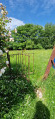
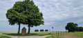
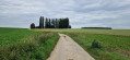
Junction of Chaussée de Charleroi and Chaussée de Wavre.
(S) Chaussée de Charleroi: head towards the motorway. Take the first road diagonally to the right. Ignore a path on the right. Take the first street on the right, Rue de Gobie. It turns left then right.
(1) Take the path on the left, which continues as a footpath. Rue Trémouroux: turn right, then take the first left onto Rue de la Tasnière. Follow this road. Cross Rue du Guêt. After a detached house, ignore path no. 7. Head for the T-junction
(2) First turn left then right. Cross the Chemin du Pont Valériane. At the ‘Y’ junction, take the right-hand branch – Chemin des Dames Jallittes – until you reach a five-way junction.
(3) Take Rue des Tumuli opposite until you reach Route de Libersart. Another five-way junction.
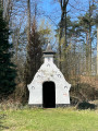
(4) Cross it and turn left into Rue Chapelle Daix. You’ll come to a junction with a small chapel – a ‘potale’ – set amongst the trees.
(5) Turn right and carry on straight ahead until you reach the Corroy-le-Grand cemetery. Take Rue des Corbeaux on the left. Follow the bend in the road. You’ll reach Saint-Étienne Church by turning left.
(6) Turn right at the corner by the church and take the Sentier de Messe to the Chemin de la Dîme. Turn right. At the right-hand bend in the street, head straight ahead onto the Chemin du Marguillier (a street that continues as a footpath) until you reach Rue Al Mez.
(7) Turn right. At the next junction – Rue de Chastre – turn left onto this street and continue straight on until you reach the Chaumont-Gistoux Recyparc.
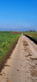
(8) Turn right onto Chemin de Vieusart. Pass the entrance to the Recyparc. At the roundabout, turn left onto Rue du Laid Burniat. Continue straight on until you reach the Ardennes motorway (E411). The road continues as a farm track running alongside the motorway. Just before the right-hand bend, a footpath appears opposite. This leads directly to Rue de Méves and the underpass beneath the motorway.
(9) Go under the motorway. The road curves in an ‘S’ shape. At the roundabout, carry on straight ahead. Caution: heavy traffic.
(10) Here, for ease of navigation, keep to the right. Use the zebra crossings but there are no traffic lights. Take the first right – Porte Lemaître. Then first turn left then right, cross Place du Levant and then Place Sainte-Barbe. Take Rue Archimède on the right until you reach the junction, ignoring all the side pedestrian paths.
(11) First turn right then left. Join Rue Georges Lemaître as it curves. Turn left, continue past another right-hand bend and pass two streets coming from the left (Rue des Liégeois and Impasse de Picardie).
(12) Take the footpath on the left just after the cul-de-sac, then immediately the one on the right. This leads to a small square. Turn right, cross the next square straight ahead to reach a large square, the Place de l’Université.
(13) Keep going straight ahead along the street and take Rue Charlemagne on the left, at the corner of the square, to reach the Grand’Place. (E)
 Visorando Member
 Difficult
 Easy
Easy