


bozierbruno

 Visorando Member
 Premium user
 - Location: Thilay (08800)
Sign up:
Published route(s)
 Around the Hautes Rivières and Nohan sur Semoy
 10.74 mi
 +1,778 ft
 -1,768 ft
 6h 30
6h 30
 Average
 Departure from Les Hautes-Rivières (Ardennes)
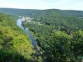
This route, located at the beginning of the French Semoy Valley, will give you access to four viewpoints that will allow you to discover Les Hautes Rivières, Nohan and the Crête du Château de Linchamp from different angles. It will give you the opportunity to admire a landscape shaped by the river and its tributaries.
The Douaire, Lazareth and Bouillonnais paths
 11.27 mi
+1,257 ft
-1,250 ft
6h 15
Average
Departure from Givonne (Ardennes)
11.27 mi
+1,257 ft
-1,250 ft
6h 15
Average
Departure from Givonne (Ardennes)
This route follows a variety of paths through a forest with a wide range of tree species. It is located almost entirely within the Sedan National Forest.
The Big Oak from Thilay
 7.44 mi
+1,158 ft
-1,138 ft
4h 25
Average
Departure from Thilay (Ardennes)
7.44 mi
+1,158 ft
-1,138 ft
4h 25
Average
Departure from Thilay (Ardennes)
A short, mainly woodland route around Thilay and Naux. You will discover the old Moulin de la Gire mill, the former hamlet of Narbruay, and the Maison du Père Labranche. This walk also includes two viewpoints over Nohan, on the ridge of the Château de Linchamps.
In the Bois de la Havetière
 5.74 mi
+620 ft
-604 ft
3h 10
Average
Departure from Charleville-Mézières (Ardennes)
5.74 mi
+620 ft
-604 ft
3h 10
Average
Departure from Charleville-Mézières (Ardennes)
Short hike in the forest near Charleville.
In the Mortehan forest: the four streams, La Roche au Sel, the Gros Chêne
 7.72 mi
+732 ft
-719 ft
4h 10
Average
Departure from Villers-Cernay (Ardennes)
7.72 mi
+732 ft
-719 ft
4h 10
Average
Departure from Villers-Cernay (Ardennes)
22 October 2025: first part of the route revised due to the recent installation of a fence on a forest plot.
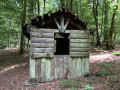
An exclusively forest route, sometimes wild, near Belgium. Especially in its first part, it takes in natural areas that are rarely visited. Modest streams have carved out a surprising landscape here. La Roche au Sel, Le Gros Chêne, and L'Étang la Motte are worth a quick look in the second part of the route.
From Les Hauts du Terne to Les Hauts Buttés
 9.77 mi
+1,142 ft
-1,142 ft
5h 30
Average
Departure from Monthermé (Ardennes)
9.77 mi
+1,142 ft
-1,142 ft
5h 30
Average
Departure from Monthermé (Ardennes)
This hike will take you in the footsteps of the Cerceaux quarry workers and the inhabitants of the "Hauts" who once lived off livestock farming, crop cultivation and forestry. You can stroll along these varied paths, perhaps once trodden by pilgrims from Saint-Antoine des Hauts Buttés. On the way back, you will enjoy an easy descent along the Pilette stream.
Champ Bernard and the Nantanru Valley
 3.94 mi
+643 ft
-643 ft
2h 20
Average
Departure from Thilay (Ardennes)
3.94 mi
+643 ft
-643 ft
2h 20
Average
Departure from Thilay (Ardennes)
Good physical condition is required for this short route, which has a significant elevation gain in its first section. The descent along the Ruisseau du Nantanru is very pretty and presents no difficulty. The return via the Transsemoisienne, the old "little train" route, allows for a leisurely return along the Semoy.
La Truche and Lombut Castle
 9.01 mi
+1,030 ft
-1,027 ft
5h 00
Average
Departure from Mouzon (Ardennes)
9.01 mi
+1,030 ft
-1,027 ft
5h 00
Average
Departure from Mouzon (Ardennes)
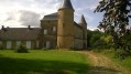
A walk starting from Mouzon, offering lovely views of the Meuse and Chiers valleys and the neighbouring villages throughout the route.
On either side of the Ruisseau de l'Ours
 7.12 mi
+1,234 ft
-1,217 ft
4h 20
Average
Departure from Les Hautes-Rivières (Ardennes)
7.12 mi
+1,234 ft
-1,217 ft
4h 20
Average
Departure from Les Hautes-Rivières (Ardennes)
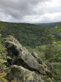
Forest walk starting from Linchamps in the commune of Hautes Rivières. A mountainous start, a stop at La Neuville aux Haies, a forest path running along the edge above the Ravin de l'Ours, a marked descent to rejoin... the Ravin de l'Ours and a peaceful finish.
See suggested alternative in the section: Places to see
The use of a GPS is recommended; do not rely on the old dot-marking system, which remains in place in some areas
The Roche Blanche bridge from Mélezet
4.78 mi
+587 ft
-568 ft
2h 45
 Easy
Departure from Les Orres (Hautes-Alpes)
Easy
Departure from Les Orres (Hautes-Alpes)
An easy hike starting from Mélezet with lovely views of the village and Les Orres resort.
The route follows the old Baratier irrigation canal for about 1.5km.
 Circuit du Mortehan
18.93 mi
+1,969 ft
-1,962 ft
4 hrs
Average
Departure from Givonne (Ardennes)
This forest route follows a variety of paths, including many sections of the Pays Sedanais mountain bike routes and various forest trails in Villers Cernay, Francheval and Pouru-aux-Bois.The elevation changes are not excessive and the numerous streams that line the route add a special charm to this route.
This is a difficult route requiring some portage.
L'Aber Bay and Pointe de Perharidy
 6.88 mi
+30 ft
-33 ft
3h 10
Average
Departure from Roscoff (Finistère)
6.88 mi
+30 ft
-33 ft
3h 10
Average
Departure from Roscoff (Finistère)
Starting from Roscoff, this route will allow you to explore the Perharidy peninsula by skirting the Anse du Laber. It is an easy walk, following theGR®® route and a local footpath, offering, in a very pleasant setting, lovely views of Roscoff and the Île de Batz.
Anse du Laber can be fully explored at low tide, and depending on the tide, the landscapes you see can be radically different.
The Vendresse Arboretum, the Ligne aux Sapins and the Cogneux springs.
 8.15 mi
+955 ft
-958 ft
4h 35
Average
Departure from Vendresse (Ardennes)
8.15 mi
+955 ft
-958 ft
4h 35
Average
Departure from Vendresse (Ardennes)
Enjoy the Vendresse State Forest, remarkable for its many species and rows of Douglas fir trees.
Take in the view of the vast Bar valley and the Ardennes canal before descending towards Omicourt. Climb back up to return to the Bar valley.
Walk along the Rouge Cogneux and discover its resurgent springs.
Return to the "Domaniale".
La Roche à Sept Heures
 8.19 mi
+1,194 ft
-1,211 ft
4h 50
Average
Departure from Tournavaux (Ardennes)
8.19 mi
+1,194 ft
-1,211 ft
4h 50
Average
Departure from Tournavaux (Ardennes)
With a fairly challenging first section through the forest and a more leisurely second section along the Meuse and Semoy rivers, this route has two main destinations:
- the Roc la Tour site, a vast quartzite massif,
- and La Roche à Sept Heures, located at the top of rocky spurs overlooking the Meuse.
The viewpoint at this site offers a very picturesque panorama of the meander, considered to be the most spectacular in France, on the convex side of which Monthermé was built.
The Liry ridge via the Fay-Phades quarries
 5.38 mi
+958 ft
-955 ft
3h 20
5.38 mi
+958 ft
-955 ft
3h 20
 Difficult
Departure from Tournavaux (Ardennes)
Difficult
Departure from Tournavaux (Ardennes)
Between Tournavaux and Haulmé, this short but invigorating route follows the ridge between the Meuse and Semoy valleys. Several viewpoints are on the itinerary, as well as a section at the start of the walk through the former Fay-Phades quarry site.
The Piot Cross at the start of the route from Wadelincourt
 11.01 mi
+1,230 ft
-1,214 ft
6h 10
Average
Departure from Wadelincourt (Ardennes)
11.01 mi
+1,230 ft
-1,214 ft
6h 10
Average
Departure from Wadelincourt (Ardennes)
A route with very few sections through woodland which, throughout the walk, offers hikers sweeping panoramic views over the Bar and Meuse valleys.
In the Semois valley near Corbion
 4.97 mi
+843 ft
-846 ft
3h 00
Average
Departure from Bouillon (Belgique) (Province de Luxembourg)
4.97 mi
+843 ft
-846 ft
3h 00
Average
Departure from Bouillon (Belgique) (Province de Luxembourg)
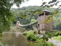
This short, mainly forest walk will take you close to the Semois river and offer beautiful views of its winding valley.
The Semoy Valley and its hills
 23.07 mi
+2,408 ft
-2,395 ft
5 hrs
Difficult
Departure from Monthermé (Ardennes)
23.07 mi
+2,408 ft
-2,395 ft
5 hrs
Difficult
Departure from Monthermé (Ardennes)
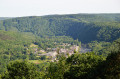
This forest route offers an introduction to the French section of the Semoy. At the various viewpoints, you can admire the rugged landscape shaped by the river and its many tributaries.
This walk takes you past almost all of the villages along the Semoy.
This route combines two other routes that I have described, starting from Thilay.
The Gespunsart Walk
 7.30 mi
+719 ft
-709 ft
4h 00
Average
Departure from Gespunsart (Ardennes)
7.30 mi
+719 ft
-709 ft
4h 00
Average
Departure from Gespunsart (Ardennes)
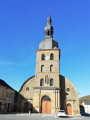
Gespunsart, a schist village situated in a vast clearing at the junction of four beautiful valleys.
A forest with a wide variety of tree species surrounds the village. Belgium is very close by.
Although the nail-makers’ workshops have disappeared, metallurgical expertise remains one of the village’s strengths.
La Dauphinée, Linchamps Castle, La Roche Margot and La Croix d’Enfer
 7.44 mi
+1,430 ft
-1,411 ft
4h 40
Average
Departure from Les Hautes-Rivières (Ardennes)
7.44 mi
+1,430 ft
-1,411 ft
4h 40
Average
Departure from Les Hautes-Rivières (Ardennes)
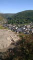
This hike along varied trails takes you to the sites of La Dauphinée and Linchamps Castle, as well as two remarkable viewpoints overlooking the industrious village of Les Hautes-Rivières.
Champ Bernard at the start of Thilay
 7.08 mi
+1,010 ft
-984 ft
4h 10
Average
Departure from Thilay (Ardennes)
7.08 mi
+1,010 ft
-984 ft
4h 10
Average
Departure from Thilay (Ardennes)
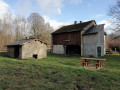
After warming up on the Transsemoysienne, you will walk along the Gire stream and the Chaufour and Nantanru paths to reach the Champ Bernard clearing. You will return via Nohan, then along the left bank of the Semoy.
This hike offers two viewpoints over the Semoy valley.
The Ennemane Valley and the Margotte wind farm
 4.44 mi
+413 ft
-404 ft
2h 25
Easy
Departure from Raucourt-et-Flaba (Ardennes)
4.44 mi
+413 ft
-404 ft
2h 25
Easy
Departure from Raucourt-et-Flaba (Ardennes)
A short, easy route ideal for families. At the bottom of the valley, you’ll find a bit of local history and lovely views across the plateau.
Forest, streams and ponds around Signy-le-Petit
11.20 mi
+482 ft
-492 ft
5h 35
Difficult
Departure from Signy-le-Petit (Ardennes)
In this corner of Thiérache, the forest, ponds and waterways have been the driving force behind various economic activities throughout the ages. Livestock farming also plays an important role in this region of scattered settlements and hedgerows.
This hike can be shortened by almost half. See Practical Information
21/08/2024: Hike modified.
At the Plateau des 1000 Étangs: the Époissets circuit
 4.60 mi
+315 ft
-315 ft
2h 25
Easy
Departure from Écromagny (Haute-Saône)
4.60 mi
+315 ft
-315 ft
2h 25
Easy
Departure from Écromagny (Haute-Saône)
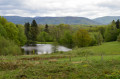
A delightful hike through magnificent sites on the Plateau des 1000 Étangs. Perfect for families or groups of friends.
The Marfée massif, a promontory steeped in history
 9.14 mi
+863 ft
-843 ft
4h 55
Average
Departure from Sedan (Ardennes)
9.14 mi
+863 ft
-843 ft
4h 55
Average
Departure from Sedan (Ardennes)
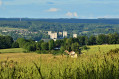
Rising to an altitude of 340 metres, the Marfée massif was particularly coveted during various conflicts. This wooded promontory, overlooking the Meuse valley, has witnessed many historic tragedies in the ‘Pays Sedanais’.
From the viewpoint, where more than ten villages can be seen, it is easy to understand the strategic importance of this key location near the border. Nearly 30,000 German and French soldiers are buried in the two cemeteries at Noyers.
East of Navaux
 7.48 mi
+1,532 ft
-1,516 ft
4h 45
Difficult
Departure from Thilay (Ardennes)
7.48 mi
+1,532 ft
-1,516 ft
4h 45
Difficult
Departure from Thilay (Ardennes)
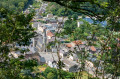
A forest trail starting from a small village in the Semoy Valley. La Roche au Pihü, Les Dames de Semoy and the Robessart viewpoint offer magnificent views of the valley's relief.
The surroundings of Melay
 7.70 mi
+446 ft
-456 ft
3h 55
Average
Departure from Ternuay-Melay-et-Saint-Hilaire (Haute-Saône)
7.70 mi
+446 ft
-456 ft
3h 55
Average
Departure from Ternuay-Melay-et-Saint-Hilaire (Haute-Saône)
On varied paths with many shaded areas, this route will allow you to discover the western part of the commune of Ternuay-Melay-et-Saint-Hilaire.
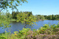
At Les Noyes, you will walk alongside a magnificent pond covering more than 6 hectares. Numerous calvaries, witnesses to the past, mark this circuit.
Le Roc la Tour in the Château-Regnault Forest
 7.63 mi
+1,355 ft
-1,335 ft
4h 40
Average
Departure from Thilay (Ardennes)
7.63 mi
+1,355 ft
-1,335 ft
4h 40
Average
Departure from Thilay (Ardennes)
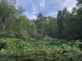
For those who enjoy forests and elevation changes, and at the heart of the walk, the Roc la Tour is characterised by its quartzite columns, likely remnants of the Château du Diable. Here, you can enjoy a magnificent view of the Ardennes forest.
A route in the "Hauts"
 8.14 mi
+584 ft
-584 ft
4h 15
Average
Departure from Thilay (Ardennes)
8.14 mi
+584 ft
-584 ft
4h 15
Average
Departure from Thilay (Ardennes)
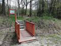
Three stunning spots and a viewpoint over the Semoy Valley are on the itinerary for this forest walk.
Short circular in the Semoy valley
 5.70 mi
+361 ft
-335 ft
2h 55
Easy
Departure from Tournavaux (Ardennes)
5.70 mi
+361 ft
-335 ft
2h 55
Easy
Departure from Tournavaux (Ardennes)
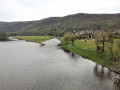
Set in lush green surroundings, this is an easy little route, ideal for getting back into exercise after a period of inactivity.
Around Linchamps
 12.35 mi
+2,093 ft
-2,113 ft
7h 30
Difficult
Departure from Les Hautes-Rivières (Ardennes)
12.35 mi
+2,093 ft
-2,113 ft
7h 30
Difficult
Departure from Les Hautes-Rivières (Ardennes)
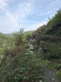
There is a lot of forest and surprising terrain around this long village on the right bank of the Saint-Jean stream.
La Crête de l’Enveloppe and Le Roc la Tour
 8.77 mi
+1,650 ft
-1,634 ft
5h 30
Average
Departure from Monthermé (Ardennes)
8.77 mi
+1,650 ft
-1,634 ft
5h 30
Average
Departure from Monthermé (Ardennes)
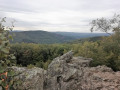
A two-part trail. The first section, through woodland, leads to an extraordinary jumble of rocks. The second takes you through a coniferous forest before offering a succession of magnificent panoramic views and vantage points over Monthermé and the Meuse valley.
From Dohan to the heights of Les Hayons
 5.14 mi
+709 ft
-692 ft
3h 00
Easy
Departure from Bouillon (Belgique) (Province de Luxembourg)
5.14 mi
+709 ft
-692 ft
3h 00
Easy
Departure from Bouillon (Belgique) (Province de Luxembourg)
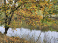
A walk through the Semois valley upstream from Bouillon. Lovely views of the Semois and the surrounding hills.
Schevauchée Walk
 4.06 mi
+299 ft
-299 ft
2h 05
Easy
Departure from Bouillon (Belgique) (Province de Luxembourg)
4.06 mi
+299 ft
-299 ft
2h 05
Easy
Departure from Bouillon (Belgique) (Province de Luxembourg)
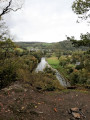
A very easy walk through one of the Semois’ many meanders.
Between Flize, Boutancourt and Dom le Mesnil
 5.25 mi
+531 ft
-512 ft
2h 55
Easy
Departure from Flize (Ardennes)
5.25 mi
+531 ft
-512 ft
2h 55
Easy
Departure from Flize (Ardennes)
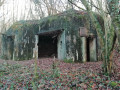
Beautiful views over the Meuse valley and the surrounding villages, as well as traces of the Second World War, in a place where stone quarrying has shaped its economic history.
From one height to another around Thilay
 8.43 mi
+1,401 ft
-1,388 ft
5h 05
Average
Departure from Thilay (Ardennes)
8.43 mi
+1,401 ft
-1,388 ft
5h 05
Average
Departure from Thilay (Ardennes)
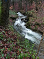
This hike offers a variety of routes, allowing you to visit the Roc la Tour and, perhaps, encounter the Dames de Semoy. Changes to the route between (8) and (10) were made on 27/7/2025 due to the closure of the Naux footbridge.
A stone’s throw from Charleville-Mézières
 6.36 mi
+833 ft
-850 ft
3h 40
Average
Departure from Charleville-Mézières (Ardennes)
6.36 mi
+833 ft
-850 ft
3h 40
Average
Departure from Charleville-Mézières (Ardennes)
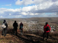
A forest route along varied paths just a stone’s throw from the town.
Along the Givonne and the Ruisseau des Fraichis
 7.58 mi
+676 ft
-650 ft
4h 05
Average
Departure from Givonne (Ardennes)
7.58 mi
+676 ft
-650 ft
4h 05
Average
Departure from Givonne (Ardennes)
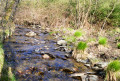
This forest walk features numerous small paths, with two main landmarks: the Givonne and the Ruisseau des Fraichis.
31/7/22: the footbridge over the Givonne at (6) has been fully restored
Walk through the Ennemane valley and on to the Meuse valley
19.65 mi
+636 ft
-646 ft
3 hrs
Average
Departure from Remilly-Aillicourt (Ardennes)
This mountain bike route, which presents no technical difficulties, features two sections of greenway, traditional farm and forest tracks, and even a section of the Roman road that linked Reims to Trier.
From Roc la Tour to Tchar Scaille
 7.63 mi
+863 ft
-866 ft
4h 15
Average
Departure from Thilay (Ardennes)
7.63 mi
+863 ft
-866 ft
4h 15
Average
Departure from Thilay (Ardennes)
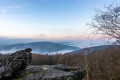
Forest route starting from Roc la Tour to the Six Chênons clearing.
Alternating between marked paths and more secluded trails.
Along the streams around Nafraiture
 6.24 mi
+738 ft
-719 ft
3h 30
Average
Departure from Vresse-sur-Semois (Province de Namur)
6.24 mi
+738 ft
-719 ft
3h 30
Average
Departure from Vresse-sur-Semois (Province de Namur)
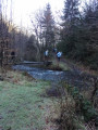
Set in beautiful countryside, this forest route along streams follows well-maintained paths and trails.
 Discover a village in Thiérache and the Maginot fortifications
 7.05 mi
+377 ft
-397 ft
4 hrs
7.05 mi
+377 ft
-397 ft
4 hrs
 Not specified
Departure from La Neuville-aux-Joûtes (Ardennes)
Not specified
Departure from La Neuville-aux-Joûtes (Ardennes)
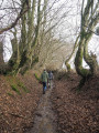
This hike follows one of three routes created by the Maginot Association in La Neuville-aux-Joûtes. Along varied paths, you will discover a pretty village in the Thiérache region, set among hedgerows and livestock farms, as well as four military structures from the Second World War.
From one bank to the other of a bend in the Semois
 4.35 mi
+617 ft
-600 ft
2h 30
Average
Departure from Vresse-sur-Semois (Province de Namur)
4.35 mi
+617 ft
-600 ft
2h 30
Average
Departure from Vresse-sur-Semois (Province de Namur)
A beautiful approach to a bend in the Semoy and its landscape. Alternating between quiet sections and physically demanding sections
Please note: this short but challenging route can only be completed in summer when the Kelhan footbridge is in place.
In the Ardennes, on the smuggling trails
9.96 mi
+1,191 ft
-1,184 ft
5h 35
Average
Departure from Gespunsart (Ardennes)
This hike will take you to the border valley of the Ruisseau du Bois Jean, which was once a hotspot for encounters, fraud and smuggling. The Baraque Laurent, the only one still standing, has now been converted into a lodge for groups. The other three huts have disappeared, but their ruins are still visible.
A short trip to Gaume
 7.26 mi
+568 ft
-554 ft
3h 50
Average
Departure from Florenville (Province de Luxembourg)
7.26 mi
+568 ft
-554 ft
3h 50
Average
Departure from Florenville (Province de Luxembourg)
A short walk along the border that will allow you to discover or rediscover Orval Abbey.
De Boult-aux-Bois à La Croix-aux-Bois en suivant les traces des Templiers
 8.91 mi
+525 ft
-525 ft
4h 35
Average
Departure from Boult-aux-Bois (Ardennes)
8.91 mi
+525 ft
-525 ft
4h 35
Average
Departure from Boult-aux-Bois (Ardennes)
Forest route between Boult-aux-Bois and La Croix-aux-Bois.Set in a magnificent forest, this route largely follows the Sentier des Templiers (PR®14 of the Argonne Ardennaise Community of Communes). This trail is dotted with large, unusual sandstone blocks. These magnificent blocks mark the perimeter ditch that delimited the forest of the Commandery established in Boult-aux-Bois inthe 12th century.Along the way, you will pass the Fontaine aux Grès, the Blanche Borne, the Borne de Justice, the Gros Grès and the Malassises. All these places are evocative of Boux's past.
Le Rocher du Pendu and Les Augustins via the Passerelle de l'Épine footbridge
9.30 mi
+1,289 ft
-1,306 ft
5h 25
Average
Departure from Bouillon (Belgique) (Province de Luxembourg)
A loop between Corbion and Bouillon, on both banks of the Semois. A castle, an abbey, viewpoints and the crossing of the Semois on the magnificent Passerelle de l'Épine footbridge.
From Bouillon Castle to Sedan Castle
14.14 mi
+1,385 ft
-1,601 ft
7h 40
Difficult
Departure from Bouillon (Belgique) (Province de Luxembourg)
This fully signposted cross-border trail links Bouillon Castle in Belgium to Sedan Castle in France.
This is one of the possible return routes for the hike from one castle to another across the border, hike no. 36479520
After following the Semois river, you will climb up to Corbion, a small village perched high in the municipality of Bouillon. Then, after crossing the border stream near the "Maison Verlaine", you will join the old Bouillonnais road, which will take you gently to the Sedan region.
Around Dohan
 7.73 mi
+1,417 ft
-1,394 ft
4h 45
Average
Departure from Bouillon (Belgique) (Province de Luxembourg)
7.73 mi
+1,417 ft
-1,394 ft
4h 45
Average
Departure from Bouillon (Belgique) (Province de Luxembourg)
This figure-of-eight hike takes you along pretty paths to five viewpoints and Roche Percée, a natural curiosity steeped in legend. Although classified as moderately difficult, this circuit requires a good level of fitness to tackle the steep gradients.
Following the water between the Givonne and the Hatrelle
5.81 mi
+597 ft
-577 ft
3h 10
Easy
Departure from Illy (Ardennes)
This walk, mostly through state-owned forest, will take you close to or past the Givonne and two of its main tributaries: the Ruisseau des Dix Frères and the Ruisseau de la Hatrelle. In places, you will also walk along the old route of the Bouillonnais, a small train that linked Sedan and Bouillon.