Country:
 City:
City:


Start: Remilly-Aillicourt – Ennemane Greenway car park
(S/E) From the car park, set off along the Ennemane Greenway to Angecourt.
(1) Continue along the greenway to La Forge (Haraucourt)
(2) Keep going in the same direction, pass through part of the village, then head towards Raucourt until you reach the first wash house.
(3) Leave the greenway and turn right onto a path that runs behind the Turquais premises. Keep going in the same direction, ignoring the streets on the left leading towards the village, until you reach the D27.
(4) Turn left and head towards the church.
(5) Continue along the Grand Rue until you reach Rue des Ormes, which you take to the right. At the Fork in the road at the end of Rue des Ormes, turn left, walk above the football pitch and, via a gravel path, head up to the D27.
(6) Cross the road and head up into the woods opposite until you reach a main track (Mont Joie).
(7) Turn right to rejoin the D27.
(8) Cross the road and head straight ahead. After a bend to the right, the path runs alongside the fields on the right and the woodland on the left. Ignore the first path on the left and continue to the second one.
(9) Turn left onto a forest track, ignore all turn-offs to the left and head towards the fields belonging to Chamblage Farm.
(10) Turn right, then left, towards Bois Gerfaux
(11) Head left onto a wide forest track, which becomes a farm track before reaching Pourron.
(12) Turn left onto the road and immediately turn right into Rue du Moulin; cross the Ruisseau de Yoncq, head slightly uphill before turning left onto a farm track. After 300 m, head uphill to the right and reach the ancient Roman road that linked Reims to Trier.
(13) Head left and, after going round a farm, you’ll reach the Faubourg Sainte Geneviève, which leads to Mouzon town centre and the Abbey Church.
(14) From the abbey church, take Avenue Charles de Gaulle, cross the Canal de la Meuse, then turn right onto Rue Guibou and head down to the right towards the Meuse greenway.
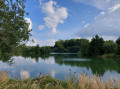
(15) Turn right. The greenway runs alongside the Meuse, then the Meuse Canal, and then the Meuse again before veering away from it opposite Villers-devant-Mouzon to cross the alluvial plain, where former gravel pits have given way to pretty ponds.
(16) At the fork near Mairy, keep left, follow the ponds and then join the D4.
(17) Take the path on the left, separate from the road, and carefully join the D4 near the two bridges (the Meuse Bridge and the Coupure de Remilly Bridge); cross both bridges and immediately turn right down along the canal. Continue to the footbridge over the Ennemane.
(18) After the footbridge, turn left then right, cross the railway line, join the D6, cross it and, via Rue de l’Illette, return to the greenway car park on Rue de l’Illette (S/E).
 Visorando Member
 Local authority
 Difficult