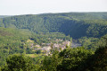
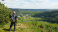
The Semoy Valley and its hills

This forest route offers an introduction to the French section of the Semoy. At the various viewpoints, you can admire the rugged landscape shaped by the river and its many tributaries.
This walk takes you past almost all of the villages along the Semoy.
This route combines two other routes that I have described, starting from Thilay.

Details

1492832
Creation:
Last update:
Last review:
  • Mountain biking
    Activity: Mountain biking
  • ↔
    Distance: 23.07 mi
  • ◔
    Duration according to the author: 5 hrs 
  • ▲
    Difficulty: Difficult

  • ⚐
    Back to start: Yes
  • ↗
    Ascent: + 2,408 ft
  • ↘
    Descent: - 2,395 ft

  • ▲
    Highest point: 1,270 ft
  • ▼
    Lowest point: 446 ft
  • ⚐ Country: France
  • ⚐
  • ⚐ City: Monthermé (08800)
  • ⚑
    Start/End: N 49.8796° / E 4.741603°
  • ❏
    IGN map(s): Ref. 3008SB, 3009SB

  • ◶
    Type of surface:
  •  
     
     
     33% Road  34% Byway  33% Path
  • ⇧
    Bike carrying: No
  • ▲
    Difficulty: Moderate
  • Hour-by-hour weather

Photos

Description of the route

Park in the car park at the Monthermé football ground on Rue André Compain.

(S/E) Head towards Bogny until you reach the end of the built-up area. Turn left onto the road leading to Phades for 150 metres, then take the first path on the right.

At the sign for the Fay forest road, veer left onto a lovely path that runs alongside the road at a distance. Follow the mountain bike markings to the Tournavaux bridge.

(1) Before the bridge, turn right and follow the River Semoy to the Ruha Fountain.

(2) Continue straight on towards the outskirts of Haulmé, turn right towards the cemetery, then left onto Rue du Tilleul and head up the tarmac road to the Col du Liry.

(3) Turn right onto the track to reach the Liry viewpoint.

(4) Return via a small footpath (marked in yellow) to the Col du Liry.

(3) Do not head back down; instead, head straight ahead (the road leading to the Col du Loup); further on, turn right onto a forest track which joins Link 2 and then Mountain Bike Trail No. 3.

(5) Do not head down to the right; continue in the same direction to the Col du Loup.

(6) Head towards Les Hautes Rivières, then turn left onto a path leading to Le Chêne Chaudron.

Continue in the same direction. At the next fork in the road, turn right until you reach a crossroads (elevation 353).(The path on the right joins the departmental road 250m further on)

(7) Head down to the left and follow the Picheleux valley, then the Ru de Narbruay stream, to the Maison du Père Labranche.

(8) Continue towards the village. Ignore a path branching off to the right, then the main track coming in from the right (gas pipeline); immediately afterwards, turn right onto the path leading down towards the bottom of the valley.

Cross the stream and take a path on the left to reach Nabruay (a isolated house).

(9) Take a wide, carriageable track to the right, pass by a reservoir and, after a high-voltage power line, reach a major junction (Chemin de Gespunsart).

(10) Turn right and climb up to the gas pipeline (reaching the top of the Dames de Semoy).

Access to a viewpoint over Nohan via a small path on the left.
Please note: The final 100 metres over rocky terrain may require you to dismount.

(11) Continue along the gas pipeline to the paragliding launch site (viewpoint over the ridge of Linchamps Castle).

Then, ignoring all paths branching off to the right, head towards a telecoms pylon. After a steep descent (tarmac), you’ll reach La Hatrelle (signposted.)

(12) Leave the mountain bike trail markings and head straight on towards the Croix d’Enfer, a lovely viewpoint over the Hautes Rivières.

The path has a few steps but presents no other hazards. Continue in the same direction, and at the next junction, turn left to descend to the Newet neighbourhood. Turn right and cycle to the bridge.

(13) Cross the Semoy, turn right and then immediately left. Follow Rue du Petit Ohan to reach the Ruisseau Saint-Jean.

Turn left onto Rue des Paquis and continue to Noiregoutte (signposted)

(14) Continue through the Ruisseau Saint-Jean valley until you reach the signpost for La Rayère

(15) Shortly afterwards, the path changes direction and climbs into the Gillaru valley. Stay on this main forest track until you reach the former Champ Bernard Forest House.

(16) Head towards Roc la Tour along the Route Forestière de la Dauphiné (tarmac) for 150 metres. Turn left onto a path marked with a GR® signpost and follow it to the Liris viewpoint.

(17) Turn back and take the path on the left. At the nearby Fork in the road, turn left again.

After a lovely bend, the path takes you to the Ruisseau du Nantanru, which you then follow alongside.
Do not go down to the Semoy; as you approach the river, keep to the right to follow a path running above the river and the Transsemoysienne.

Before a steep climb, keep to the left towards an old quarry track leading to the Moulin de Naux.

(18) Head down to the left and immediately keep to the right (there’s a wayside cross by the path’s edge), then head back up the path marked with GR® signposts and yellow markings until you reach the Route des Éteignières (tarmac)

(19) Head left until you reach a crossroads, then turn right (signposted for walking and mountain biking routes) towards Blossette.

On the path that bypasses the stony section of the main track, keep a close eye on the path so as not to veer too far to the left.

(20) At the corner of the Auberge du Ch’ti, cross the road, and from the car park take a path that descends steeply and joins the Transsemoysienne at Tournavaux.
Note: There are two options here, but both require you to be careful.

(21) Turn right onto the ‘Voie Verte’ and head for the bridge over the Semoy.

(22) Cross the Semoy and continue along the ‘Voie Verte’ back to the starting point (S/E).

Waypoints

  1. S/E : mi 0 - alt. 463 ft - Monthermé football pitch, Rue André Compain - Meuse (fleuve)
  2. 1 : mi 2.84 - alt. 482 ft - Tournavaux Bridge
  3. 2 : mi 3.76 - alt. 515 ft - Ruha Fountain
  4. 3 : mi 4.92 - alt. 971 ft - Col du Liry (296m)
  5. 4 : mi 5.49 - alt. 1,040 ft - Liry viewpoint
  6. 5 : mi 6.85 - alt. 1,115 ft - Mountain bike trail no. 3
  7. 6 : mi 7.57 - alt. 1,260 ft - Col du Loup (384m)
  8. 7 : mi 8.49 - alt. 1,155 ft - Crossroads
  9. 8 : mi 10.54 - alt. 636 ft - Maison du Père Labranche
  10. 9 : mi 11 - alt. 587 ft - Nabruay
  11. 10 : mi 11.45 - alt. 728 ft - Gespunsart Path
  12. 11 : mi 12.49 - alt. 1,053 ft - Gas pipeline
  13. 12 : mi 13.32 - alt. 738 ft - La Hatrelle (signpost)
  14. 13 : mi 14.17 - alt. 538 ft - Newet Bridge
  15. 14 : mi 14.61 - alt. 551 ft - Noiregoutte (signpost)
  16. 15 : mi 15.71 - alt. 666 ft - Signpost for La Rayère to the left of the path
  17. 16 : mi 16.88 - alt. 1,142 ft - Former Forest Ranger’s House at Champ Bernard
  18. 17 : mi 17.39 - alt. 1,066 ft - Liris viewpoint
  19. 18 : mi 18.93 - alt. 528 ft - Naux Mill
  20. 19 : mi 19.48 - alt. 715 ft - Route des Éteignères
  21. 20 : mi 20.14 - alt. 696 ft - Blossette
  22. 21 : mi 20.4 - alt. 525 ft - Tournavaux
  23. 22 : mi 21.56 - alt. 469 ft - Bridge over the - Semoy (rivière)
  24. S/E : mi 23.07 - alt. 463 ft - Monthermé football pitch, Rue André Compain

Notes

The route passes through the Château Regnault state-owned forest and several communal forests. Please check the hunting dates from 1 October to 31 January.

Tables, benches and a simple shelter at Champ Bernard.
Tables and benches are available near the Liry viewpoint.

The route can be easily undertaken from Tournavaux, Haulmé, Naux or Hautes Rivières (Newet district).

Worth a visit

Remains of the old quarries at Fay Phades.
The Ruha Fountain.
The Liry viewpoint.
Robessart viewpoint.
The Croix d’Enfer viewpoint.
The Liris viewpoint.

Always be cautious and plan ahead when you're outdoors. Visorando and the author of this route cannot be held responsible for any accidents occurring on this route.

The GR® and PR® markings are the intellectual property of the Fédération Française de Randonnée Pédestre.

Reviews and comments

4.2 / 5
Based on 3 reviews

Reliability of the description
4.3 / 5
Ease of following the route
4 / 5
Route interest
4.3 / 5
User 23603703

Overall rating : 4.3 / 5

Date of your route : Aug 15, 2025
Reliability of the description : ★★★★★ Very good
Ease of following the route : ★★★★☆ Good
Route interest : ★★★★☆ Good
Very busy route : No

A pleasant route to explore.

Machine-translated

Romain 08
Romain 08

Overall rating : 5 / 5

Date of your route : Nov 14, 2022
Reliability of the description : ★★★★★ Very good
Ease of following the route : ★★★★★ Very good
Route interest : ★★★★★ Very good
Very busy route : No

MA-GNI-FIC.

Machine-translated

bozierbruno
bozierbruno

Hello Michel Georges
Thank you for your comment, to which I am replying rather late.
1. It’s true that major works are currently underway at Champ Bernard and can be confusing even for locals.
This work is actually taking place to the right of the route.
2 You mention a difficulty at (7). I think you must have made a mistake in identifying the location.
At this point, there are three possible routes to follow, and the paths shown on the map correspond to the actual terrain.
The GPX track is reliable.

It’s a good idea to want to come back.
The Semoy Valley offers plenty of hiking opportunities.

Enjoy your walks
Bozierbruno

Machine-translated

michel.georges
michel.georges

Overall rating : 3.3 / 5

Date of your route : Jun 08, 2020
Reliability of the description : ★★★☆☆ Average
Ease of following the route : ★★★☆☆ Average
Route interest : ★★★★☆ Good
Very busy route : No

carried out on Thursday 4 June (2 people)
1. – Of the three maps relating to the high rivers, one didn’t print out. No problem – it was on the GPS
2. At point 7, there were four paths ahead of us, but only two were shown on the GPS map. No problem – we took an alternative route
all the way to the Hautes Rivières.
3. Major roadworks at Champ Bernard. In short, we took a detour, went via Le Roc and headed towards La Roche at 7 am
and descended to Monthermé – a total of 41 km and 820 m of elevation gain.
A good day all the same, and back to St Quentin.
I’ll be back.

Machine-translated

For more walks, use our search engine .

The GPS track and description are the property of this route's author. Please do not copy them without permission.