The Marfée massif, a promontory steeped in history

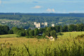
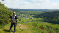
Rising to an altitude of 340 metres, the Marfée massif was particularly coveted during various conflicts. This wooded promontory, overlooking the Meuse valley, has witnessed many historic tragedies in the ‘Pays Sedanais’.
From the viewpoint, where more than ten villages can be seen, it is easy to understand the strategic importance of this key location near the border. Nearly 30,000 German and French soldiers are buried in the two cemeteries at Noyers.

Details

2152583
Creation:
Last update:
Last review:
  • Walking
    Activity: Walking
  • ↔
    Distance: 9.14 mi
  • ◔
    Average duration: 4h 55 
  • ▲
    Difficulty: Moderate

  • ⚐
    Back to start: Yes
  • ↗
    Ascent: + 863 ft
  • ↘
    Descent: - 843 ft

  • ▲
    Highest point: 1,115 ft
  • ▼
    Lowest point: 581 ft
  • ⚐ Country: France
  • ⚐ City: Sedan (08200)
  • ⚑
    Start/End: N 49.68874° / E 4.902783°
  • ❏
    IGN map(s): Ref. 3009SB
  • Hour-by-hour weather

Photos

Description of the walk

Starting point: Frénois Church.

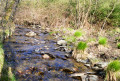
(S) From Frénois Church, take Ruelle de Messe, follow the Ruz stream and emerge onto Rue du Four. Keep to the right to take Rue du Château Renel.

(1) At Chemin de la Linerie, turn right and head uphill along a stony track towards Tue-Chevaux. At the top of the climb, ignore the path to the left (an old Roman road) and the next path (a mountain bike track), and continue to a main track leading down to the right towards Cheveuges.

(2) Head down to the right (beautiful view over the Bar valley) and turn right, passing under the power line, to reach the memorial to Adjudant Carrier, an airman who was killed in action in 1944. Retrace your steps.

(2) Head south again along a path with very little elevation change. The path is badly rutted in places, but parallel tracks have formed. Ignore the paths branching off to the left until you reach the junction with the Chemin de Cheveuges in Chaumont.

(3) Turn left, head towards the edge of the fields and then, at the bottom of a short descent, turn right towards Chaumont. At the next junction, go straight on until you reach the Chemin de la Renardière.

(4) Continue on level ground to Chaumont.

(5) After visiting the village, return to the previous junction.

(4) Turn right onto Chemin de la Renardière and, at the next three junctions, keep right to reach the road from Chaumont to Noyers. (GR® tarmac) (signposting at this point)

(6) Turn left towards Thelonne to reach the German Military Cemetery at Noyers Pont-Maugis.

(7) A visit to this necropolis, which is open at all times, is a must.
After your visit, head back towards Noyers until you reach the Route de la Marfée.

(8) Head north-north-west, just below this road, along the Chemin de la Belle Volée (an old sign at the corner of a wall). This grassy path overlooks the village.
At the next junction, head left up a small path and join the Route de la Marfée. Continue to the right until you reach the Belvédère, situated near the National Necropolis (signpost at the junction with theGR®).

(9) Carry on in the same direction, passing a monument in memory of Colonel de Marolles, skirting a meadow then a stand of wild cherry trees, and entering the forest. Stay on the main path to reach a crossroads near the ruins of the Maison Neveux.

(10) Turn right and head down to the Pré des Queues.

(11) Turn right; you’ll soon come across a small path on the left which leads to the edge of the fields before joining a wide farm track that takes you back to Frénois.

(12) At the Chemin des Romains (village entrance), continue straight ahead to return to the starting point (S/E)..

Waypoints

  1. S/E : mi 0 - alt. 587 ft - Frénois Church
  2. 1 : mi 0.25 - alt. 597 ft - Chemin de la Linerie
  3. 2 : mi 1.3 - alt. 965 ft - Path to Cheveuges
  4. 3 : mi 2.78 - alt. 1,001 ft - Path from Cheveuges to Chaumont
  5. 4 : mi 3.46 - alt. 958 ft - Chemin de la Renardière
  6. 5 : mi 3.95 - alt. 935 ft - Chaumont
  7. 6 : mi 5.36 - alt. 1,001 ft - Road from Chaumont to Noyers
  8. 7 : mi 5.54 - alt. 971 ft - Cimetière militaire allemand (Noyers-Pont-Maugis)
  9. 8 : mi 5.89 - alt. 906 ft - Chemin de la Belle Volée
  10. 9 : mi 6.4 - alt. 1,079 ft - Nécropole nationale (Noyers-Pont-Maugis)
  11. 10 : mi 7.15 - alt. 1,053 ft - Ruins of the Maison Neveux
  12. 11 : mi 7.67 - alt. 902 ft - Le Pré des Queues
  13. 12 : mi 8.75 - alt. 669 ft - Junction with the Chemin des Romains
  14. S/E : mi 9.14 - alt. 584 ft - Frénois Church

Notes

Trail conditions: Some sections of the route may be slippery in wet weather, mainly between (4) and (6). In this case, theGR® can be used as an alternative between (5) and (6).

Shortcut: It is possible to take a shortcut between the two military cemeteries

Facilities: Tables and benches at the Belvédère

Worth a visit

Warstein dedicated to Warrant Officer Carrier.
Visit to the village of Chaumont, with its13th -century church and its pediments engraved during the ‘Phoney War’.
Visit to the German Military Cemetery.
La Marfée Lookout (viewpoint, orientation table and information panels on the history of this major battleground).
National Military Cemetery.
Colonel Marolles’ memorial

Always be cautious and plan ahead when you're outdoors. Visorando and the author of this route cannot be held responsible for any accidents occurring on this route.

The GR® and PR® markings are the intellectual property of the Fédération Française de Randonnée Pédestre.

Reviews and comments

4.8 / 5
Based on 2 reviews

Reliability of the description
4.5 / 5
Ease of following the route
5 / 5
Route interest
5 / 5
bozierbruno
bozierbruno

Good evening, Philippe
Thank you for your comment.
If I’ve given 1944 for Warrant Officer Carrier, I’ll correct it. It does indeed refer to the fighting in May 1940.
The memorial is signposted, but only when approaching from Cheveuges… not very clever!
Enjoy your walks
Bruno Bozier

Machine-translated

Philippe Degeye
Philippe Degeye
• Edited:

Overall rating : 4.7 / 5

Date of your route : May 24, 2022
Reliability of the description : ★★★★☆ Good
Ease of following the route : ★★★★★ Very good
Route interest : ★★★★★ Very good
Very busy route : No

A lovely walk, with stunning views, spring colours and a light breeze to make it all the more impressive. An interesting historical aspect. It’s a shame that the way to Adjutant CARRIER’s memorial isn’t signposted. Furthermore, the accident he was involved in took place in May 1940, not 1944. The military cemeteries are as impressive as ever.
It took three and a half hours to complete the circular route. I find the map more helpful than the description. All the best.

Machine-translated

celia08512
celia08512

Overall rating : 5 / 5

Date of your route : May 17, 2020
Reliability of the description : ★★★★★ Very good
Ease of following the route : ★★★★★ Very good
Route interest : ★★★★★ Very good
Very busy route : No

A lovely walk with a scenic viewpoint at Noyers Pont-Maugis.
Alternating between shade and sunshine, from the forest to the fields

Machine-translated

Other walks in the area

For more walks, use our search engine .

The GPS track and description are the property of this route's author. Please do not copy them without permission.