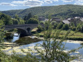
Walk along a bend in the River Semoy

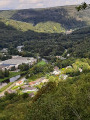
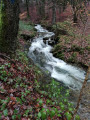
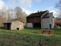
 This easy walk around Thilay is ideal for a family outing. You’ll follow a variety of paths and have the pleasure of passing three streams and two historic settlements.

Details

n°74605829
Creation:
Last update:
Last review:
  • Walking
    Activity: Walking
  • ↔
    Distance: 5.35 mi
  • ◔
    Average duration: 3h 00 
  • ▲
    Difficulty: Easy

  • ⚐
    Back to start: Yes
  • ↗
    Ascent: + 584 ft
  • ↘
    Descent: - 571 ft

  • ▲
    Highest point: 732 ft
  • ▼
    Lowest point: 499 ft

Description of the walk

Starting point: Thilay church square.

(S/E) From the church, head down Rue Eva Thomé, then turn left onto Rue de la Motte to reach the war memorial.

(1) Turn right onto the Transsemoisienne, pass the former Thilay railway station – now a ‘boule en bois’ court – then continue along the Semoy greenway to the former Naux railway station.

(2) Head left uphill until you approach the Moulin de la Gire. Cross the Gire via the bridge, then head uphill opposite to reach an old cart track overlooking the Semoy. As you approach the Ruisseau de Nantanru, head down to the right to reach the confluence of the Nantanru and Semoy.

(3) Turn left back onto the Transsemoisienne route until you reach a path on the right. Take this path to reach the Nohan bridge.

(4) Cross the Semoy and, on the other side, head left, then climb immediately to the right up the embankment. After the short climb, the well-marked path leads to the old Chemin de Nohan.

(5) Turn right and, taking the first path on the right, head down towards Naux.

(6) Turn left onto the departmental road for 50 metres, then head left up the Chemin de Gespunsart to reach a crossroads at elevation 223.

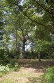
(7) Turn right and follow a wide track to the hamlet of Narbruay.

(8) Leave the track and take a path on the left leading to the Narbruay Stream. Cross the stream, head uphill, then turn right onto the Chemin de Bozin to reach the RD131. Head down towards the bridge and return to the church square in Thilay (S/E).

Waypoints

  1. S/E : mi 0 - alt. 499 ft - Church square
  2. 1 : mi 0.2 - alt. 509 ft - Transsemoisienne War Memorial
  3. 2 : mi 1.23 - alt. 522 ft - Former Naux railway station
  4. 3 : mi 1.87 - alt. 525 ft - Confluence at Nantaru - Semoy (rivière)
  5. 4 : mi 2.51 - alt. 512 ft - Nohan Bridge
  6. 5 : mi 3.03 - alt. 702 ft - Old Nohan track
  7. 6 : mi 3.76 - alt. 505 ft - Naux, Grand Rue
  8. 7 : mi 4.29 - alt. 728 ft - Crossroads (elevation 223)
  9. 8 : mi 4.75 - alt. 587 ft - Nabruay hamlet
  10. S/E : mi 5.35 - alt. 499 ft - Church square

Worth a visit

La Forge café and restaurant in Naux.

Le Val de Semoy restaurant in Thilay.

Reviews and comments

4.2 / 5
Based on 2 reviews

Reliability of the description
4 / 5
Ease of following the route
4 / 5
Route interest
4.5 / 5
User 28748732

Overall rating : 4.7 / 5

Date of your route : Sep 21, 2026
Reliability of the description : ★★★★★ Very good
Ease of following the route : ★★★★★ Very good
Route interest : ★★★★☆ Good
Very busy route : No

A lovely, very pleasant route

However, we found the path running parallel to the cycle route after the Moulin de la Gire to be unnecessary, as the descent to rejoin the cycle route is steep and would certainly be dangerous in muddy conditions. If you want to see the mill, you can do a round trip.

Machine-translated

User 20933320
• Edited:

Overall rating : 3.7 / 5

Date of your route : May 17, 2026
Reliability of the description : ★★★☆☆ Average
Ease of following the route : ★★★☆☆ Average
Route interest : ★★★★★ Very good
Very busy route : Yes

The walk was very pleasant; we came across quite a few French- and Dutch-speaking hikers and cyclists.
However, we had a few difficulties following the route between points 3 and 6:
- between 3 and 4, we probably veered off the route too early and ended up at the Nohan bridge, which was visible from our route;
- between 4 and 6: we lost the route again; we reached the D31 about 1 km before point 6 (Naux), from which point we had no further trouble following the route to the finish.

Despite these few hiccups, we have very fond memories of the walk.

Machine-translated

Other walks in the area

For more walks, use our search engine .

The GPS track and description are the property of this route's author. Please do not copy them without permission.