Country:

 City:
City:


Park near the water tower on Chemin de la Havetière.
(S/E) Take the forest track.
(1) Ignore the return path on the left and continue along the forest track until you reach a sharp left-hand bend. Turn right onto a small path that descends to the confluence of two small streams. Cross the stream and turn right, following its left bank as far as the houses at Pré Saint-Ange.
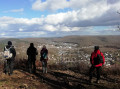
(2) Ignore the path branching off to the left, head slightly downhill to cross the Ruisseau de la Fontaine du Prince, then turn left to stay as close as possible to the stream on a path marking the boundary between the municipalities of Charleville and Montcy-Notre-Dame. Cross two small ditches, then, after a third, deeper one, continue to a crossroads. Keep going in the same direction and head uphill until you reach a cross path. Turn right and continue as far as the power lines. There is a viewpoint looking south-east over part of the Charleville-Mézières conurbation.
(3) Cross over the power lines by going straight on, then turn right onto a path that runs alongside the edge of the national forest, marked by a ditch. Continue to the corner of this boundary.
(4) Carry on straight ahead, passing a path that branches off to the right, and continue until you reach a wide path coming from the left.
(5) Turn left (north). The path begins to descend and then reaches a Fork in the road where you should turn left. Continue down the slope until you reach a military boundary marker to the left of the path (concrete marker).
(6) Make your way to the artillery bunker visible on the left from the marker, then return to the track and continue in the same direction. Ignore a very narrow path that climbs to the left beneath the power lines and take, on the left, the next, more clearly marked and slightly easier path to reach the top of Roche Martin and rejoin the edge of the state-owned forest.
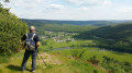
(7) As soon as you reach the top of the climb, take the first path on the right which follows the ridge of Roche Martin. 200 metres further on, the path passes slightly above a small military structure from the Maginot Line. Continue along the path, which passes under one of the power lines again before reaching a viewpoint overlooking Nouzonville and the surrounding area.
(8) After the viewpoint, continue along the path. Turn left as soon as possible to pass under the previous power line and then a second one, so as to walk alongside a new line running perpendicular to the previous two. Walk to the left of this line for 400 m before turning left onto a forest track. Descend slightly, then turn right and join a recently built forest road.
(9) Take this forest track to the right until you reach a sharp bend. At this bend, leave the forest track and take a path on the left (not shown on the map) which joins the RD989.
(10) Do not cross the road, but turn left onto a track at the bottom of the valley and continue to a junction (elevation 215). At this point, cross the stream and head up to the right until you reach a hunting lodge near the La Havetière housing estate.
(11) From the lodge, take the path heading east. This path goes round the housing estate and joins the forest track taken at the start of the route.
(1) Turn right to return to the water tower (S/E).

 Visorando Member

 Easy
Easy