Blombay Mill

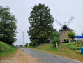
An easy walk that will take you through three small villages in the western Ardennes, culminating in a visit to Blombay Mill. The mill was originally built in the mid-16th century, and its renovation, carried out by a local resident, was completed in 2024.

Details

100695872
Creation:
Last update:
Last review:
  • Walking
    Activity: Walking
  • ↔
    Distance: 6.32 mi
  • ◔
    Average duration: 3h 10 
  • ▲
    Difficulty: Easy

  • ⚐
    Back to start: Yes
  • ↗
    Ascent: + 328 ft
  • ↘
    Descent: - 315 ft

  • ▲
    Highest point: 984 ft
  • ▼
    Lowest point: 741 ft
  • ⚐ Country: France
  • ⚐ City: Blombay (08260)
  • ⚑
    Start/End: N 49.823662° / E 4.452824°
  • ❏
    IGN map(s): Ref. 2909SB
  • Hour-by-hour weather

Photos

Description of the walk

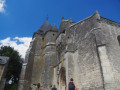
Car park next to Saint-Rémi Church in Blombay, situated on the village’s main street.

(S/E) Head down the main road, the D109, heading south-west. Ignore two turn-offs to the left until you reach a crossroads (with a wayside cross).

(1) Leave the D109, but continue in the same direction. Head uphill to the mill, which is situated near the road and surrounded by trees.

(2) From the mill, turn left, heading south-east, onto a track that joins the D9.

(3) Take this road to the right until the next fork in a bend (elevation 276).

(4) Leave the D9, turn right, and head down to the hamlet of Belzy.

(5) Turn right onto the road, ignore the first track on the left, and continue for about 1 km.

(6) Turn left onto a track and join the D20.

(7) Follow it to the right to reach Cernion and its Saint-Quentin Church. Pass the town hall.

(8) Turn right onto Rue de l’Arbre, then, on leaving the village, turn left. Ignore the first road on the left and continue heading due north. At the next Fork in the road, take the left-hand fork and you’ll reach a junction with a track (elevation 280).

(9) Turn right onto the dirt track and head for the windmill you passed on the way out.

(2) Return along the same path you took on the way there, turning left and heading in the opposite direction, to get back to the village (S/E).

Waypoints

  1. S/E : mi 0 - alt. 919 ft - Blombay Church
  2. 1 : mi 0.2 - alt. 935 ft - Calvary
  3. 2 : mi 0.55 - alt. 984 ft - Blombay Windmill
  4. 3 : mi 1.02 - alt. 935 ft - D9
  5. 4 : mi 1.35 - alt. 906 ft - Turn right at the fork (elevation 276)
  6. 5 : mi 2.2 - alt. 761 ft - Belzy
  7. 6 : mi 2.94 - alt. 837 ft - Junction on the track
  8. 7 : mi 3.31 - alt. 896 ft - D20
  9. 8 : mi 3.94 - alt. 899 ft - Rue de l’Arbre
  10. 9 : mi 5.09 - alt. 922 ft - Crossroads (elevation 280)
  11. S/E : mi 6.32 - alt. 919 ft - Blombay Church

Notes

This walk can be done by mountain bike.

Worth a visit

Other walks in the area

For more walks, use our search engine .

The GPS track and description are the property of this route's author. Please do not copy them without permission.