


 Country:

 City:
City:


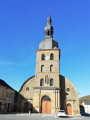
Park in the car park at Gespunsart Church.
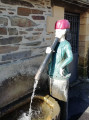
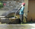
(S/E) Head towards the village exit via Rue de Helle, pass by the Malbrought Fountain, and continue along Rue de la Belle Vue.
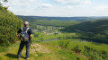
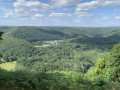
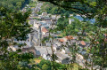
On leaving the village, take the first path on the right towards the water catchment. Just before the wayside cross, take a small path on the left to climb up towards the old quarries, then head right to reach a lovely viewpoint over the village. Continue along the small path to the wayside cross.
(1) Take the path on the left (mountain bike trail no. 4). Carry on until you approach the water intake.
(2) Do not head back down to the right; carry on in the same direction until you reach the next junction, where you leave the MTB track and head up to the left towards the Chemin des Gardes (old hunting lodge).
(3) Turn right and stay on the most clearly marked path. Make sure you keep to the left at the junction at the 340-metre mark. (Do not take the path on the right, which is not shown on the map.) Continue to the boundary of the state-owned forest.
(4) Turn right to join a wide forest track, which you should follow until you reach the Chemin de Bagimont.
(5) Head up to the left, ignoring the boundary of the plots that branches off to the right, and take the next path on the right. The path crosses a forest plot boundary, descends to the bottom of a small valley, passes another boundary, and then reaches a Fork in the road.
(6) Continue to the left, descending a section where rocks are exposed, and join a main track. Keep to the right and arrive at La Goutelle. Turn right immediately after crossing the bridge to pass by the Rogissart wash house and join the RD 979.
(7) Turn left onto the RD, then take the first path on the right and turn right again immediately afterwards. At the next Fork in the road, turn right again (not shown on the IGN map but marked on OpenStreetMap Hiking). Cross a stream and continue straight ahead. At the next junction, go straight ahead and join a wide, carriageable track (Chemin de Gernelle).
(8) Turn left, then, after 1 km, turn right onto a track suitable for vehicles. After crossing the Vrigne, turn right and head for the Les Proums neighbourhood and the RD 979.
Head towards the village, then turn left onto a small street which joins the RD 22.
(9) Head left, ignore the forest track on the left and take the next path on the left to reach the Chapelle du Saint-Lieu. Turn left after the chapel towards the forest track, then turn right towards Les Trois Croix.
(10) Turn round. Return to the RD 22.
Cross it, pass by the cemetery and then in front of the Dejembes premises. Take Rue de l’Abattoir to reach Rue de la Gare. Continue in the same direction as far as the fountain, then turn left to reach the church and the car park where you started (S/E).

 Visorando Member
 Local authority
 Easy
Easy 
 Difficult
