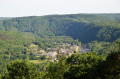
Robessart, the Gillaru valley, the Nantanru valley

Following a variety of paths, this walk will take you on a journey of discovery through the eastern part of the French Semoy valley. The landscape, shaped by the Semoy and its tributaries, as well as the forest with its many different tree species, are truly remarkable.

Details

n°1458134
Creation:
Last update:
Last review:
  • Mountain biking
    Activity: Mountain biking
  • ↔
    Distance: 12.01 mi
  • ◔
    Duration according to the author: 3 hrs 
  • ▲
    Difficulty: Difficult

  • ⚐
    Back to start: Yes
  • ↗
    Ascent: + 1,440 ft
  • ↘
    Descent: - 1,417 ft

  • ▲
    Highest point: 1,161 ft
  • ▼
    Lowest point: 499 ft
  • ⚐ Country: France
  • ⚐
  • ⚐ City: Thilay (08800)
  • ⚑
    Start/End: N 49.873156° / E 4.809332°
  • ❏
    IGN map(s): Ref. 3008SB, 3009SB

  • ◶
    Type of surface:
  •  
     
     
    ■ 33% Road ■ 34% Byway ■ 33% Path
  • ⇧
    Bike carrying: Not specified
  • ▲
    Difficulty: Moderate
  • Hour-by-hour weather

Photos

Description of the route

Starting point: Thilay community hall.

(S/E) Opposite the church, turn right into Rue Éva Thomé, then left into Rue de la Motte. At the war memorial, head up Rue de la Roche until you reach Chemin des Éteignières.

(1) Cycle along the Chemin des Éteignières until you reach a crossroads.

(2) Continue along the tarmac road and, 150 metres further on, turn right (GR® red and white markings). At the next two junctions, keep going in the same direction until you reach the Naux footbridge.

(3) Turn left onto the Transsemoysienne, follow the Semoy river, then take the first path to the right to reach the Nohan bridge.

(4) Cross the bridge and head up the embankment to the left, before following a well-marked path which joins the Chemin de Nohan

(5) Turn right until you reach a large junction (Chemin de Gespunsart).

(6) Turn left and climb up to the gas pipeline (you will then be at the top of the Dames de Semoy). Access to a viewpoint via a small path on the left. (The final 100 metres over rocky ground may require you to dismount).

(7) Continue along the gas pipeline to the paragliding launch site, then ignore all paths branching off to the right and head towards a telecoms pylon.
After a steep descent (tarmac), you’ll reach La Hatrelle (signposted).

(8) Leave the mountain bike trail markings and head straight ahead towards the Croix d’Enfer, a lovely viewpoint over the Hautes Rivières.
The path has a few “substantial steps” but presents no other hazards.

(9) Continue in the same direction and, at the next junction, turn left to head down to the Newet neighbourhood. Turn right (Rue du Château d’eau) until you reach the bridge.

(10) Cross the Semoy, turn right and then immediately left onto Rue du Lyri, then right onto Rue du Petit Ohan, until you reach the Ruisseau Saint-Jean.

(11) Take Rue des Paquis on the left and continue to Noiregoutte (signposted).

(12) Continue through the Ruisseau Saint-Jean valley; then, after a left-hand bend, the path climbs into the Gillaru valley. Stay on the main forest track until you reach the old Champ Bernard Forest House.

(13) Take the Route Forestière de la Dauphiné (tarmac) for about 150 metres towards Roc la Tour, then turn left onto a path marked with a GR® signpost, leading to the Liris viewpoint.

(14) Turn back and, 200 metres further on, take a path on the left. At the nearby Fork in the road, turn left again. After a lovely bend, the path leads to the Ruisseau du Nantanru, which you then follow alongside. As you approach the river, keep to the right to follow a path running above the Semoy and the Transsemoysienne. Before a steep climb, keep to the left towards an old quarry track leading to the Moulin de Naux. Head back down to the footbridge. Access to the footbridge has been prohibited since 26 March 2025.

(3) Turn right onto the Transsemoysienne towards Thilay. At the Fork in the road at the entrance to the village, turn left towards the church (S/E).

Waypoints

  1. S/E : mi 0 - alt. 502 ft - Thilay multi-purpose hall
  2. 1 : mi 0.35 - alt. 558 ft - Chemin des Éteignères
  3. 2 : mi 0.83 - alt. 709 ft - Crossroads
  4. 3 : mi 1.48 - alt. 522 ft - Naux footbridge - Semoy (rivière)
  5. 4 : mi 2.75 - alt. 522 ft - Nohan Bridge
  6. 5 : mi 3.17 - alt. 702 ft - Nohan Path
  7. 6 : mi 3.33 - alt. 728 ft - Gespunsart path
  8. 7 : mi 4.3 - alt. 1,024 ft - Gas pipeline
  9. 8 : mi 5.2 - alt. 738 ft - La Hatrelle (signpost)
  10. 9 : mi 5.37 - alt. 778 ft - La Croix d’Enfer
  11. 10 : mi 6.04 - alt. 538 ft - Newet Bridge
  12. 11 : mi 6.27 - alt. 528 ft - Saint-Jean stream
  13. 12 : mi 6.5 - alt. 551 ft - Noiregoutte (signpost)
  14. 13 : mi 8.77 - alt. 1,142 ft - Champ Bernard
  15. 14 : mi 9.27 - alt. 1,063 ft - Viewpoint at Liris
  16. S/E : mi 12.01 - alt. 502 ft - Thilay multi-purpose hall

Notes

Shelter, table and benches at Champ Bernard.

A 20-metre stretch where you’ll need to carry your bike after the Pont de Nohan, and a few sections where you’ll need to dismount on the Croix d’Enfer ridge.

Worth a visit

Viewpoint at the paragliding site.
Viewpoint at the Croix d’Enfer.
Viewpoint at Le Liris.

Always be cautious and plan ahead when you're outdoors. Visorando and the author of this route cannot be held responsible for any accidents occurring on this route.

The GR® and PR® markings are the intellectual property of the Fédération Française de Randonnée Pédestre.

Reviews and comments

5 / 5
Based on 1 review

Reliability of the description
5 / 5
Ease of following the route
5 / 5
Route interest
5 / 5
Barbosa claude
Barbosa claude
• Edited:

Overall rating : 5 / 5

Date of your route : Oct 29, 2018
Reliability of the description : ★★★★★ Very good
Ease of following the route : ★★★★★ Very good
Route interest : ★★★★★ Very good

I walked the circular route starting from Naux in glorious weather. The Ardennes are beautiful!!!

Although I know this region well, I discovered the Champ Bernard viewpoint overlooking Nohan, which I hadn’t known about before

The climb from Hautes Rivieres to Champ Bernard is quite long, but it’s true that the route is designed for mountain biking. Some sections are tricky

This walk is absolutely lovely and comes highly recommended

Claude

Machine-translated

For more walks, use our search engine .

The GPS track and description are the property of this route's author. Please do not copy them without permission.