Country:

 City:
City:


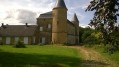
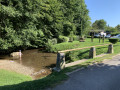
Park near the P. Sommer sports complex on Rue de la Tour Saint-Jérôme in Mouzon.
(S/E) From the Aquatic Centre, take Rue de la Tour Saint-Jérôme towards the centre of Mouzon, turn left onto Rue de l’Abreuvoir, then right onto Rue des Tanneurs.
Go under the main road, carry on straight ahead, and turn into a side street.
(1) At the first junction, turn right and head up to the RD964. Cross the road and continue straight on to the housing estate.
In the housing estate, turn left, then right and left again to reach the Route Royale.
(2) Turn right to join the Chemin de Tétaigne, about 260 metres further on.
(3) Head uphill to the left (northwards) and pass under the power lines. Go past the Ruelle de Tétaigne.
(4) At the first junction (elevation 317), turn left towards the mobile phone mast. At the second junction (elevation 332), take the path on the right; after a change of direction towards the north-east, you will reach the top of La Truche (a lovely property on your left).
(5) Continue along the farm track, ignoring all the paths branching off to the right, until you reach a more clearly marked farm track (elevation 277).
Turn right, then immediately left.
(6) Shortly afterwards, leave the path on the left to join the small tarmac road between Euilly and Lombut.
(7) Turn left for a return trip to Lombut Castle.
(8) Retrace your steps.
(7) Carry on straight ahead along the small tarmac road to reach the cemetery and the church at Euilly (slightly off the centre of the village).
(9) Head downhill, southwards, towards the Grand-Rue, then turn right and take the next left to leave Euilly via the Route des Casernes.
(10) Head down into the bottom of a small valley before entering a wooded area. Stay on the most clearly marked path and follow it to the Chemin de la Ferme de Baybel.
(11) Continue along this path to the left until you reach the RD19. Cross it and turn immediately left. You are now at the entrance to the Horgues housing estate.
(12) Do not enter the housing estate but take the tarmac track towards the Ferme de la Folie.
Go round the back of the housing estate, and at the first fork, take the path on the right.
Ignore the paths leading off to the left and follow a very pleasant grassy path to the Mouzon cemetery, then onto the RD964.
(13) Turn right, then left to rejoin Rue de la Tour Jérôme and continue to the Aquatic Centre (S/E).

 Visorando Member
 Easy
Easy