The Ennemane Valley and the Margotte wind farm

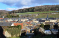
A short, easy route ideal for families. At the bottom of the valley, you’ll find a bit of local history and lovely views across the plateau.

Details

1763958
Creation:
Last update:
Last review:
  • Walking
    Activity: Walking
  • ↔
    Distance: 4.44 mi
  • ◔
    Average duration: 2h 25 
  • ▲
    Difficulty: Easy

  • ⚐
    Back to start: Yes
  • ↗
    Ascent: + 413 ft
  • ↘
    Descent: - 404 ft

  • ▲
    Highest point: 1,014 ft
  • ▼
    Lowest point: 581 ft

Photos

Description of the walk

Start from the Place du Pavé near the church in Raucourt

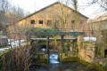
(S/E) From the Place du Pavé, head down Rue de l’Abreuvoir to Rue de l’Ennemane. Take this street to the right as far as the post office, then turn left to reach the wash house via Rue des Marronniers.

(1) Stay on the greenway, passing close to the ruins of the lime kilns at La Cense.

(2) Carry on to Haraucourt. Keep heading in the same direction. Enter the village and follow Rue de la Gare to reach Rue Haute.

(3) Turn left, cross the Ennemane, ignore the street leading to the town hall and then turn left until you reach the next Fork in the road.

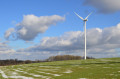
(4) Head up to the right along the Voie de Villers. Continue in the same direction until you reach the Chemin du Cimetière. Follow this main track to reach the first wind turbine on the Margote plateau.

(5) Carry on along the main track and, before the second wind turbine, turn left. Climb slightly further to reach the highest point of the route. Pass a third wind turbine and join the path from Raucourt to Villers

(6) Carry on in the same direction, keeping to the left at the next junction. Turn left immediately after crossing the crossroads. Head back down towards the village.

(7) Cross the Voie de Villers and, via an old flight of steps, head down to Rue du Gué Nollet. First turn left then right to rejoin Rue de l’Abreuvoir and head back up towards Place du Pavé and the church (S/E).

Waypoints

  1. S/E : mi 0 - alt. 633 ft - Place du Pavé near the church in Raucourt
  2. 1 : mi 0.6 - alt. 630 ft - Washing house
  3. 2 : mi 0.86 - alt. 627 ft - Ruins of old lime kilns, along the - Ennemane (rivière)
  4. 3 : mi 1.59 - alt. 581 ft - Rue Haute
  5. 4 : mi 1.76 - alt. 594 ft - Voie de Villers
  6. 5 : mi 3.03 - alt. 951 ft - Path to the first wind turbine
  7. 6 : mi 3.82 - alt. 909 ft - Raucourt to Villers Trail
  8. 7 : mi 4.31 - alt. 643 ft - Voie de Villers
  9. S/E : mi 4.44 - alt. 633 ft - Place du Pavé near Raucourt Church

Reviews and comments

4.7 / 5
Based on 2 reviews

Reliability of the description
4.5 / 5
Ease of following the route
5 / 5
Route interest
4.5 / 5
User 11611348

Overall rating : 5 / 5

Date of your route : Sep 07, 2026
Reliability of the description : ★★★★★ Very good
Ease of following the route : ★★★★★ Very good
Route interest : ★★★★★ Very good
Very busy route : Yes

A very good route, with clear and well-marked signposting. Please note that there is a second circular loop when you reach the village of Raucourt.
If you follow the identical signposting, you’ll set off on a second circular route located below the first dune, covering a distance of 8 kilometres, if you turn right.
If you turn left, you’ll head back towards the village centre and the starting point.

Machine-translated

REDANC
REDANC
• Edited:

Overall rating : 4.3 / 5

Date of your route : Feb 24, 2019
Reliability of the description : ★★★★☆ Good
Ease of following the route : ★★★★★ Very good
Route interest : ★★★★☆ Good

This route is largely signposted.
It can be extended by 4–5 km as far as Angecourt.

Machine-translated

Other walks in the area

For more walks, use our search engine .

The GPS track and description are the property of this route's author. Please do not copy them without permission.