Country:
 City:


Car park near Wadelincourt Town Hall, Place Stévenin
(S/E) From the town hall, head east to cross the RD6, take Rue de l’Abreuvoir towards the railway line. Pass under it through a tunnel. Take the steps leading from the tunnel, climb a slope and, continuing in the same direction, reach the greenway linking Sedan to Mouzon.
(1) Turn right towards Noyers Pont Maugis along the Canal de l’Est (see IGN), walk for 2 km, then leave the greenway to cross the railway line and the RD6 in turn.
(2) Turn right towards the village, then left shortly afterwards to take Rue du Liry. Ignore Rue de Lamartine on the right and continue along Rue du Liry. At the Fork in the road, take the right-hand path to cross Parc Désiré Étienne. Take Ruelle Saint Blaise, then turn left to find yourself in front of Pont Maugis Church.
(3) Continue along the route until you reach Rue de l’Égalité. Head up to the right, pass the cemetery and continue along a farm track until you reach the first houses in Noyers (junction of several streets and tracks)
(4) Ignore the first street on the left and keep left to reach the church at Noyers.
(5) Head up to the right into Ruelle du Colonel Marolles, then take a small road and head up to the right.
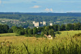
(6) You’ll reach the German military cemetery and then the Belvédère de la Marfée.
Rising to an altitude of 340 m, the Marfée massif was particularly coveted during various conflicts.
(7) Turn right onto theGR® and head down to the Liry (signposted).
(8) Ignore the Chemin de Vallière joining from the right and continue on level ground along theGR® before descending again, still following theGR®, towards Wadelincourt and the Place de la Mairie (S/E).

 Visorando Member


 Easy