


Refine your search for walks in Roquebillière
Roquebillière walks


 The summit of Castel Vieil from Roquebillière
 Visorando Member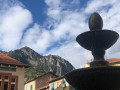
 6.38 mi
 +2,785 ft
 -2,759 ft
 5h 20
5h 20
 Difficult
 Departure from Roquebillière (Alpes-Maritimes)
A very beautiful hike offering stunning views of the Vésubie Valley. The imposing Villette ridge overlooks the return trail. The route between points (8) and (9) bears witness to an ancestral agricultural past.
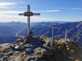
Tres Crous from Belvédère
 8.46 mi
+3,780 ft
-3,776 ft
7h 10
8.46 mi
+3,780 ft
-3,776 ft
7h 10
 Very difficult
Departure from Belvédère (Alpes-Maritimes)
Very difficult
Departure from Belvédère (Alpes-Maritimes)
A challenging hike to reach the Tres Crous viewpoint, characterised by its three crosses and the panoramic view of the Vésubie valley stretching all the way to the sea.
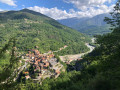
The Lantosque elephant via the Crête des Martourins
 8.77 mi
+3,399 ft
-3,428 ft
7h 00
Difficult
Departure from Lantosque (Alpes-Maritimes)
8.77 mi
+3,399 ft
-3,428 ft
7h 00
Difficult
Departure from Lantosque (Alpes-Maritimes)
A pleasant hike thanks to its diversity. Wooded areas with different species of trees, beautiful views, ancient trails including the Crête des Martourins, and a finale in this little aquatic paradise where the elephant is located, a swimming spot once known mainly to the people of Lantosquois and its surroundings.
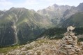
Cirque de Férisson and Cime de la Valette de Prals
 5.54 mi
+2,644 ft
-2,671 ft
4h 50
5.54 mi
+2,644 ft
-2,671 ft
4h 50
 Moderate
Departure from Belvédère (Alpes-Maritimes)
Moderate
Departure from Belvédère (Alpes-Maritimes)
A circular hike starting from the Férisson cattle shed and passing through all the ridges around the Férisson cirque.
Superb views all along the way, with the sea on one side and the Mercantour peaks on the other.
As the end of the route is off-trail and unmarked, a good sense of direction and route-finding skills are essential.
Mont Capelet Inférieur
 6.05 mi
+3,192 ft
-3,196 ft
5h 35
Difficult
Departure from Belvédère (Alpes-Maritimes)
6.05 mi
+3,192 ft
-3,196 ft
5h 35
Difficult
Departure from Belvédère (Alpes-Maritimes)
Capelet Inférieur is one of the southernmost peaks of the Mercantour. The viewpoint over the 3000-metre peaks of Gélas, Malédie and Clapier is superb, with beautiful panoramic views over the Gordolasque valley and, on a clear day, the Baie des Anges in Antibes.
Mont Ponset and Cime de Paranova
 10.85 mi
+6,578 ft
-6,552 ft
10 hrs
Very difficult
Departure from Belvédère (Alpes-Maritimes)
10.85 mi
+6,578 ft
-6,552 ft
10 hrs
Very difficult
Departure from Belvédère (Alpes-Maritimes)
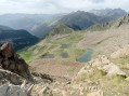
This is a beautiful circuit that allows you to discover the valleys of Gouitrous and Ponset, including the Lacs de Prals, Mont Ponset and the Cime de Paranova. You will see many chamois and marmots throughout the circuit.
Cime de Piagu
 11.88 mi
+5,249 ft
-5,233 ft
10h 00
Difficult
Departure from Saint-Martin-Vésubie (Alpes-Maritimes)
11.88 mi
+5,249 ft
-5,233 ft
10h 00
Difficult
Departure from Saint-Martin-Vésubie (Alpes-Maritimes)
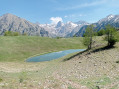
A magnificent mid-mountain hike offering a variety of landscapes: the village of Saint-Martin-Vésubie, the Boréon forest and, finally, a rocky landscape with a 360° view of the surrounding peaks.
Alpine pastures and woodland above the Vésubie Valley and Valdeblore
6.28 mi
+2,398 ft
-2,398 ft
5h 00
Moderate
Departure from Venanson (Alpes-Maritimes)
A hike starting from the village of Venanson in the Vésubie Valley; relatively short but with a significant elevation gain. It offers a variety of views over different parts of the region: the Tinée and Vésubie valleys, and the villages in the Valdeblore area. A good mix of wooded and open sections. There are no difficulties with navigation. The paths are clearly visible and the signposts are very helpful.
From Saint-Colomban to Peïra-Cava via the Maïris Forest
 Association / Club / Walk leader
 9.23 mi
+3,241 ft
-3,232 ft
7h 05
Difficult
Departure from Lantosque (Alpes-Maritimes)
9.23 mi
+3,241 ft
-3,232 ft
7h 05
Difficult
Departure from Lantosque (Alpes-Maritimes)
This beautiful walk takes us through the Saint-Colomban valley, the starting point of the walk. It can be reached from Lantosque by turning right onto a winding road for 5 km. Its hamlets – Gorblaou on the way out and Camari on the way back – have retained an undeniable charm (small colourful houses, orange lilies surrounding the fountain in Camari). The climb to the Peïra-Cava resort through the Maïris Forest allows us to encounter various species of trees: pines, chestnut trees, beech trees, firs and larches. Upon reaching the summit of Peïra-Cava, between Vésubie and Bévéra, we are treated to a panoramic view of the woodlands of the three surrounding villages: Lantosque, Moulinet and Lucéram.
Mercantour route via the GR®52
 65.54 mi
+21,585 ft
-24,639 ft
7 days
Very difficult
Departure from Saint-Martin-Vésubie (Alpes-Maritimes)
65.54 mi
+21,585 ft
-24,639 ft
7 days
Very difficult
Departure from Saint-Martin-Vésubie (Alpes-Maritimes)
TheGR® 52 is a route that crosses the Mercantour National Park, through the Alpes-Maritimes from Saint-Dalmas-de-Valdeblore to Menton.
ThisGR® route is very challenging due to the varied terrain and significant elevation changes.
You’ll reach altitudes of up to 2,700m, where you can admire the high-mountain landscapes, flora and fauna. Then, in the second half of the route, you’ll encounter panoramas that are more southern in character but just as extraordinary.
Saint-Martin-de-Vésubie - Saint-Dalmas de Valdeblore
 4.01 mi
+1,821 ft
-732 ft
3h 25
Moderate
Departure from Saint-Martin-Vésubie (Alpes-Maritimes)
4.01 mi
+1,821 ft
-732 ft
3h 25
Moderate
Departure from Saint-Martin-Vésubie (Alpes-Maritimes)
The GR®52 starts in Saint-Dalmas de Valdeblore. This first stage is a transition to reach the starting point of the GR®.This is a lovely hike that passes through the small resort of La Colmiane and offers a relatively easy climb, following the GR®52 A through the woods for just over 6km.
The giant fir trees of Maïris and the barns of Suorcas
 5.89 mi
+1,437 ft
-1,421 ft
3h 55
Moderate
Departure from La Bollène-Vésubie (Alpes-Maritimes)
5.89 mi
+1,437 ft
-1,421 ft
3h 55
Moderate
Departure from La Bollène-Vésubie (Alpes-Maritimes)
In the heart of the magnificent Turini Forest (3,500 hectares), the pass of the same name (1,674 metres) marks the climatic boundary between the Mediterranean hinterland of Nice and the mountainous "high country".
Olive groves give way to fir, beech and larch forests, which are ablaze with colour in autumn.
Throughout this loop, you will enjoy superb views of the entire region, including the Mounier, the Cime du Diable and the Vallon de la Maïris.
The Cime de l’Authion and the Granges de la Brasque
 12.02 mi
+4,236 ft
-4,239 ft
6 hrs
Very difficult
Departure from Lantosque (Alpes-Maritimes)
12.02 mi
+4,236 ft
-4,239 ft
6 hrs
Very difficult
Departure from Lantosque (Alpes-Maritimes)
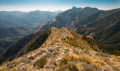
A long hike that will take you to the summit of the Cime de l’Authion for a breathtaking view of the Vésubie valley.
The Pélasque Woodland Walk
 9.11 mi
+3,402 ft
-3,415 ft
7h 10
Difficult
Departure from Lantosque (Alpes-Maritimes)
9.11 mi
+3,402 ft
-3,415 ft
7h 10
Difficult
Departure from Lantosque (Alpes-Maritimes)
A walk through wooded countryside, beginning with two hours of gentle incline – a rarity in this mountainous area. The return route follows an abandoned irrigation canal, leading onto the wooded paths near the village of Pélasque.
 Crête de l'Arpiha from Camp d'Argent
 5.46 mi
+1,142 ft
-1,129 ft
4 hrs
Moderate
Departure from La Bollène-Vésubie (Alpes-Maritimes)
5.46 mi
+1,142 ft
-1,129 ft
4 hrs
Moderate
Departure from La Bollène-Vésubie (Alpes-Maritimes)
A lovely, easy forest hike. Some beautiful views of the surrounding peaks.
The fortifications of the Authion massif
 8.75 mi
+1,959 ft
-1,929 ft
5h 45
Moderate
Departure from La Bollène-Vésubie (Alpes-Maritimes)
8.75 mi
+1,959 ft
-1,929 ft
5h 45
Moderate
Departure from La Bollène-Vésubie (Alpes-Maritimes)
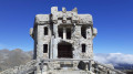
In April 1945, the entire Authion massif was the scene of fighting that led to the liberation of the Alpes-Maritimes. This route passes through the main fortifications of the Alpes-Maritimes fortified sector (SFAM). Apart from its historical significance, this circular route offers magnificent panoramic views of the high peaks of the Mercantour to the north and the Mediterranean to the south.
Merveilles Rest House – Merveilles Mountain Hut
 5.68 mi
+3,688 ft
-1,909 ft
5h 50
Difficult
Departure from Belvédère (Alpes-Maritimes)
5.68 mi
+3,688 ft
-1,909 ft
5h 50
Difficult
Departure from Belvédère (Alpes-Maritimes)
The aim of this fourth stage is to reach the Merveilles mountain refuge. The route is less well-travelled than the classic one via the Pas de l’Arpette. You’ll discover the Verrariers valley and the Pas du Trem. This small pass lies at the foot of the Cime du Diable, which you simply must climb. This magnificent viewpoint offers a 360° panorama of the Mercantour, as well as the Authion, the Col de Turini and all the way to the sea. You’ll then walk alongside the lakes of La Muta, Le Trem and Fourca.
Forest walk starting from the Col de Turini
 3.75 mi
+676 ft
-676 ft
2h 20
3.75 mi
+676 ft
-676 ft
2h 20
 Easy
Departure from La Bollène-Vésubie (Alpes-Maritimes)
Easy
Departure from La Bollène-Vésubie (Alpes-Maritimes)
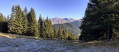
A short circular forest offering views of the mountains towards the Mediterranean, as well as the peaks of the Mercantour.
From the Calmette ridge to the barns at Suorcas, a circular route.
 9.43 mi
+2,543 ft
-2,516 ft
6h 35
Moderate
Departure from La Bollène-Vésubie (Alpes-Maritimes)
9.43 mi
+2,543 ft
-2,516 ft
6h 35
Moderate
Departure from La Bollène-Vésubie (Alpes-Maritimes)
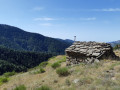
If you enjoy walks in the forest, this one is for you. This route, which runs mainly through a forest of larch, pine and spruce trees, starts at the legendary Col de Turini and takes you, via the Calmette ridge and then the Baisse de Patronel, to the Granges de Suorcas. The return journey is via the Piste de Tardei.
La Baisse de Camp d'Argent – Sospel
 13.53 mi
+1,670 ft
-6,289 ft
10 hrs
Very difficult
Departure from La Bollène-Vésubie (Alpes-Maritimes)
13.53 mi
+1,670 ft
-6,289 ft
10 hrs
Very difficult
Departure from La Bollène-Vésubie (Alpes-Maritimes)
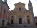
The sixth stage ofthe GR®52, where the landscapes change dramatically. Due to its length and significant descent of nearly 2,000 metres, the stage is very difficult. The descent to Sospel, which makes up two-thirds of the route, puts a real strain on the knees and ankles. Please note, it gets very hot in summer on this section.
Col de Turini circular
4.66 mi
+1,201 ft
-1,207 ft
3h 10
Moderate
Departure from Moulinet (Alpes-Maritimes)
From the Col de Turini, the trail climbs steadily towards the Cime de la Calmette, alternating between forest and open areas. The ascent is via a wide, safe path to the summit, which offers a beautiful view of the valley. The crossing to the Baisse de Patronel follows a pleasant path. The return journey, along a balcony path, becomes more challenging in places, with a few narrow passages requiring caution. A varied, bright and panoramic route, ideal for hikers accustomed to mountain terrain. Time: approximately 4 hours.
The tour of the Cime des Verrairiers via the Refuge des Merveilles
 10.18 mi
+4,334 ft
-4,360 ft
8h 25
Difficult
Departure from Belvédère (Alpes-Maritimes)
10.18 mi
+4,334 ft
-4,360 ft
8h 25
Difficult
Departure from Belvédère (Alpes-Maritimes)
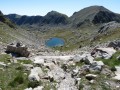
This beautiful circular route takes you from valley to valley, each time revealing a new landscape, from a wild valley to the lakes around the Refuge des Merveilles in a stunning rocky setting.
The four fortified structures of Authion
 4.86 mi
+1,467 ft
-1,463 ft
3h 30
Moderate
Departure from La Bollène-Vésubie (Alpes-Maritimes)
4.86 mi
+1,467 ft
-1,463 ft
3h 30
Moderate
Departure from La Bollène-Vésubie (Alpes-Maritimes)
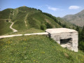
This area with its four fortifications located at high altitude was the scene of fierce fighting, both in 1793 when the French invaded the County of Nice, and in April 1945, during one of the last battles between the German army and the Allies. These stone and cement structures, bearing multiple cannon and gunshot marks, bear witness to the violence of these final confrontations.
The forts of Authion
 4.18 mi
+1,102 ft
-1,070 ft
2h 55
Easy
Departure from La Bollène-Vésubie (Alpes-Maritimes)
4.18 mi
+1,102 ft
-1,070 ft
2h 55
Easy
Departure from La Bollène-Vésubie (Alpes-Maritimes)
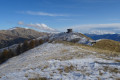
Located on the borders of the Vésubie, Bévéra and Roya valleys, Authion is the southernmost peak in the Alps above 2,000 metres.
Hiking its three peaks (Pointe des Trois Communes, Forca and Mille Fourches) offers magnificent panoramic views between the Mediterranean Sea and the Mercantour massif.
It is also an opportunity to discover its ancient military forts, which guarded the French-Italian border from the end of the19th century until the end of the Second World War.
Cime de la Valette and Lake Prals
 7.28 mi
+2,523 ft
-2,523 ft
5h 35
Difficult
Departure from Saint-Martin-Vésubie (Alpes-Maritimes)
7.28 mi
+2,523 ft
-2,523 ft
5h 35
Difficult
Departure from Saint-Martin-Vésubie (Alpes-Maritimes)
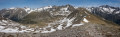
From the summit of La Valette, there is a breathtaking view of all the peaks of the Mercantour, La Colmiane and, on a clear day, Cap d'Antibes. You will pass by the five lakes of Le Prals.
Lacs de Prals via Baisse de Férisson and Cime de la Valette de Prals
 8.15 mi
+2,625 ft
-2,595 ft
6h 00
Moderate
Departure from Saint-Martin-Vésubie (Alpes-Maritimes)
8.15 mi
+2,625 ft
-2,595 ft
6h 00
Moderate
Departure from Saint-Martin-Vésubie (Alpes-Maritimes)
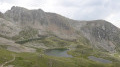
The Lacs de Prals or "Cinq Lacs" route takes you into the heart of the Mercantour, along pleasant, easy trails that are suitable for all walkers.
This route will allow you to discover the Tête de la Lave, the Cime de la Valette de Prals (2,496 m) with its panoramic view of the upper Vésubie and the great snow-capped peaks of the Oisans, before reaching the Lacs de Prals site.
The Prals Lakes loop
 4.65 mi
+1,729 ft
-1,755 ft
3h 40
Moderate
Departure from Saint-Martin-Vésubie (Alpes-Maritimes)
4.65 mi
+1,729 ft
-1,755 ft
3h 40
Moderate
Departure from Saint-Martin-Vésubie (Alpes-Maritimes)
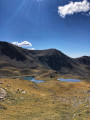
A charming circular hike that can be done at the start of the season (June) when there is still snow. Chamois are often seen (early in the morning). The lake area is very pleasant and offers many options and views for picnics.
Ascent of Baus de la Frema
 4.46 mi
+1,982 ft
-1,988 ft
3h 45
Moderate
Departure from Valdeblore (Alpes-Maritimes)
4.46 mi
+1,982 ft
-1,988 ft
3h 45
Moderate
Departure from Valdeblore (Alpes-Maritimes)
An easy hike offering beautiful views of the Mercantour Massif and, opposite, the Madone de Fenestre valley. You can extend the hike on the mountain pasture towards the Tête du Brec (2566m).
The Pas des Ladres via the Col de Fenestre
 4.68 mi
+2,054 ft
-2,041 ft
3h 55
Moderate
Departure from Saint-Martin-Vésubie (Alpes-Maritimes)
4.68 mi
+2,054 ft
-2,041 ft
3h 55
Moderate
Departure from Saint-Martin-Vésubie (Alpes-Maritimes)
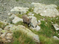
A beautiful loop around the Fenestre valley with Lake Fenestre as its centre point.
Summit of Gélas
 7.01 mi
+4,672 ft
-4,672 ft
8 hrs
7.01 mi
+4,672 ft
-4,672 ft
8 hrs
 Extremely difficult
Departure from Saint-Martin-Vésubie (Alpes-Maritimes)
Extremely difficult
Departure from Saint-Martin-Vésubie (Alpes-Maritimes)
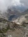
This route, which is closer to simple mountaineering than standard hiking, provides access to the highest peak in the Mercantour. From the summit, there is an exceptional panorama of the surrounding mountains and a view of the sea, stretching as far as Corsica on a clear day.
The proposed ascent is via the small pass Saint-Robert and the west-southwest ridge, descending via the northeast ridge and the Balcon du Gélas.
Balaour Lakes
 3.62 mi
+1,768 ft
-1,768 ft
3h 10
Moderate
Departure from Saint-Martin-Vésubie (Alpes-Maritimes)
3.62 mi
+1,768 ft
-1,768 ft
3h 10
Moderate
Departure from Saint-Martin-Vésubie (Alpes-Maritimes)
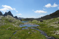
This hike in the Vallon de la Madone de Fenestre will take you to the wild lakes of Balaour, a little-visited spot at the foot of the Cime du Gélas, the highest point in the Mercantour.
These lakes are fed by the famous Vésubie river, which rises some 300 metres higher up at Lac Blanc.
Madone de Fenestre Mountain Hut – Relais des Merveilles
 6.64 mi
+2,280 ft
-3,343 ft
5h 00
Difficult
Departure from Saint-Martin-Vésubie (Alpes-Maritimes)
6.64 mi
+2,280 ft
-3,343 ft
5h 00
Difficult
Departure from Saint-Martin-Vésubie (Alpes-Maritimes)
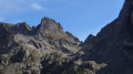
This third stage is less demanding than the previous two. The entire route follows a marked path.
Only the start of the descent from the Pas du Mont Colomb and the sections over scree require a little care. This is the classic route linking the Madone de Fenestre valley with the Gordolasque valley. The scenery along the way is magnificent, and the Pas du Mont Colomb offers two completely different views from its eastern and western sides.
Caïre Gros
 6.51 mi
+2,270 ft
-2,254 ft
5h 00
Moderate
Departure from Valdeblore (Alpes-Maritimes)
6.51 mi
+2,270 ft
-2,254 ft
5h 00
Moderate
Departure from Valdeblore (Alpes-Maritimes)
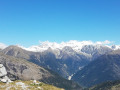
A magnificent viewpoint, the summit of Caïre Gros, between the Tinée and Vésubie valleys, offers superb views of the Franco-Italian mountain range and the main peaks of the Mercantour.
Lac Autier via the Nice refuge
 7.37 mi
+3,064 ft
-3,061 ft
6h 05
Difficult
Departure from Belvédère (Alpes-Maritimes)
7.37 mi
+3,064 ft
-3,061 ft
6h 05
Difficult
Departure from Belvédère (Alpes-Maritimes)
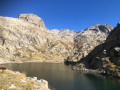
A very beautiful circular in one of the wildest valleys in the Southern Alps. It offers landscapes of rare beauty in an exceptional setting. The refuge is a welcome place to take a break. Keep an eye out for wildlife: chamois, marmots (outside hibernation period) and ibex.
Vallon de la Gordolasque starting from the Pont du Countet
 1.78 mi
+367 ft
-367 ft
1h 10
Easy
Departure from Belvédère (Alpes-Maritimes)
1.78 mi
+367 ft
-367 ft
1h 10
Easy
Departure from Belvédère (Alpes-Maritimes)
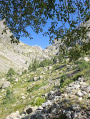
A very pleasant family walk in the Gordolasque Valley, with no particular difficulties and wonderful scenery.
Tour of the Estrech Waterfall
 3.05 mi
+1,102 ft
-1,106 ft
2h 20
Moderate
Departure from Belvédère (Alpes-Maritimes)
3.05 mi
+1,102 ft
-1,106 ft
2h 20
Moderate
Departure from Belvédère (Alpes-Maritimes)
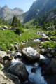
A circular route in Gordolasque to discover this pretty valley, the starting point for long hikes in the Mercantour.
You will climb up opposite the Cascade de l'Estrech waterfall, then pass by the Mur des Italiens, a place where chamois and ibex are often seen, before descending on the right bank, which offers a beautiful view of the valley with the Cime du Diable peak in the distance.
Please note that the return route on the right bank is currently inaccessible, see description.
Mont Clapier
 8.94 mi
+4,390 ft
-4,390 ft
8 hrs
Very difficult
Departure from Belvédère (Alpes-Maritimes)
8.94 mi
+4,390 ft
-4,390 ft
8 hrs
Very difficult
Departure from Belvédère (Alpes-Maritimes)
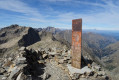
Mont Clapier (3,045 m) is one of the five 3,000-metre peaks in the Alpes-Maritimes, and probably the most accessible.
The ascent does not present any particular technical difficulties, but you do need a good sense of direction to navigate the scree slopes from the Lacs du Mont Clapier.
At the summit, there is a superb panorama of the peaks from the Italian-Swiss border to Corsica, passing through the Po plain, the ever-isolated Mont Viso, and closer by, Mont Bégo, Grand Capelet, Gélas and Argentera.
From Pont du Countet to the Refuge des Merveilles
5.87 mi
+3,271 ft
-1,824 ft
5h 35
Difficult
Departure from Belvédère (Alpes-Maritimes)
The first stage of a three-day trek in the heart of the Mercantour National Park, this route immediately takes the hiker into the high mountains via a little-used alpine route, away from the classic Pas de l’Arpette. On the itinerary: a steady climb up the Vallon des Verrairiers from the Gordolasque Valley, crossing the Pas du Trem (2,477 m) at the foot of the legendary Cime du Diable (2,685 m), then a long descent past a string of glacial lakes – Lac du Diable, Lac de la Muta, Lac du Trem, Lac Fourca – down to Lac Long Supérieur and the Refuge des Merveilles (2,130 m). A route combining the geological richness of the upper Gordolasque, breathtaking views of the Authion, Mont Capelet Supérieur and the Mediterranean on clear days, and a majestic entrance to the Vallée des Merveilles, a site listed as a Historic Monument. Characteristic wildlife: chamois, ibex, marmots.
The Balcon du Gélas via Lac Long
 8.70 mi
+4,567 ft
-4,537 ft
8 hrs
Very difficult
Departure from Belvédère (Alpes-Maritimes)
8.70 mi
+4,567 ft
-4,537 ft
8 hrs
Very difficult
Departure from Belvédère (Alpes-Maritimes)
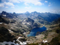
The Balcon du Gélas, which rises to over 3,000 metres, is a minor peak in the Haute Vésubie, situated close to its larger counterparts, the iconic Gélas peaks.
The ascent, however, offers superb views of the highest peaks of the Gordolasque, Lac Long, as well as the Argentera and even the Viso on the Italian side.
This hike, starting from Pont du Countet, takes you up the Gordolasque valley to Lac de la Fous, then leads you to the peaceful Lac Long before a climb to the Terrasse du Gélas—the only tricky section—and an easy final ascent to reward you with this beautiful summit, at the foot of the highest peak in the Mercantour massif.
Madone de Fenestre refuge - Pont du Countet
7.75 mi
+2,812 ft
-3,642 ft
6h 00
Difficult
Departure from Saint-Martin-Vésubie (Alpes-Maritimes)
Route linking the Vésubie and Gordolasque valleys.
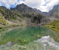
Lac Autier
 4.09 mi
+1,923 ft
-1,923 ft
3h 35
Moderate
Departure from Belvédère (Alpes-Maritimes)
4.09 mi
+1,923 ft
-1,923 ft
3h 35
Moderate
Departure from Belvédère (Alpes-Maritimes)
A round trip that will see you cover nearly 600m of elevation gain in 4 hours and enjoy this magnificent lake.
Tour of the Tête du Lac Autier
 7.16 mi
+2,989 ft
-2,989 ft
5h 55
Difficult
Departure from Belvédère (Alpes-Maritimes)
7.16 mi
+2,989 ft
-2,989 ft
5h 55
Difficult
Departure from Belvédère (Alpes-Maritimes)
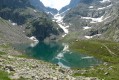
A beautiful loop in the Gordolasque valley that takes you close to five lakes, including the superb Lac Autier and Lac Niré. There are also some beautiful waterfalls, including the vast Cascade de l'Estrech. Numerous chamois can be seen throughout the hike. A few ibex and marmots can be spotted below the Lac de la Fous dam.
Mont Bego and Grand Capelet
 12.32 mi
+6,532 ft
-6,526 ft
11h 20
Very difficult
Departure from Belvédère (Alpes-Maritimes)
12.32 mi
+6,532 ft
-6,526 ft
11h 20
Very difficult
Departure from Belvédère (Alpes-Maritimes)
This magnificent circular will take you to the two main peaks of the Vallée des Merveilles: Mont du Grand Capelet and Mont Bego. You will encounter numerous chamois around the Pas de l'Arpette and Lac Autier.
Lac de la Fous - Refuge de Nice - Lac Niré
 7.46 mi
+2,280 ft
-2,277 ft
5h 25
Difficult
Departure from Belvédère (Alpes-Maritimes)
7.46 mi
+2,280 ft
-2,277 ft
5h 25
Difficult
Departure from Belvédère (Alpes-Maritimes)
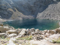
Discover the Gordolasque Valley and the Mercantour.
Lac Long de la Gordolasque
 6.71 mi
+2,959 ft
-2,933 ft
5h 40
Difficult
Departure from Belvédère (Alpes-Maritimes)
6.71 mi
+2,959 ft
-2,933 ft
5h 40
Difficult
Departure from Belvédère (Alpes-Maritimes)
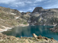
The destination of a hike starting from Pont du Countet, the traditional entry point to the Vallée des Merveilles, Lac Long is relatively uncrowded and exudes an atmosphere of serenity in its rocky setting dominated by the elegant Cime de la Malédie.
Reaching this lake allows you to enter a wild and mineral valley located near the very popular Refuge de Nice. Ibex and chamois will probably be your only companions.
Mont des Merveilles
 5.54 mi
+3,297 ft
-3,297 ft
5h 25
Difficult
Departure from Belvédère (Alpes-Maritimes)
5.54 mi
+3,297 ft
-3,297 ft
5h 25
Difficult
Departure from Belvédère (Alpes-Maritimes)
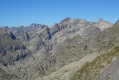
Mont des Merveilles or Caïre des Conques is a peak located between the Vallée des Merveilles and the Vallée de la Gordolasque.
This hike from Pont du Countet will take you up Pas de l'Arpette via Vallon d'Empuonrame.
On the agenda: beautiful panoramic views of several lakes and the peaks of the Mercantour, as well as encounters with chamois and marmots if you're lucky.
Le Grand Capelet and the Vallée des Merveilles
 9.30 mi
+5,174 ft
-5,167 ft
10 hrs
Very difficult
Departure from Belvédère (Alpes-Maritimes)
9.30 mi
+5,174 ft
-5,167 ft
10 hrs
Very difficult
Departure from Belvédère (Alpes-Maritimes)
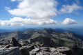
A demanding hike through steep terrain to reach the summit of the Grand Capelet, offering a 360° panorama from the Mediterranean to the Argentera, and a return via the famous Vallée des Merveilles, allowing you to discover some of the rock carvings in the area.
This circular route is very long and very difficult; it is reserved for seasoned mountaineers.
Mont des Merveilles and Grand Capelet from Gordolasque
 7.40 mi
+4,465 ft
-4,465 ft
6 hrs
Very difficult
Departure from Belvédère (Alpes-Maritimes)
7.40 mi
+4,465 ft
-4,465 ft
6 hrs
Very difficult
Departure from Belvédère (Alpes-Maritimes)
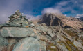
This hike is mostly off-trail, with significant elevation gain, and is reserved for experienced walkers. The view from the summit of Grand Capelet, at the crossroads of the Gordolasque, Merveilles and Valmasque valleys, is undoubtedly one of the most beautiful in the Mercantour.Please take note of the practical information.
Pont du Countet - Refuge des Merveilles
 3.63 mi
+2,697 ft
-1,276 ft
4h 00
Moderate
Departure from Belvédère (Alpes-Maritimes)
3.63 mi
+2,697 ft
-1,276 ft
4h 00
Moderate
Departure from Belvédère (Alpes-Maritimes)
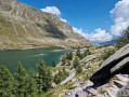
Discover the Vallée des Merveilles by connecting the Vallée de la Gordolasque to the famous Refuge des Merveilles.
Route in the Mercantour
20.23 mi
+9,656 ft
-9,665 ft
4 days
Difficult
Departure from Belvédère (Alpes-Maritimes)
Four-day route in the Mercantour Massif. Passing through the unmissable Vallée des Merveilles, continuing on to the Refuges de Nice and Madone de Fenestre, then ending the circular at Pont du Countet, the terminus of the Gordolasque valley road.
Mont Pepoiri, Petoumier and Lacs de Millefonts
 12.11 mi
+5,696 ft
-5,669 ft
10 hrs
Very difficult
Departure from Valdeblore (Alpes-Maritimes)
12.11 mi
+5,696 ft
-5,669 ft
10 hrs
Very difficult
Departure from Valdeblore (Alpes-Maritimes)
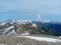
This is a beautiful circuit that allows you to discover the Baus de la Frema and Mont Pétoumier with incredible views of the Argentera and Gélas massifs, then the Lacs de Millefonts with the final climb to Mont Pépoiri, which offers an extraordinary panorama of the entire Mercantour and the middle country.
Circular walk around the Vallon and the Baisse de Peïra Cava
8.44 mi
+3,235 ft
-3,212 ft
6h 40
Difficult
Departure from Lantosque (Alpes-Maritimes)
We were charmed by this pleasant walk because of its shaded nature.
Indeed, the path winds its way mostly under the shelter of the trees, allowing you to enjoy the pleasant woodland setting. The view is rarely unobstructed, but the route offers a rich variety of flora and geological features.
The path is very even and gradually ascending: except on the return leg, where the climb is concentrated in a series of short hairpin bends, though these are shaded, making the effort quite manageable. The walk is well worth the detour
The Cime du Diable
 10.27 mi
+3,845 ft
-3,858 ft
8h 05
Difficult
Departure from La Bollène-Vésubie (Alpes-Maritimes)
10.27 mi
+3,845 ft
-3,858 ft
8h 05
Difficult
Departure from La Bollène-Vésubie (Alpes-Maritimes)
Hike along the Authion border, climb the Cime du Diable (2,685 m), with views of the lakes of the Vallée des Merveilles and its ancient rock carvings.
The West Peak of Fenestre via Lac de Trécolpas
 6.83 mi
+3,209 ft
-3,189 ft
5h 55
Difficult
Departure from Saint-Martin-Vésubie (Alpes-Maritimes)
6.83 mi
+3,209 ft
-3,189 ft
5h 55
Difficult
Departure from Saint-Martin-Vésubie (Alpes-Maritimes)
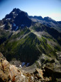
This hike in the Haut Boréon will take you, via the iconic Lac de Trécolpas, to a minor but wild summit that is particularly interesting for its breathtaking view of the Cime du Gélas. The ascent presents no major difficulties, apart from a section off the beaten track and a few easy climbing moves towards the end, as well as the possibility of encountering chamois and ibex along much of the route.
Cime Guilié
 8.40 mi
+4,459 ft
-4,459 ft
7 hrs
Very difficult
Departure from Saint-Martin-Vésubie (Alpes-Maritimes)
8.40 mi
+4,459 ft
-4,459 ft
7 hrs
Very difficult
Departure from Saint-Martin-Vésubie (Alpes-Maritimes)
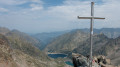
A challenging hike that takes you to the Cime Guilié (2,999 m), a border peak just one metre short of reaching the Mercantour’s 3,000-metre peaks. At the top, there are magnificent views both on the French side and of the lakes on the Italian side. On the way back, a short detour will allow you to explore the Bessons Lakes.
Lac de Trécolpas and return via the Refuge de la Cougourde
 6.95 mi
+2,293 ft
-2,290 ft
5h 10
Moderate
Departure from Saint-Martin-Vésubie (Alpes-Maritimes)
6.95 mi
+2,293 ft
-2,290 ft
5h 10
Moderate
Departure from Saint-Martin-Vésubie (Alpes-Maritimes)
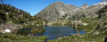
This is a fine route with the beautiful Lac de Trécolpas at the foot of the Pas des Ladres.
Please note that following storm Alex, the start of the hike on the right bank is no longer possible and must therefore be made on the left bank.
From Saint-Dalmas to Utelle
 15.80 mi
+4,124 ft
-5,745 ft
10h 50
Difficult
Departure from Valdeblore (Alpes-Maritimes)
15.80 mi
+4,124 ft
-5,745 ft
10h 50
Difficult
Departure from Valdeblore (Alpes-Maritimes)
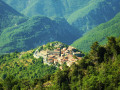
This twentieth stage marks the end of the crossing of the Mercantour Massif. From Saint-Dalmas, the GR®5 heads south to climb the steep slope towards the Cime de Colmiane, which it bypasses by heading for the Col du Varaire. It crosses the Bois Noir and reaches the Col des Deux Caïres, then the Caïre Gros. The route follows its ridge and, hugging the hillside, passes beneath Mont Chalancha, La Partissuola and the Cime de la Combe before descending to the small pass of Trous. Before the Col du Fort, the path descends to the Granges de la Brasque, crosses the upper part of the Riou du Figaret valley and arrives at the Col d’Andrion. Cutting across the hairpin bends of the M33, the GR®5 reaches the Col des Fournès and the Col de Gratteloup. Through rocky gaps, it runs alongside the Petit Brec d’Utelle and then the Brec d’Utelle. From there, the path descends towards the Crête de l’Albaréa and reaches the Col du Castel Ginesté. It crosses the slope below the ridges of the Têtes du Sac de Bécasse, Parabosquet and Les Pennes to reach the Utelle community lodge.
Saint-Dalmas de Valdeblore - Utelle
15.74 mi
+4,354 ft
-5,919 ft
11h 00
Difficult
Departure from Valdeblore (Alpes-Maritimes)
Étape de la traversée des Alpes de Saint-Dalmas de Valdeblore jusqu'à Utelle. Randonnée sur une ligne de crête offrant des panoramas extraordinaires sur l'arrière pays niçois.
Saint-Dalmas de Valdeblore – Le Boréon
 12.91 mi
+4,491 ft
-3,720 ft
10 hrs
Very difficult
Departure from Valdeblore (Alpes-Maritimes)
12.91 mi
+4,491 ft
-3,720 ft
10 hrs
Very difficult
Departure from Valdeblore (Alpes-Maritimes)
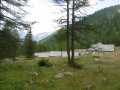
Second stage of the route and first stage on theGR®52. A long 21km stage taking in the Col de Veillos, numerous lakes, the Col du Barn, the Vacherie du Collet and the Col de Salèse, ending at a place called Le Boréon.
A spectacular stage thanks to its landscapes and views, but very difficult.
Bessons Lakes
 7.06 mi
+3,232 ft
-3,235 ft
6h 05
Difficult
Departure from Saint-Martin-Vésubie (Alpes-Maritimes)
7.06 mi
+3,232 ft
-3,235 ft
6h 05
Difficult
Departure from Saint-Martin-Vésubie (Alpes-Maritimes)
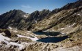
The Bessons Lakes are among the most beautiful and airy in Boréon. The striking glacial relief, with the passage of barriers defending this cirque, is truly awe-inspiring.
The Belvédère de Séréna via Mont Viroulet
 7.59 mi
+2,385 ft
-2,375 ft
5h 35
Difficult
Departure from Valdeblore (Alpes-Maritimes)
7.59 mi
+2,385 ft
-2,375 ft
5h 35
Difficult
Departure from Valdeblore (Alpes-Maritimes)
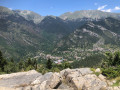
A beautiful hike in a very shady forest environment, best done in spring or during the warmer months, where you can enjoy this area rich in fir and spruce trees. Finally, enter the fortified village through the old ogival gate to discover what is certainly the oldest of the three villages of Valdeblore.
The summit of Peïra Cava
 2.22 mi
+459 ft
-466 ft
1h 25
Moderate
Departure from Lucéram (Alpes-Maritimes)
2.22 mi
+459 ft
-466 ft
1h 25
Moderate
Departure from Lucéram (Alpes-Maritimes)
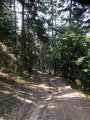
The route, lined with fir and larch trees, is a haven of peace; it is more of a short forest walk than a proper hike, with the only slight challenge being the climb up to the Cime de Peïra Cava, a rise of about a hundred metres.
This walk is suitable from May to October.
Boréon – Cougourde Mountain Hut
 5.37 mi
+2,559 ft
-472 ft
4h 40
Moderate
Departure from Saint-Martin-Vésubie (Alpes-Maritimes)
5.37 mi
+2,559 ft
-472 ft
4h 40
Moderate
Departure from Saint-Martin-Vésubie (Alpes-Maritimes)
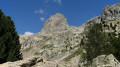
This first stage largely follows theGR®52. It takes you through wooded countryside and offers a relaxing break by the peaceful Lac de Trécolpas. From the Cougourde Mountain Hut, you’ll enjoy superb views of this majestic, pumpkin-shaped peak.
Editor’s note added on 26/07/2021: A section is closed due to bad weather. See the notices for an alternative route
The ridge of the Pointe de Faule
 7.56 mi
+2,844 ft
-2,851 ft
5h 55
Difficult
Departure from Lucéram (Alpes-Maritimes)
7.56 mi
+2,844 ft
-2,851 ft
5h 55
Difficult
Departure from Lucéram (Alpes-Maritimes)
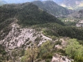
The stunning, seemingly endless ridge of the Pointe de Faule with its myriad views, the Peïra Cava forest renowned for its tall, mixed-species trees, anda walk through the abandoned 17th-century village of Béasse, uninhabited since 1930, are all part of this challenging hike.A few short technical and exposed sections; the Visorando app may prove useful
Le Boreon - Refuge de Nice
 10.85 mi
+5,971 ft
-3,678 ft
12 hrs
Very difficult
Departure from Saint-Martin-Vésubie (Alpes-Maritimes)
10.85 mi
+5,971 ft
-3,678 ft
12 hrs
Very difficult
Departure from Saint-Martin-Vésubie (Alpes-Maritimes)
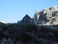
The most difficult stage of thisGR®, but the most beautiful for its landscapes, flora and fauna: chamois, marmots, ibex.
After the Pas des Ladres, we chose to take theGR®52via the alternative route that passes close to the Col de Fenestre, then descends to Lac de Fenestre before reaching La Madone de Fenestre.
Three sections are particularly difficult: between Lac de Trecolpas and the Pas des Ladres, the ascent of the Pas du Colomb, and the descent from the Pas du Colomb.
Lac du Mercantour and Col de Cerise
 5.71 mi
+3,845 ft
-3,819 ft
6h 00
Difficult
Departure from Saint-Martin-Vésubie (Alpes-Maritimes)
5.71 mi
+3,845 ft
-3,819 ft
6h 00
Difficult
Departure from Saint-Martin-Vésubie (Alpes-Maritimes)
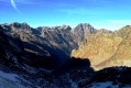
A short but challenging hike in a wild valley in Haute-Vésubie.
Rocky landscape, a pretty lake and a beautiful view of several Italian peaks, including Monte Matto (3,088 m).
Col des Cerises, starting from Boréon
 5.13 mi
+3,353 ft
-3,353 ft
5h 15
Difficult
Departure from Saint-Martin-Vésubie (Alpes-Maritimes)
5.13 mi
+3,353 ft
-3,353 ft
5h 15
Difficult
Departure from Saint-Martin-Vésubie (Alpes-Maritimes)
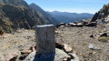
A lovely summit hike, as you’ll be climbing over 1,000 metres. Initially sheltered by a forest, you’ll then move through a more alpine landscape before finishing with a pleasant climb over scree. You’ll pass by the little Lac de Cerise. On the way down, the easier going will surely allow you to spot the chamois and marmots you may have missed on the way up.
Mercantour Peak
 6.23 mi
+4,078 ft
-4,091 ft
5 hrs
Very difficult
Departure from Saint-Martin-Vésubie (Alpes-Maritimes)
6.23 mi
+4,078 ft
-4,091 ft
5 hrs
Very difficult
Departure from Saint-Martin-Vésubie (Alpes-Maritimes)
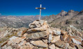
The secondary summit of the park, to which it gives its name (by mistake, according to legend), the Cime du Mercantour is relatively accessible and offers a pleasant, uncrowded hike.
Please note: the descent to the Vallon des Erps requires caution and is only suitable for experienced walkers.
Nice Mountain Hut – Madone de Fenestre Mountain Hut
 4.88 mi
+2,523 ft
-3,527 ft
7 hrs
Very difficult
Departure from Belvédère (Alpes-Maritimes)
4.88 mi
+2,523 ft
-3,527 ft
7 hrs
Very difficult
Departure from Belvédère (Alpes-Maritimes)
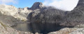
This second day will take you to the foot of the Cime du Gélas (just 200 m below the summit); you’ll walk for a long time alongside Lac Long and the superb Malédie. You’ll then head into another small valley to admire the Cime Saint-Robert. The Lac Blanc, from which the stream flows, is none other than the Vésubie, and of course, the Gélas on its western face. The route will become more familiar and less strenuous once you rejoin the path coming from the Lac de la Fenestre.
Refuge de Nice - Refuge de la Madone de Fenestre
 3.36 mi
+1,512 ft
-2,533 ft
2h 50
Difficult
Departure from Belvédère (Alpes-Maritimes)
3.36 mi
+1,512 ft
-2,533 ft
2h 50
Difficult
Departure from Belvédère (Alpes-Maritimes)
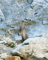
This route, which runs parallel to the border, is dominated throughout by the large peak of Gélas, the highest summit in the area.
The Mont Clapier Lakes from the Nice refuge
 2.00 mi
+1,191 ft
-1,194 ft
1h 55
Moderate
Departure from Belvédère (Alpes-Maritimes)
2.00 mi
+1,191 ft
-1,194 ft
1h 55
Moderate
Departure from Belvédère (Alpes-Maritimes)
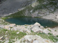
A short additional hike if you arrive at the Nice refuge too early. The lakes of Mont Clapier are a lovely and charming destination. As in the rest of the Mercantour, chamois and ibex are everywhere.
The lakes may still be frozen in mid-June. The path is not signposted, but is clearly visible. The same instructions appear on the map and on the suggested walks displayed at the entrance to the refuge. The elevation gain is approximately 300m.
Nice Refuge - Merveilles Refuge
 5.74 mi
+1,995 ft
-2,303 ft
4h 20
Difficult
Departure from Belvédère (Alpes-Maritimes)
5.74 mi
+1,995 ft
-2,303 ft
4h 20
Difficult
Departure from Belvédère (Alpes-Maritimes)
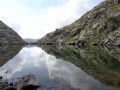
Starting from the Refuge de Nice, the fourth stage of this journey through the Mercantour is the shortest. Short but just as difficult. You’ll pass the Baisse du Basto, the highest point ofthe GR®52. You’ll cross over to Lac du Basto, then it’s the climb up the Baisse de la Valmasque, before descending into the Vallée des Merveilles.
Cime de Linière starting from Moulinet
 7.48 mi
+2,585 ft
-2,592 ft
5h 40
Moderate
Departure from Moulinet (Alpes-Maritimes)
7.48 mi
+2,585 ft
-2,592 ft
5h 40
Moderate
Departure from Moulinet (Alpes-Maritimes)
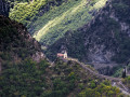
The route starts from the village of Moulinet, which you can visit on your return. At the Saint-Sébastien Chapel, take a steep path that winds its way up to the ruins of L’Avenquet. At the summit of Linière, you’ll catch a glimpse of the peaks around Sospel.
The Bévéra Gorges at Moulinet
 4.42 mi
+1,276 ft
-1,293 ft
3h 10
Moderate
Departure from Moulinet (Alpes-Maritimes)
4.42 mi
+1,276 ft
-1,293 ft
3h 10
Moderate
Departure from Moulinet (Alpes-Maritimes)
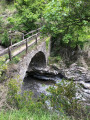
A few kilometres from Sospel, the village of Moulinet offers beautiful mountain scenery. The end of this circular route follows the wooded, sometimes steep banks of the Bévéra Gorges, located in the Mercantour National Park.
The ruins of the hamlet of L’Avenquet
 3.37 mi
+1,732 ft
-1,722 ft
3h 05
Moderate
Departure from Moulinet (Alpes-Maritimes)
3.37 mi
+1,732 ft
-1,722 ft
3h 05
Moderate
Departure from Moulinet (Alpes-Maritimes)
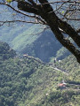
A lovely little, quiet forest walk. The ruins of the hamlet of L’Avenquet bear witness to a bygone era of traditional farming. A few steep banks and wooded paths lined with spruce trees in the Bouissièra forest will delight nature lovers.