Madone de Fenestre Mountain Hut – Relais des Merveilles

This third stage is less demanding than the previous two. The entire route follows a marked path.
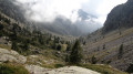
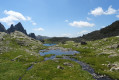
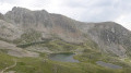
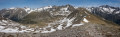
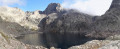
Only the start of the descent from the Pas du Mont Colomb and the sections over scree require a little care. This is the classic route linking the Madone de Fenestre valley with the Gordolasque valley. The scenery along the way is magnificent, and the Pas du Mont Colomb offers two completely different views from its eastern and western sides.

This walk is part of a multi-day hike: Circular route in the Mercantour starting from Castérino

Details

1620209
Creation:
Last update:
Last review:
  • Walking
    Activity: Walking
  • ↔
    Distance: 6.64 mi
  • ◔
    Average duration: 5h 00 
  • ▲
    Difficulty: Difficult

  • ⚐
    Back to start: No
  • ↗
    Ascent: + 2,280 ft
  • ↘
    Descent: - 3,343 ft

  • ▲
    Highest point: 8,356 ft
  • ▼
    Lowest point: 5,194 ft

Photos

Description of the walk

(S) From the Madone de Fenestre refuge, head due east towards the Madone cattle shed.

(1) Turn left to follow theGR®52towards the Pas du Mont Colomb, pass marker 367, and continue heading north. Reach the ruins near Gias Cabret.

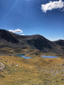
(2) Start to curve eastwards and continue along the path to a flat area after passing a dried-up lake.

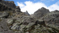
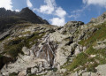
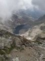
(3) Cross a scree slope, then climb the switchbacks up a long scree slope to reach the Pas du Mont Colomb, a clearly visible pass.

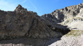
(4) At marker 400, which marks the Pas du Mont Colomb, carefully begin the steep descent. Then make your way along a long scree slope – not always easy going, but well signposted – until you reach the junction with the path coming from the Refuge de Nice at marker 416.

(5) Turn right, heading south, and descend to marker 415.

(6) Turn left and follow the path known as the “Mur des Italiens”. At the fork, turn right. Continue to a footbridge spanning the torrent.

(7) Cross the footbridge and follow the Gordolasque along its right bank to the Pont du Countet (marker 411).

(8) Turn right and follow the road to the Relais des Merveilles (E).

Waypoints

  1. S : mi 0 - alt. 6,270 ft - Madone de Fenestre Refuge
  2. 1 : mi 0.29 - alt. 6,106 ft - Madone de Fenestre cattle shed - Vésubie (rivière)
  3. 2 : mi 1 - alt. 6,870 ft - Gias Cabret Ruins
  4. 3 : mi 2.05 - alt. 7,795 ft - Dried-up lake
  5. 4 : mi 2.59 - alt. 8,281 ft - Pas du Mont Colomb
  6. 5 : mi 3.33 - alt. 7,070 ft - Junction with the path coming from the Refuge de Nice
  7. 6 : mi 4.08 - alt. 6,627 ft - Marker 415
  8. 7 : mi 4.81 - alt. 5,863 ft - Footbridge over the - Gordolasque
  9. 8 : mi 5.61 - alt. 5,535 ft - Crossing at the Countet Bridge
  10. E : mi 6.64 - alt. 5,194 ft - Relais des Merveilles

Notes

This route passes through a protected area, which may be subject to special regulations:

Worth a visit

  • Fenestre Lake and Pass.
  • Pas des Ladres.
  • Cime du Gélas.

Always be cautious and plan ahead when you're outdoors. Visorando and the author of this route cannot be held responsible for any accidents occurring on this route.

The GR® and PR® markings are the intellectual property of the Fédération Française de Randonnée Pédestre.

Reviews and comments

4 / 5
Based on 1 review

Reliability of the description
2 / 5
Ease of following the route
5 / 5
Route interest
5 / 5
yoguini
yoguini

Overall rating : 4 / 5

Date of your route : Aug 11, 2020
Reliability of the description : ★★☆☆☆ Disappointing
Ease of following the route : ★★★★★ Very good
Route interest : ★★★★★ Very good
Very busy route : No

Please note, it took me 6 hours to complete this walk, and the route is very difficult and technical. There’s a very long scree slope both on the way up and on the way down. But it is doable, of course. This walk is for experienced walkers only.
But it’s absolutely stunning!

Machine-translated

Other walks in the area

For more walks, use our search engine .

The GPS track and description are the property of this route's author. Please do not copy them without permission.