Nice Mountain Hut – Madone de Fenestre Mountain Hut

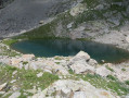
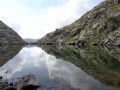
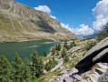
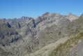
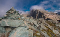
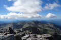
This second day will take you to the foot of the Cime du Gélas (just 200 m below the summit); you’ll walk for a long time alongside Lac Long and the superb Malédie. You’ll then head into another small valley to admire the Cime Saint-Robert. The Lac Blanc, from which the stream flows, is none other than the Vésubie, and of course, the Gélas on its western face. The route will become more familiar and less strenuous once you rejoin the path coming from the Lac de la Fenestre.

This walk is part of a multi-day hike: Circular route in the Mercantour starting from Castérino

Details

1620185
Creation:
Last update:
Last review:
  • Walking
    Activity: Walking
  • ↔
    Distance: 4.88 mi
  • ◔
    Duration according to the author: 7 hrs 
  • ▲
    Difficulty: Very difficult

  • ⚐
    Back to start: No
  • ↗
    Ascent: + 2,523 ft
  • ↘
    Descent: - 3,527 ft

  • ▲
    Highest point: 9,646 ft
  • ▼
    Lowest point: 6,276 ft

Photos

Description of the walk

(S) From the Refuge de Nice, go down the steps to the small bridge.

(1) Turn left onto theGR®52towards the Pas du Mont Colomb. Just before the Lac de la Fous dam, look out for a path that climbs northwards.

Please note: from point 2 to point 7, the path is rated T3 and is suitable for experienced walkers.

(2) At the junction, turn right and head north along the well-marked path leading to Lac Long.

(3) Keep to the right-hand side of the lake and continue due north, following the numerous cairns closely. The slope is gentle until you reach three-quarters of the way round the lake. Then, climb westwards to reach the Terrasse du Gélas.
Continue north-north-west along the path over scree alternating with grassy slopes that become increasingly steep. Head up a final, steep gully to reach an almost flat scree slope.
At this point (the highest point of the walk), the Cime du Gélas is directly opposite and the Balcon du Gélas is to the right. Behind you, the gap offers views of Lac Long and the Cime de la Malédie.

(4) Turn left, heading south-west, down a wide scree gully to begin the descent. Continue to lose altitude over the well-marked scree until you reach Lac Blanc, which is clearly visible.

(5) Ignore the path branching off to the left and head towards Lac Blanc, reaching its southern shore. Walk along the lake.

(6) Cross the stream – this is the Source de la Vésubie, which rises here. Follow a path marked with cairns to join the track coming from the Col du Saint-Robert. Continue to Lac Mort; this lake is dry.
Stay on a clear but occasionally steep path to join the track coming from Lac de Fenestre.

(7) Carry on straight ahead along a very good path until you reach the junction with theGR®52.

(8) Head south-west to finish the stage on a ‘boulevard’ (GR®52) to the Madone de Fenestre refuge (E).

Waypoints

  1. S : mi 0 - alt. 7,287 ft - Refuge de Nice
  2. 1 : mi 0.23 - alt. 7,188 ft - Turn left onto the GR°°®°°52 - Gordolasque
  3. 2 : mi 0.49 - alt. 7,218 ft - Lac Long junction - Lac de la Fous
  4. 3 : mi 1.27 - alt. 8,458 ft - Lac Long (Mercantour)
  5. 4 : mi 2.13 - alt. 9,633 ft - Junction of the Cime du Gélas and Balcon du Gélas paths
  6. 5 : mi 2.58 - alt. 8,822 ft - Junction - Lac Blanc - Mercantour
  7. 6 : mi 2.68 - alt. 8,740 ft - Source of the - Vésubie (rivière)
  8. 7 : mi 3.76 - alt. 7,530 ft - Junction with the Lac de la Fenestre path
  9. 8 : mi 4.32 - alt. 6,785 ft - Junction with the GR52
  10. E : mi 4.88 - alt. 6,276 ft - Madone de Fenestre Refuge

Notes

  • This route includes a long section rated T3.
  • A quick reminder about route ratings: see this page.
  • The duration calculated by the Visorando software is very optimistic. The terrain does not allow for such a fast pace, either on the ascent or the descent. Allow 6 to 7 hours instead

This route passes through a protected area, which may be subject to special regulations:

Worth a visit

  • The Cime de la Malédie.
  • The Cime du Gelas.
  • The Balcon du Gélas (3,073 m) – an additional 130 m of elevation gain. This can be tackled during this hike if the sky is clear (which wasn’t the case on the day of this stage).
  • Mont Saint Robert.
  • Lac Blanc, which is the source of the Vésubie.

Always be cautious and plan ahead when you're outdoors. Visorando and the author of this route cannot be held responsible for any accidents occurring on this route.

The GR® and PR® markings are the intellectual property of the Fédération Française de Randonnée Pédestre.

Other walks in the area

For more walks, use our search engine .

The GPS track and description are the property of this route's author. Please do not copy them without permission.