The West Peak of Fenestre via Lac de Trécolpas

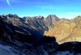
This hike in the Haut Boréon will take you, via the iconic Lac de Trécolpas, to a minor but wild summit that is particularly interesting for its breathtaking view of the Cime du Gélas. The ascent presents no major difficulties, apart from a section off the beaten track and a few easy climbing moves towards the end, as well as the possibility of encountering chamois and ibex along much of the route.

Details

36578718
Creation:
Last update:
Last review:
  • Walking
    Activity: Walking
  • ↔
    Distance: 6.83 mi
  • ◔
    Average duration: 5h 55 
  • ▲
    Difficulty: Difficult

  • ⚐
    Back to start: Yes
  • ↗
    Ascent: + 3,209 ft
  • ↘
    Descent: - 3,189 ft

  • ▲
    Highest point: 8,648 ft
  • ▼
    Lowest point: 5,515 ft

Photos

Description of the walk

The start of the walk is at La Vacherie du Boréon; if possible, use the upper car park (follow the track – which was somewhat damaged by Storm Alex – to the final car park).

(S/E) At the upper car park, marker 420 points towards the Pas des Ladres. Follow this track, which climbs gently through the forest. A little further on, pass the first marker 421, then look out for a second marker 421 at a bend.

(1) Continue straight on along the GR®52 path (marked in white and red), still heading towards the Pas des Ladres. The climb through the forest is gradual, then descends slightly at the Chalet Vidron (marker 422). Continue along the GR®52 until you reach a footbridge over the Boréon torrent, the Pont de Peïrastrèche.

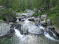
(2) Cross the stream and follow it upstream along the right bank. Just after the bridge, you’ll notice the former marker 423, which used to lead down to the Refuge Saladin and offered a view of the Peïrastrèche Waterfall a little further down; however, due to Storm Alex, the path is no longer passable. Continue following the stream upstream and, as you pass through the Vallon Sangué, note the still clearly visible signs of damage and the work being done to rebuild the paths following this tragic event. Continue in this way until you reach a junction at marker 425.

(3) Leave the GR®52 and turn right, still heading towards the Pas des Ladres (yellow markings). Cross the torrent via a footbridge and tackle the steepest part of the ascent towards Lac de Trécolpas.
After a climb that may be gruelling due to the heat, depending on the time of day, rejoin the GR®52 at marker 427.

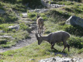
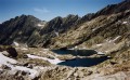
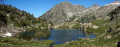
(4) Turn right onto the GR® and you’ll soon reach Lac de Trécolpas, where you may well spot chamois and come across young ibex and female ibex, which are strangely curious.
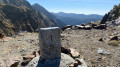
Walk past the lake to climb up to the Pas des Ladres, which you can make out at the top of a cliff face at the far end of the valley. The first part of the climb is fairly gentle and the final section is quite steep but not difficult thanks to a good, winding path.

(5) From this point, the rest of the ascent is mainly off-trail.
From the pass, head left, due north, to reach a small promontory offering a bird’s-eye view of Lac de Trécolpas. Follow the start of a path marked by a few cairns. Try to follow these cairns, sometimes through grass, sometimes over small scree slopes, until you reach a grassy ledge where you could easily imagine pitching a tent.

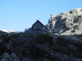
(6) A scree gully lies ahead. To avoid it, veer left to join the ridge overlooking the Combe de Trécolpas. Then follow the cairns which run diagonally across this scree slope. Still following the cairns, turn left towards what you think is the summit. You’ll reach a small stone shelter; pass through it to discover the final couloir, at the top of which you can see the summit cross, which you’ll need to go round to the left.

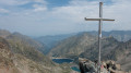
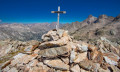
(7) Climb up this couloir with care (no difficulty, but the rocks are not always stable). Just before reaching the end of the couloir, which opens out onto the Italian side, climb up to the right via a few easy climbing moves to reach the summit and its cross, which faces the Gélas.

(8) Take a moment to enjoy the comfortable rocks on the summit and the 360° view, before descending via the same route back to the Vacherie du Boréon car park (S/E).


Waypoints

  1. S/E : mi 0 - alt. 5,515 ft - Vacherie du Boréon
  2. 1 : mi 0.17 - alt. 5,564 ft - Marker 421
  3. 2 : mi 0.91 - alt. 6,027 ft - Pont de Peïrastrèche
  4. 3 : mi 1.49 - alt. 6,322 ft - Waymark 425 - Boréon (torrent - Affluent de la Vésubie
  5. 4 : mi 2.02 - alt. 6,949 ft - Marker 427
  6. 5 : mi 2.98 - alt. 8,022 ft - Waymark 428 - Pas des Ladres
  7. 6 : mi 3.11 - alt. 8,196 ft - Grassy plateau
  8. 7 : mi 3.34 - alt. 8,553 ft - Final couloir
  9. 8 : mi 3.41 - alt. 8,648 ft - Cime Ouest de Fenestre
  10. S/E : mi 6.83 - alt. 5,515 ft - Vacherie du Boréon

Notes

The final section of the walk, starting from the Pas des Ladres (5), is mostly off-trail, with a few cairns to indicate the direction.
A good sense of direction and the GPX track may be useful to help you find your way.

There are a few easy, non-exposed climbing moves to reach the summit.

An early start is recommended to avoid the heat during the climb to Lac de Trécolpas.

This route passes through a protected area, which may be subject to special regulations:

Worth a visit

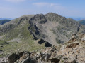
The summit offers a 360° view, with a particularly striking vista of the Gélas.

You may spot chamois and ibex.

Lac de Trécolpas is unique in that it has an island accessible on foot by wading through the water.

Always be cautious and plan ahead when you're outdoors. Visorando and the author of this route cannot be held responsible for any accidents occurring on this route.

The GR® and PR® markings are the intellectual property of the Fédération Française de Randonnée Pédestre.

Reviews and comments

4.6 / 5
Based on 3 reviews

Reliability of the description
5 / 5
Ease of following the route
4 / 5
Route interest
4.7 / 5
Danouche
Danouche

Overall rating : 4.3 / 5

Date of your route : Jun 23, 2026
Reliability of the description : ★★★★★ Very good
Ease of following the route : ★★★★☆ Good
Route interest : ★★★★☆ Good
Very busy route : No

A lovely walk; Lake Trecolpas is magnificent. The climb up to the Pas des Ladres was a bit steep, but the view from the top was splendid.

Machine-translated

User 26883650

Overall rating : 4.3 / 5

Date of your route : Aug 05, 2025
Reliability of the description : ★★★★★ Very good
Ease of following the route : ★★★☆☆ Average
Route interest : ★★★★★ Very good
Very busy route : Yes

Completed in August 2025, a beautiful hike, everything is straightforward until Pas de Ladres. The rest is off-trail, as clearly indicated in the description, with some difficulty finding the path to the summit. There are also a few fairly steep sections. The view from the summit is magnificent.

Machine-translated

Jiaime
Jiaime

Overall rating : 5 / 5

Date of your route : Jun 16, 2025
Reliability of the description : ★★★★★ Very good
Ease of following the route : ★★★★★ Very good
Route interest : ★★★★★ Very good
Very busy route : Yes

Beautiful hike, Lake Trecolpas still as beautiful as ever despite a drone and a dog (no respect for the park).
The climb to the Pas des Ladres pass was steep but not impossible, and the view of Fenestre and Trecolpas was superb.

Machine-translated

Other walks in the area

For more walks, use our search engine .

The GPS track and description are the property of this route's author. Please do not copy them without permission.