Merveilles Rest House – Merveilles Mountain Hut

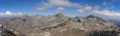
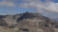
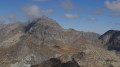
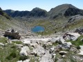
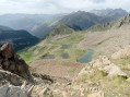
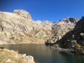
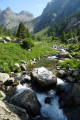
The aim of this fourth stage is to reach the Merveilles mountain refuge. The route is less well-travelled than the classic one via the Pas de l’Arpette. You’ll discover the Verrariers valley and the Pas du Trem. This small pass lies at the foot of the Cime du Diable, which you simply must climb. This magnificent viewpoint offers a 360° panorama of the Mercantour, as well as the Authion, the Col de Turini and all the way to the sea. You’ll then walk alongside the lakes of La Muta, Le Trem and Fourca.

This walk is part of a multi-day hike: Circular route in the Mercantour starting from Castérino

Details

1620211
Creation:
Last update:
Last review:
  • Walking
    Activity: Walking
  • ↔
    Distance: 5.68 mi
  • ◔
    Average duration: 5h 50 
  • ▲
    Difficulty: Difficult

  • ⚐
    Back to start: No
  • ↗
    Ascent: + 3,688 ft
  • ↘
    Descent: - 1,909 ft

  • ▲
    Highest point: 8,793 ft
  • ▼
    Lowest point: 5,135 ft

Photos

Description of the walk

(S) From the Merveilles mountain hut, head to the little bridge at Les Sagnes.
Cross the bridge over the Gordolasque, then take the path on the right until you reach a sign marking the entrance to the Mercantour National Park.

(1) Leave the wide path and take a small path through the woodland on the left. Climb gradually up the switchbacks to reach a clearing.

(2) Continue until you reach a junction with the ‘balcon’ path, which joins the Sentier de l’Arpette.

(3) Turn right; the path becomes less defined but is nevertheless well signposted. You’ll reach a ledge that opens out onto a wide valley.

(4) Make sure you stay in the Vallon des Verrairiers, which follows the bed of a dry torrent. Be careful: several paths branch off to the right and lead towards large scree slopes that will slow you down.

(5) The Pas du Trem is now clearly visible. Cross the scree, then continue along a path that becomes increasingly pleasant as you approach the Pas du Trem.

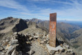
(6) Once you reach the Pas du Trem, the Cime du Diable is very close by. Follow a well-marked path to the right and reach the summit, where an exceptional panorama awaits you.

(7) Make your way back down at a leisurely pace to the Pas du Trem.

(6) Turn right and head east towards the Lacs du Diable below.

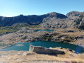
(8) At Lac du Diable, ignore the path on the right leading to L’Authion via the Pas du Diable; continue eastwards. Walk easily along theGR®52, skirting the Lacs de la Muta and du Trem.

(9) Then on to Lac Fourca.

(10) Arrive at Lac Long Supérieur and the Refuge des Merveilles (E).

Waypoints

  1. S : mi 0 - alt. 5,180 ft - Merveilles Inn6 Cross the - Gordolasque
  2. 1 : mi 0.15 - alt. 5,197 ft - Vallon des Verrariers Trail
  3. 2 : mi 0.86 - alt. 6,132 ft - Clearing
  4. 3 : mi 1.03 - alt. 6,243 ft - Balcony path joining the Arpette trail
  5. 4 : mi 1.69 - alt. 7,054 ft - Verrairiers Valley
  6. 5 : mi 2.62 - alt. 7,795 ft - Start of the scree slope
  7. 6 : mi 3.03 - alt. 8,127 ft - Pas du Trem (2480m)
  8. 7 : mi 3.41 - alt. 8,783 ft - Cile du Diable (2685m)
  9. 8 : mi 4.04 - alt. 7,907 ft - Lacs du Diable
  10. 9 : mi 4.74 - alt. 7,434 ft - Lake du Trem - Lac de la Muta
  11. 10 : mi 5.41 - alt. 7,106 ft - Lac Fourca
  12. E : mi 5.68 - alt. 6,959 ft - Refuge des Merveilles

Notes

This route passes through a protected area, which may be subject to special regulations:

Worth a visit

  • Trem Pass.
  • Cime du Diable.
  • Devil’s Lake.
  • Lake de la Muta.
  • Lake du Trem.
  • Fourca Lake.

Long Supérieur Lake

Always be cautious and plan ahead when you're outdoors. Visorando and the author of this route cannot be held responsible for any accidents occurring on this route.

The GR® and PR® markings are the intellectual property of the Fédération Française de Randonnée Pédestre.

Reviews and comments

4 / 5
Based on 2 reviews

Reliability of the description
4.5 / 5
Ease of following the route
3 / 5
Route interest
4.5 / 5
E2manue2le
E2manue2le

Overall rating : 4 / 5

Date of your route : Jun 22, 2026
Reliability of the description : ★★★★☆ Good
Ease of following the route : ★★★☆☆ Average
Route interest : ★★★★★ Very good
Very busy route : No

I completed this 5-day route starting from the Pont du Countet, following stage 4 of the guidebook.
I was travelling independently, so I carried all my gear on my back.
I really enjoyed this route, which is off the GR52 trail – wild and rarely, if ever, visited in June.
You need to have mountain experience, know how to use your hands, read a map, read the terrain and enjoy steep terrain.
The Mercantour is a technical area.
The elevation gain is concentrated over just a few kilometres, so it’s a real climb.

On Stage 1, with thunderstorms starting at 11am, I altered my route to reach the Refuge de Nice via the Baisse de Basto. I’d thought I’d find an easy path by taking the GR52 – far from it. There were sections across snowfields (which allowed me to make faster progress – I love that) and a technical descent.

Stage 2: I spent the night at Lac Long.
To reach the Gélas ridges, it’s a steep, grassy, stony slope. 400 m elevation gain over 1.5 km.
Be careful on the descent through the scree to reach Lac Blanc. Keep your eyes peeled for the cairns.

Stage 3: Climb up a scree slope to reach the Pas de Colomb, where there are snowfields.
The descent features some high steps.
Then the path winds along the Gordolasque. Magnificent.

Stage 4: The climb beneath the larch trees, alongside the river, is magical. Take care on the ‘Casse’ section. I left my rucksack at the Pas de Trem to climb the Cime du Diable.
Then I descended to the Refuge des Merveilles.

I took a walk through the Vallée des Merveilles in the afternoon, but you’re not allowed to leave the path.
Guides from the refuge lead guided tours off the GR52 trail. This is surely the best way to get all the information you need.

Stage 5: the climb up Mont Bégo is steep and beautiful. Follow the cairns carefully to avoid having to traverse the ridges without a rope. You’ll need to use your hands towards the end and also on the descent.
Please note that the GPX track differs from the single path. Then the route winds its way along the lakes…

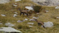
It’s absolutely stunning. This route is varied. I saw ibex, chamois and marmots up close, and heard a black grouse.

You’ve got to love routes off the beaten track.
I loved it

Machine-translated

Blueoliver
Blueoliver

Overall rating : 4 / 5

Date of your route : Sep 23, 2024
Reliability of the description : ★★★★★ Very good
Ease of following the route : ★★★☆☆ Average
Route interest : ★★★★☆ Good
Very busy route : No

A lovely, quiet route into the Valley of Wonders

Machine-translated

Other walks in the area

For more walks, use our search engine .

The GPS track and description are the property of this route's author. Please do not copy them without permission.