From the Calmette ridge to the barns at Suorcas, a circular route.

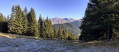
If you enjoy walks in the forest, this one is for you. This route, which runs mainly through a forest of larch, pine and spruce trees, starts at the legendary Col de Turini and takes you, via the Calmette ridge and then the Baisse de Patronel, to the Granges de Suorcas. The return journey is via the Piste de Tardei.

Details

53164456
Creation:
Last update:
Last review:
  • Walking
    Activity: Walking
  • ↔
    Distance: 9.43 mi
  • ◔
    Average duration: 6h 35 
  • ▲
    Difficulty: Moderate

  • ⚐
    Back to start: Yes
  • ↗
    Ascent: + 2,543 ft
  • ↘
    Descent: - 2,516 ft

  • ▲
    Highest point: 5,846 ft
  • ▼
    Lowest point: 4,416 ft

Photos

Description of the walk

Head straight to the Col de Turini, where there are plenty of parking spaces available.

(S/E) Join the D2566 and marker 184. Follow the track to the left to reach marker 32.

(1) Take the path on the right which climbs due south through the forest to reach the ridge. Turn west along the path, following the ridge, then take a short detour to the left to reach the Cime de la Calmette.

(2) From here, you can enjoy the panoramic view, which stretches from the Mercantour peaks to the Grasse Pre-Alps, and on a clear day, you can often see as far as Corsica. Retrace your steps and rejoin the path on the left. This runs through the middle of the old Calmette ski run to reach marker 183, where it joins theGR® 52A. Continue to the left to reach marker 182.

(3) Continue due south on theGR®52Ato reach the Baisse de Patronel at marker 181. Follow the track, keeping in the same direction, until you reach marker 34.

(4) Leave the track and take the path that climbs to the right for about a hundred metres to reach a plateau. From there, turn right towards the south-west, leaving theGR®, to reach marker 180.

(5) Turn right to join the M2566 at marker 173. Turn right again and follow the road carefully for about 200 m to reach marker 178.

(6) Take the path leading down to the left to join the Granges de la Maïris track at a hairpin bend. Continue left along this track until the next hairpin bend to reach marker 177.

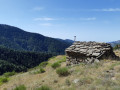
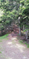
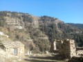
(7) Leave the track and take the path on the right, heading north-east, which descends towards the Maïris valley: from this point onwards, numerous trees felled by recent storms litter the path as far as the Piste de Tardei, but these obstacles are easily negotiated. After crossing the valley, the path climbs again then levels out along the mountainside, before reaching the Granges de Suorcas.

(8) After the barns, the path climbs through drier terrain, lined with flat stones. You’ll reach the Baisse de Suorcas at marker 192.

.(9) Continue straight on along the ridge to reach the Cime de Suorcas, where the panoramic view from the summit is breathtaking.

(10) Retrace your steps.

(9) Take the path on the left which descends into the forest towards the Piste de Tardei; you’ll reach it at marker 191, where it joins theGR®52A.

(11) Turn right and head up the Piste de Tardei.

(12) Keep to the right on theGR® to reach the Col de Turini and the D2566 at marker 195. Turn left to return to the car park (S/E).

Waypoints

  1. S/E : mi 0 - alt. 5,262 ft - Car park - Col de Turini (1604m)
  2. 1 : mi 0.2 - alt. 5,361 ft - Marker 32
  3. 2 : mi 0.97 - alt. 5,804 ft - Cime de la Calmette (1773m)
  4. 3 : mi 1.54 - alt. 5,630 ft - Marker 182
  5. 4 : mi 2.44 - alt. 5,269 ft - Marker 34
  6. 5 : mi 3.2 - alt. 5,167 ft - Marker 180
  7. 6 : mi 3.72 - alt. 4,928 ft - Marker 178
  8. 7 : mi 4.5 - alt. 4,600 ft - Marker 177
  9. 8 : mi 5.61 - alt. 4,593 ft - Suorcas barns
  10. 9 : mi 5.95 - alt. 4,728 ft - Descent to Suorcas. Marker 192. Return to the viewpoint
  11. 10 : mi 6.15 - alt. 4,941 ft - Cime de Suorcas (1517m)
  12. 11 : mi 7.19 - alt. 4,455 ft - Tardei Track
  13. 12 : mi 7.76 - alt. 4,656 ft - Three-Way Junction
  14. S/E : mi 9.43 - alt. 5,262 ft - Col de Turini car park

Notes

Apart from the restaurants at the Col de Turini, where you can have a meal, there are no drinking water points on this route.

Worth a visit

From the Col de Turini, you can reach the Camp d’Argent, where Napoleon’s troops camped during the Italian Campaign, as well as the Authion massif, famous for its Séré de Rivière and Maginot-style fortifications.

Always be cautious and plan ahead when you're outdoors. Visorando and the author of this route cannot be held responsible for any accidents occurring on this route.

The GR® and PR® markings are the intellectual property of the Fédération Française de Randonnée Pédestre.

Reviews and comments

4.6 / 5
Based on 3 reviews

Reliability of the description
4.7 / 5
Ease of following the route
4.7 / 5
Route interest
4.3 / 5
User 10778203

Overall rating : 5 / 5

Date of your route : Jun 10, 2025
Reliability of the description : ★★★★★ Very good
Ease of following the route : ★★★★★ Very good
Route interest : ★★★★★ Very good
Very busy route : No

Follow the Visorando trail carefully, otherwise there are no particular difficulties. A superb hike through woods and meadows with magnificent views. Passes from north to south slopes, offering different panoramas and vegetation. The numerous fallen trees between points 7 and 10 are still there but do not obstruct the path and are not difficult to cross.

Machine-translated

Roby06
Roby06

Thank you for your understanding, but unfortunately the forest rangers have been overwhelmed since Storm Alex, and this path won’t be cleared any time soon.

Machine-translated

Perseepj
Perseepj

Overall rating : 4.7 / 5

Date of your route : Sep 10, 2024
Reliability of the description : ★★★★★ Very good
Ease of following the route : ★★★★★ Very good
Route interest : ★★★★☆ Good
Very busy route : No

A lovely walk with no particular difficulties, apart from the climb to the Cime du Suorcas, which is quite steep towards the end. What’s more, in my opinion, only three or four people can fit at the summit at the same time. But in any case, the climb to the summit is a must!
I also really enjoyed the walk through the dark coniferous forest up to point 7, with the contrast of the rest of the path being very dry and exposed to full sun.
There are still plenty of large trees lying across the path from point 9 onwards.

Machine-translated

Orson
Orson

Overall rating : 4 / 5

Date of your route : Jul 11, 2024
Reliability of the description : ★★★★☆ Good
Ease of following the route : ★★★★☆ Good
Route interest : ★★★★☆ Good
Very busy route : No

A pleasant walk, particularly during the first part of the route up to the summit of Suorcas. The return journey is somewhat tedious, featuring in particular 3 km of monotonous track.

A few additional details to the description:

  • at point 7, there are two signposts marked 177; one is clearly visible on the track, whilst the other, which indicates the path towards the Maïris valley, is a few metres off the track at the hairpin bend, hidden by vegetation;
  • there are numerous fallen trees, many of which slow you down, not only after point 7, but also after point 9 right up to the Tardei track

Machine-translated

Other walks in the area

For more walks, use our search engine .

The GPS track and description are the property of this route's author. Please do not copy them without permission.