


 Country:

 City:
City:


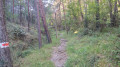
From Lantosque, take the D73 towards Saint-Colomban. The walk begins at the edge of the hamlet. Park in the hamlet after turning round at the turning point.
(S/E) From the hamlet, continue along the ascending road to marker 165 (740 m).
(1) Turn right onto the path leading down into the valley to reach Gourblaou. As you leave the hamlet, turn right onto the path that climbs through the pine trees to La Baisse de Béasse.
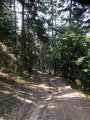
(2) Turn left at the cross to begin the steep but splendid climb up the north-facing slope of the Forêt de la Maïris.
(3) At the end of the steepest section, a path on the right offers a chance to take a break whilst enjoying a lovely view of Peïra Cava. Return to the original path to soon reach the Granges du Lac plateau at marker 172.
(4) Follow the path on the right to the former Peïra Cava ski resort. Then continue straight on until you reach the road at marker 36.
(5) Take the small tarmac road opposite. At the bend, turn right, then, at the next junction, turn left onto a road. At the end of this road, follow the path leading to the summit of Peïra Cava (1,581 m) and enjoy the panoramic views.
(6) Take the panoramic ridge on the left to reach the Baisse de Peïra Cava at marker 179.
(7) Continue straight on towards the Malpertus Cave until you reach a junction marked with signpost 180.
(8) To the right, below the path, lies the Grotte de Malpertus, which is a little difficult to find. Back at the marker, head towards “Forêt de la Maïris” by continuing straight on and join the departmental road at marker 173.
(9) Cross the road to enter the deep Maïris Forest. This descent features numerous hairpin bends before joining a forest track (marker 174). Cut across this track and continue to the junction at the bottom of the valley.
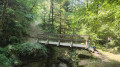
(10) Carry on to the left until you reach a footbridge and marker 176.
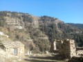
(11) Cross the footbridge and take the track on the left to the hamlet of Camari.
(12) After a stop at the hamlet’s fountain, continue along the now tarmac-surfaced road to the starting point (S/E).

 Visorando Member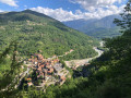

 Moderate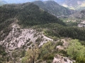

 Very difficult
