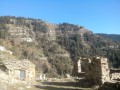
The ruins of the hamlet of L’Avenquet

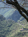
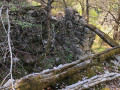
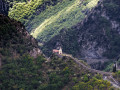
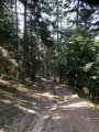
A lovely little, quiet forest walk. The ruins of the hamlet of L’Avenquet bear witness to a bygone era of traditional farming. A few steep banks and wooded paths lined with spruce trees in the Bouissièra forest will delight nature lovers.

Details

48319600
Creation:
Last update:
Last review:
  • Walking
    Activity: Walking
  • ↔
    Distance: 3.37 mi
  • ◔
    Average duration: 3h 05 
  • ▲
    Difficulty: Moderate

  • ⚐
    Back to start: Yes
  • ↗
    Ascent: + 1,732 ft
  • ↘
    Descent: - 1,722 ft

  • ▲
    Highest point: 4,003 ft
  • ▼
    Lowest point: 2,388 ft

Photos

Description of the walk

Park next to the Saint-Sébastien chapel. If there are no spaces available, park nearby or in the village of Moulinet and walk back to this chapel, which is the starting point.

(S/E) Take the path in front of the chapel. You will immediately enter the Mercantour National Park, marked by the tricolour flag, a small yellow arrow and a ‘Via Alpina’ sign. Follow the concrete path down for a few metres; it then becomes a paved slanting street. Continue to marker 21.

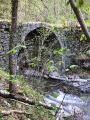
(1) Continue straight ahead towards L’Avenquet. Follow the beautiful Gouargas valley and arrive at the stone bridge over the river.

(2) Cross it, then turn right. Follow the direction indicated on the signpost for Lou Camin de Firpou; this path is marked in yellow. Pass through the ruins of L’Avenquet, then reach a junction of paths.

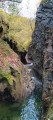
(3) Leave Lou Camin de Firpou and turn right to reach a river.

(4) Cross the river, then enter the Bouissièra Forest. Follow an easy descent to reach the junction marked ‘24’.

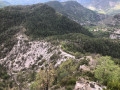
(5) Turn right, towards Moulinet. This single descending path, which occasionally winds, takes you back to the start of this walk. On the left, on several occasions, there are views of ‘the Great Wall of the 06’.

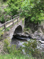
(6) You’ll reach the bridge over the River Gouargas. Cross it and you’ll immediately come back to the original junction.

(1) Turn left and follow the route back in the opposite direction to return to the car park at the Chapelle Saint-Sébastien (S/E).


Waypoints

  1. S/E : mi 0 - alt. 2,405 ft - Car park at the - Chapelle Saint-Sébastien (Moulinet)
  2. 1 : mi 0.17 - alt. 2,470 ft - Junction of the circular loop – Marker 21
  3. 2 : mi 0.49 - alt. 2,556 ft - Bridge over the river
  4. 3 : mi 1.17 - alt. 3,734 ft - End of Lou camin de Firpou
  5. 4 : mi 1.57 - alt. 3,907 ft - Bouissièra Forest
  6. 5 : mi 2.1 - alt. 3,822 ft - Marker 24
  7. 6 : mi 3.16 - alt. 2,533 ft - Bridge over the river
  8. S/E : mi 3.37 - alt. 2,398 ft - Chapelle Saint-Sébastien car park (Moulinet) - Bévéra (rivière)

Notes

Please note: this walk in the Mercantour National Park requires you to comply with the regulations displayed at the park entrance.
There are no water sources on the route, but you will cross two rivers.
Make sure you have good walking shoes; walking poles are useful for both the descent and the ascent.
On the way back, at point (6), in summer, there is access to the left of the bridge for a refreshing swim.

This route passes through a protected area, which may be subject to special regulations:

Worth a visit

Stop off at Notre-Dame de Menour, situated on the road between Sospel and Moulinet, also known as “the Great Wall of China of the 06”.

Reviews and comments

4.7 / 5
Based on 2 reviews

Reliability of the description
4.5 / 5
Ease of following the route
5 / 5
Route interest
4.5 / 5
bernard bb
bernard bb

Thank you for this review, dear Charlotte – that says it all :-)
Have a lovely summer; kind regards, b.

Machine-translated

Charlotte.S
Charlotte.S

Overall rating : 5 / 5

Date of your route : Jul 13, 2024
Reliability of the description : ★★★★★ Very good
Ease of following the route : ★★★★★ Very good
Route interest : ★★★★★ Very good
Very busy route : No

A lovely walk, mostly in the shade, which is a real bonus in July! This year, the vegetation is still lush and there’s water in the streams. The wild lavender is in bloom and the butterflies love it. A real treat, with no difficulties.

Machine-translated

bernard bb
bernard bb

Thank you, Jojo, for this information and your interesting opinion
Best wishes, Rando B.

Machine-translated

Jojo06300
Jojo06300

Overall rating : 4.3 / 5

Date of your route : Jun 17, 2024
Reliability of the description : ★★★★☆ Good
Ease of following the route : ★★★★★ Very good
Route interest : ★★★★☆ Good
Very busy route : No

Difficulty finding a parking space in the vicinity of St Sebastian’s Chapel

Machine-translated

Other walks in the area

For more walks, use our search engine .

The GPS track and description are the property of this route's author. Please do not copy them without permission.