Country:

 City:
City:


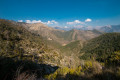
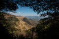
The walk starts at Pélasque in the Vésubie Valley. Between Saint-Jean-la-Rivière and Lantosque, you’ll come across a restaurant on your right, then a road on the left heading towards Le Figuaret / Pélasque. Take this road and head gently uphill towards Pélasque until you reach a junction where you’ll need to turn left again into a cul-de-sac. Park right at the end near marker 142 and the Ancien Hôtel Auda; there’s space for several vehicles.
Note: generally speaking, throughout the entire route, my GPS pinpointed my location several times just a few metres off the IGN map route, particularly along much of the climb from the Cangelard valley to the summit of the Cime de l’Authion.
(S/E) Head due north to marker 142. Take the path on the left heading north-west. Continue along the small stream until you reach the junction at marker 143.
(1) Turn left, heading towards Les Barmes and the Col de l’Authion. You’ll reach the junction at the Saint-André Chapel.
(2) Turn slightly left to reach this chapel.
(3) Return to the previous junction.
(2) Here you’ll come to a junction that is neither marked on the IGN map nor signposted along the path. Take the path on the left which descends towards the river. Cross the culvert and, a little further on, you’ll come to another junction not marked on the map. Head down again to the left towards the river at the bottom of the valley and leave the path and the culvert on your right. You’ll come to a small bridge spanning the Cangelard valley.
(4) Cross the valley via this bridge to begin the long climb to the summit of the Authion. A few metres further on, you’ll reach a fork in the path.
(5) Continue the ascent to the left, heading west, to reach the hamlet of Les Barmes.
See the recommendations in the ‘Practical Information’ section.
(6) Continue north, following the scattered trail markers along the route; be very careful and observant to spot them. You’ll emerge into an area where the vegetation thins out.
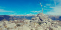
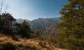
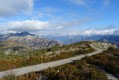
(7) From here, the path becomes much easier to follow, especially as the Cime de l’Authion is now clearly visible ahead. Be careful, though, as a few sections will still require you to use your hands. Reach the Cime de l’Authion, marked by a small cairn with a Red Cross.
(8) Begin the descent down the other side of the ridge; you’ll reach the Col de l’Authion fairly quickly.
(9) Begin a very gentle climb to reach marker 146.
(10) Head towards Les Granges de la Brasque until you reach the Manouinas track.
(11) Just past a small hut on your right, you’ll come to an unsigned bend in the track; head up to the right here, where the climb steepens slightly until you reach marker 145.
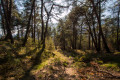
(12) Turn left, still heading towards Les Granges de la Brasque. You’ll find yourself back in the heart of the forest, and the path climbs a bit more steeply through the conifers. Pass Plan d’Utelle and its few barns to rejoin the track before turning left. You’ll pass a water tank on your right and a fountain (water marked as undrinkable), then another barn, which you’ll go round to reach the picnic area. Here you’ll find theGR®5.
(13) Take it to the right, going round the barn, then climb gently up to Les Granges de la Brasque. Stay on the track and pass the old military buildings until you reach marker 149.
(14) Leave theGR®5here and turn right, following the sign for Pélasque as indicated on the marker. Head down this very easy-to-follow path; the direction to Pélasque is signposted at every junction. You’ll reach marker 150.
(15) Continue straight ahead, south-east towards Pélasque, until you reach marker 135.
(16) Take the path on the right to quickly reach marker 136, another junction.
(17) Stay on the path on the right again; the direction changes to due south. Further on, you’ll reach the ruins of Rastuna at marker 138.
(18) Continue along the path on the right, heading towards Pélasque. You’ll reach a junction with a road.
(19) Keep heading due south, cutting across the hairpin bends of the road. Pass through the hamlet of Coupas at marker 137. Now follow the sign for Ancien Hôtel Auda, heading down to the left. The path leaves the road one last time to enter the forest; push open the gate and walk down through the trees to reach the car park (S/E).

 : the signposting has recently been renewed between points 5 and 8.
 Visorando Member
 Difficult
 Association / Club / Walk leader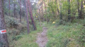
 Moderate