


Refine your search for walks in Cime de Castel Vieil (1306 m)
Cime de Castel Vieil (1306 m) walks


 The summit of Castel Vieil from Roquebillière
 Visorando Member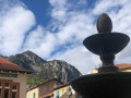
 6.38 mi
 +2,785 ft
 -2,759 ft
 5h 20
5h 20
 Difficult
 Departure from Roquebillière (Alpes-Maritimes)
A very beautiful hike offering stunning views of the Vésubie Valley. The imposing Villette ridge overlooks the return trail. The route between points (8) and (9) bears witness to an ancestral agricultural past.
Walks near Cime de Castel Vieil (1306 m)
Saint-Martin-de-Vésubie - Saint-Dalmas de Valdeblore
 4.01 mi
+1,821 ft
-732 ft
3h 25
4.01 mi
+1,821 ft
-732 ft
3h 25
 Moderate
Departure from Saint-Martin-Vésubie (Alpes-Maritimes)
Moderate
Departure from Saint-Martin-Vésubie (Alpes-Maritimes)
The GR®52 starts in Saint-Dalmas de Valdeblore. This first stage is a transition to reach the starting point of the GR®.This is a lovely hike that passes through the small resort of La Colmiane and offers a relatively easy climb, following the GR®52 A through the woods for just over 6km.
Mercantour route via the GR®52
 65.54 mi
+21,585 ft
-24,639 ft
7 days
65.54 mi
+21,585 ft
-24,639 ft
7 days
 Very difficult
Departure from Saint-Martin-Vésubie (Alpes-Maritimes)
Very difficult
Departure from Saint-Martin-Vésubie (Alpes-Maritimes)
TheGR® 52 is a route that crosses the Mercantour National Park, through the Alpes-Maritimes from Saint-Dalmas-de-Valdeblore to Menton.
ThisGR® route is very challenging due to the varied terrain and significant elevation changes.
You’ll reach altitudes of up to 2,700m, where you can admire the high-mountain landscapes, flora and fauna. Then, in the second half of the route, you’ll encounter panoramas that are more southern in character but just as extraordinary.
From Saint-Dalmas to Utelle
 15.80 mi
+4,124 ft
-5,745 ft
10h 50
Difficult
Departure from Valdeblore (Alpes-Maritimes)
15.80 mi
+4,124 ft
-5,745 ft
10h 50
Difficult
Departure from Valdeblore (Alpes-Maritimes)
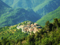
This twentieth stage marks the end of the crossing of the Mercantour Massif. From Saint-Dalmas, the GR®5 heads south to climb the steep slope towards the Cime de Colmiane, which it bypasses by heading for the Col du Varaire. It crosses the Bois Noir and reaches the Col des Deux Caïres, then the Caïre Gros. The route follows its ridge and, hugging the hillside, passes beneath Mont Chalancha, La Partissuola and the Cime de la Combe before descending to the small pass of Trous. Before the Col du Fort, the path descends to the Granges de la Brasque, crosses the upper part of the Riou du Figaret valley and arrives at the Col d’Andrion. Cutting across the hairpin bends of the M33, the GR®5 reaches the Col des Fournès and the Col de Gratteloup. Through rocky gaps, it runs alongside the Petit Brec d’Utelle and then the Brec d’Utelle. From there, the path descends towards the Crête de l’Albaréa and reaches the Col du Castel Ginesté. It crosses the slope below the ridges of the Têtes du Sac de Bécasse, Parabosquet and Les Pennes to reach the Utelle community lodge.
Saint-Dalmas de Valdeblore - Utelle
15.74 mi
+4,354 ft
-5,919 ft
11h 00
Difficult
Departure from Valdeblore (Alpes-Maritimes)
Étape de la traversée des Alpes de Saint-Dalmas de Valdeblore jusqu'à Utelle. Randonnée sur une ligne de crête offrant des panoramas extraordinaires sur l'arrière pays niçois.
Saint-Dalmas de Valdeblore – Le Boréon
 12.91 mi
+4,491 ft
-3,720 ft
10 hrs
Very difficult
Departure from Valdeblore (Alpes-Maritimes)
12.91 mi
+4,491 ft
-3,720 ft
10 hrs
Very difficult
Departure from Valdeblore (Alpes-Maritimes)
Second stage of the route and first stage on theGR®52. A long 21km stage taking in the Col de Veillos, numerous lakes, the Col du Barn, the Vacherie du Collet and the Col de Salèse, ending at a place called Le Boréon.
A spectacular stage thanks to its landscapes and views, but very difficult.
Merveilles Rest House – Merveilles Mountain Hut
 5.68 mi
+3,688 ft
-1,909 ft
5h 50
Difficult
Departure from Belvédère (Alpes-Maritimes)
5.68 mi
+3,688 ft
-1,909 ft
5h 50
Difficult
Departure from Belvédère (Alpes-Maritimes)
The aim of this fourth stage is to reach the Merveilles mountain refuge. The route is less well-travelled than the classic one via the Pas de l’Arpette. You’ll discover the Verrariers valley and the Pas du Trem. This small pass lies at the foot of the Cime du Diable, which you simply must climb. This magnificent viewpoint offers a 360° panorama of the Mercantour, as well as the Authion, the Col de Turini and all the way to the sea. You’ll then walk alongside the lakes of La Muta, Le Trem and Fourca.
Madone de Fenestre Mountain Hut – Relais des Merveilles
 6.64 mi
+2,280 ft
-3,343 ft
5h 00
Difficult
Departure from Saint-Martin-Vésubie (Alpes-Maritimes)
6.64 mi
+2,280 ft
-3,343 ft
5h 00
Difficult
Departure from Saint-Martin-Vésubie (Alpes-Maritimes)
This third stage is less demanding than the previous two. The entire route follows a marked path.
Only the start of the descent from the Pas du Mont Colomb and the sections over scree require a little care. This is the classic route linking the Madone de Fenestre valley with the Gordolasque valley. The scenery along the way is magnificent, and the Pas du Mont Colomb offers two completely different views from its eastern and western sides.
Madone de Fenestre refuge - Pont du Countet
7.75 mi
+2,812 ft
-3,642 ft
6h 00
Difficult
Departure from Saint-Martin-Vésubie (Alpes-Maritimes)
Route linking the Vésubie and Gordolasque valleys.
Boréon – Cougourde Mountain Hut
 5.37 mi
+2,559 ft
-472 ft
4h 40
Moderate
Departure from Saint-Martin-Vésubie (Alpes-Maritimes)
5.37 mi
+2,559 ft
-472 ft
4h 40
Moderate
Departure from Saint-Martin-Vésubie (Alpes-Maritimes)
This first stage largely follows theGR®52. It takes you through wooded countryside and offers a relaxing break by the peaceful Lac de Trécolpas. From the Cougourde Mountain Hut, you’ll enjoy superb views of this majestic, pumpkin-shaped peak.
Editor’s note added on 26/07/2021: A section is closed due to bad weather. See the notices for an alternative route
La Baisse de Camp d'Argent – Sospel
 13.53 mi
+1,670 ft
-6,289 ft
10 hrs
Very difficult
Departure from La Bollène-Vésubie (Alpes-Maritimes)
13.53 mi
+1,670 ft
-6,289 ft
10 hrs
Very difficult
Departure from La Bollène-Vésubie (Alpes-Maritimes)
The sixth stage ofthe GR®52, where the landscapes change dramatically. Due to its length and significant descent of nearly 2,000 metres, the stage is very difficult. The descent to Sospel, which makes up two-thirds of the route, puts a real strain on the knees and ankles. Please note, it gets very hot in summer on this section.