Circular walk around the Vallon and the Baisse de Peïra Cava

We were charmed by this pleasant walk because of its shaded nature.
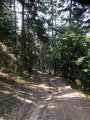
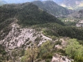
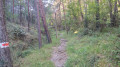
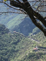
Indeed, the path winds its way mostly under the shelter of the trees, allowing you to enjoy the pleasant woodland setting. The view is rarely unobstructed, but the route offers a rich variety of flora and geological features.
The path is very even and gradually ascending: except on the return leg, where the climb is concentrated in a series of short hairpin bends, though these are shaded, making the effort quite manageable. The walk is well worth the detour

Details

10326472
Creation:
Last update:
Last review:
  • Walking
    Activity: Walking
  • ↔
    Distance: 8.44 mi
  • ◔
    Average duration: 6h 40 
  • ▲
    Difficulty: Difficult

  • ⚐
    Back to start: Yes
  • ↗
    Ascent: + 3,235 ft
  • ↘
    Descent: - 3,212 ft

  • ▲
    Highest point: 5,348 ft
  • ▼
    Lowest point: 2,552 ft

Description of the walk

Park at the Bécas–Peïra Cava link track, the start of the DFCI path, on the M2566 road.

(S/E) Take the DFCI track, go through the barrier and head for marker 179 at the Baisse de Païra Cava.

(1) Leave the DFCI track here and take the path on the left towards the Grotte de Malpertuis. At marker 180, take the path opposite and leave the trail on your left. Continue to the junction at marker 34, where you’ll rejoin theGR®52A.

(2) Turn right onto it, follow the red and white markings, pass two hairpin bends and begin a long descent. You’ll reach the hamlet of Le Castelet.

(3) Turn right, staying on theGR®, and head for the village of Le Moulinet; walk through it to reach the junction marked with signpost 10.

(4) Begin the climb, cross the Vallon de Peïra Cava stream, and continue uphill to reach the junction marked with signpost 2.

(5) Leave theGR® here and turn right onto the track, which follows a wide circular route, to reach marker 8 at a new junction in the hamlet of Canabieras.

(6) Before a small bridge, take the path on the left towards Peïra Cava. Continue uphill to reach the junction marked with signpost 7.

(7) Keep to the path on the right and, continuing uphill, after a few hairpin bends, reach the junction marked with signpost 6. Here, rejoin the DFCI track.

(8) Turn right onto it and follow it until you reach the original junction.

(1) Cross the track to the opposite side to quickly reach the M2566 car park (S/E).

Waypoints

  1. S/E : mi 0 - alt. 4,859 ft - M2566 car park
  2. 1 : mi 0.12 - alt. 4,921 ft - Descent from Païra Cava
  3. 2 : mi 1.22 - alt. 5,285 ft - Marker 34
  4. 3 : mi 3.83 - alt. 2,979 ft - Le Castelet
  5. 4 : mi 4.34 - alt. 2,585 ft - Marker 10
  6. 5 : mi 4.86 - alt. 3,041 ft - Waymark 2
  7. 6 : mi 5.34 - alt. 2,884 ft - Marker 8
  8. 7 : mi 6.11 - alt. 3,383 ft - Marker 7
  9. 8 : mi 7.02 - alt. 4,386 ft - Marker 6
  10. S/E : mi 8.44 - alt. 4,859 ft - M2566 car park

Notes

You can park not far from the stated starting point, or further up the route, at the car park alongside the road, just past the adventure park.
You can top up your water supplies in Moulinet, a pretty village. (There is a restaurant.)
The walk can also start from Moulinet, where parking is also easy

Worth a visit

(4) Places to visit in Moulinet
You can cool off on the way out of Moulinet or in the Peïra Cava valley.

Always be cautious and plan ahead when you're outdoors. Visorando and the author of this route cannot be held responsible for any accidents occurring on this route.

The GR® and PR® markings are the intellectual property of the Fédération Française de Randonnée Pédestre.

Reviews and comments

4.8 / 5
Based on 2 reviews

Reliability of the description
5 / 5
Ease of following the route
5 / 5
Route interest
4.5 / 5
steph06000
steph06000

Overall rating : 5 / 5

Date of your route : Oct 07, 2024
Reliability of the description : ★★★★★ Very good
Ease of following the route : ★★★★★ Very good
Route interest : ★★★★★ Very good
Very busy route : No

A fantastic hike in the Esterel. Stunning views all along the route – and don’t hesitate to set off from the Col Thayar to complete the hike by taking the Notre-Dame-d’Afrique circular route and heading down to L’Aiguille beach.

Machine-translated

Perseepj
Perseepj

Overall rating : 4.7 / 5

Date of your route : Aug 10, 2021
Reliability of the description : ★★★★★ Very good
Ease of following the route : ★★★★★ Very good
Route interest : ★★★★☆ Good
Very busy route : Yes

The description of the walk accurately reflects the route.
The descent to Moulinet may seem long to some, but it isn’t very difficult. The vast majority of the descent is along a path covered in leaves, which is easy on the legs.
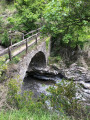
Moulinet is a lovely place to visit. In my view, the best spots for a long break are near the bridge at waypoint 6 (marker 8).
As for parking, I parked in front of ‘Peira-cava Adventure’ and started at marker 35 to reach checkpoint 1 (marker 179).

Machine-translated

Other walks in the area

For more walks, use our search engine .

The GPS track and description are the property of this route's author. Please do not copy them without permission.