Boréon – Cougourde Mountain Hut

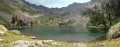
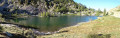
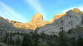
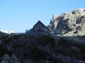
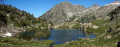
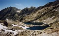
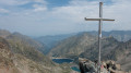
This first stage largely follows theGR®52. It takes you through wooded countryside and offers a relaxing break by the peaceful Lac de Trécolpas. From the Cougourde Mountain Hut, you’ll enjoy superb views of this majestic, pumpkin-shaped peak.
Editor’s note added on 26/07/2021: A section is closed due to bad weather. See the notices for an alternative route

This walk is part of a multi-day hike: Du Boréon au pied de l'Argentera

Details

3148922
Creation:
Last update:
Last review:
  • Walking
    Activity: Walking
  • ↔
    Distance: 5.37 mi
  • ◔
    Average duration: 4h 40 
  • ▲
    Difficulty: Moderate

  • ⚐
    Back to start: No
  • ↗
    Ascent: + 2,559 ft
  • ↘
    Descent: - 472 ft

  • ▲
    Highest point: 7,083 ft
  • ▼
    Lowest point: 4,846 ft

Photos

Description of the walk

This three-day route starts at Le Boréon (Saint-Martin-Vésubie). Long-stay parking is available just past the lake, near the Boréon visitor centre.

(S) From the car park, follow the Boréon along its left bank until you reach the first bridge over the stream.

(1) Turn left towards La Vacherie de Salèse (signposted). Walk for about 250 m heading west and join theGR®52at the first junction.

(2) Now follow theGR®52Anorth-eastwards. Pass the Lodge du Boréon and marker 371, then continue to marker 377.

(3) Leave the Chemin du Vallon des Erps on your left and stay on theGR®52, turning south. Pass marker posts 379 and 380 to reach the Refuge Saladin (private).

(4) Continue south on theGR®52until you cross the road leading to the Vacherie du Boréon.

(5) At the junction, turn left, heading due east, and, still on theGR®52, climb gradually northwards to reach the Peïrastrèche Bridge.

(6) Cross the Boréon and stay on theGR®52until you reach the Gias de Peïrastrèche.

(7) Leave the direct path to the Refuge de Cougourde on your left. Head for Lac de Trécolpas. Leave the right bank of the Boréon via a small bridge at marker 425. At marker 427, start looking for a suitable spot for a lunch break by the lake.

(8) From the lake, retrace your steps back to marker 427. Turn off northwards and follow the path leading to the Refuge de Cougourde (E).

Waypoints

  1. S : mi 0 - alt. 4,846 ft - Le Boréon
  2. 1 : mi 0.09 - alt. 4,892 ft - Road to the Salèse dairy farm
  3. 2 : mi 0.26 - alt. 4,967 ft - GR52 junction
  4. 3 : mi 0.64 - alt. 5,358 ft - Junction with the Vallon de L’Erps
  5. 4 : mi 1.89 - alt. 5,397 ft - Saladin Private Mountain Hut
  6. 5 : mi 2.15 - alt. 5,564 ft - Junction of the GR52 and the Route de la Vacherie du Boréon
  7. 6 : mi 2.9 - alt. 6,027 ft - Peïrastrèche Bridge
  8. 7 : mi 3.52 - alt. 6,322 ft - Gias de Peïrastrèche
  9. 8 : mi 4.31 - alt. 7,054 ft - Lac de Trécolpas
  10. E : mi 5.37 - alt. 6,955 ft - Refuge de Cougourde

Notes

This route passes through a protected area, which may be subject to special regulations:

Worth a visit

- Le Boréon.
- Lake Trécolpas.
- Pas des Ladres.
- Col de Fenestre.
- La Cougourde
- Lac des peatlands

Always be cautious and plan ahead when you're outdoors. Visorando and the author of this route cannot be held responsible for any accidents occurring on this route.

The GR® and PR® markings are the intellectual property of the Fédération Française de Randonnée Pédestre.

Reviews and comments

4.7 / 5
Based on 2 reviews

Reliability of the description
5 / 5
Ease of following the route
4 / 5
Route interest
5 / 5
Faby26
Faby26

Overall rating : 5 / 5

Date of your route : Sep 14, 2023
Reliability of the description : ★★★★★ Very good
Ease of following the route : ★★★★★ Very good
Route interest : ★★★★★ Very good
Very busy route : Yes

A lovely walk through woodland and mountain scenery. We stopped at the mountain hut to enjoy omelettes and blueberry tarts; we received a warm welcome (make sure to bring a warm jumper depending on the weather). We continued on to Lake Trécolpas, where we were lucky enough to come across a herd of about fifteen chamois. You need to be careful on certain sections, but it’s a magnificent walk.

Machine-translated

henrigole
henrigole

Hello,
Thank you for this information.
Unfortunately, Storm Alex caused a great deal of damage and, as a result, some trails in the Vésubie and Roya valleys are still closed. Repair work will be carried out throughout the summer. You can follow the progress on this page. Trail conditions

Enjoy your hikes in the Mercantour.
Kind regards,
Dominique

Machine-translated

archimome
archimome

Overall rating : 4.3 / 5

Date of your route : Jul 26, 2021
Reliability of the description : ★★★★★ Very good
Ease of following the route : ★★★☆☆ Average
Route interest : ★★★★★ Very good
Very busy route : Yes

Hello,
The trail is closed from the Boréon car park to around point 5 following Storm Alex. You’ll need to set off from the upper car park near La Vacherie. Otherwise, it’s a lovely walk.

Machine-translated

Other walks in the area

For more walks, use our search engine .

The GPS track and description are the property of this route's author. Please do not copy them without permission.