Country:

 City:
City:


Park at the Pont du Countet car park at the end of the M 171, which you take from the village of Belvédère.
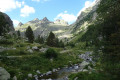
(S/E) From the car park, take the track above and cross the River Gordolasque via the Pont du Countet.
At the signpost just after the bridge, turn left and follow the river up the left bank. The path then quickly gains a little height, crosses a few small torrents via footbridges and reaches a junction at a long footbridge.
Head up a stony, damp path on the right, on the left bank of another stream, the Vallon de l’Autier.
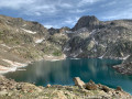
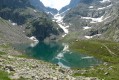
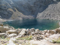
(1) When you reach a path marked with a yellow signpost, turn right (east) to take the path that climbs up the Vallon de l’Autier to the lake of the same name. The path veers away from the valley for a while to gain height, then draws closer to it, following the left bank for a while before crossing over and skirting the right bank. It veers off to the left again towards a tributary stream and then turns right once more to reach Lac Autier.
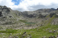
(2) From the lake, follow the path that skirts it to the right and look out for the tracks and cairns leading up the valley of a small stream feeding into the lake. The Baisse du Lac Autier is visible at the far end of the valley. Follow the cairns carefully; the going is somewhat laborious over the scree, mainly on the left bank at first, then more or less in the stream bed once the stream disappears.
Continue in this way to the foot of the pass. The path is then clearly marked but very slippery on a steep and unstable scree slope. Climb carefully , taking care not to dislodge any stones towards the people behind you. This is the trickiest part of the hike.
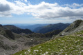
(3) Once at the Baisse du Lac Autier (elevation 2637), you’ll see the Baisse de Valmasque below and Mont Bego above. Then take a well-marked path that climbs along a ledge to the right. Keep heading south-south-east until you reach a fork, where you’ll join a wider path coming from the Baisse de Valmasque.
(4) Climb up to the right (west) and you’ll soon reach a small ridge offering a lovely view over the Vallée des Merveilles. Follow this ridge and the cairns, then descend a few metres in a series of switchbacks to the left. Climb back up to the bottom of a small valley between the Cime de Muffié and the Grand Capelet, and ascend to the left, continuing to follow the cairns. A short slippery section requires you to use your hands and take care before joining a ledge path that takes you just below the eastern summit, from where you reach the highest point of Mont du Grand Capelet in a few steps.
(5) Retrace your steps, descending carefully and following the cairns back to the Valmasque path.
(4) Follow the path straight ahead (north-east) towards the Baisse de Valmasque. This is well marked and presents no difficulty.
(6) At the pass, turn right (south-west) towards the Vallée des Merveilles. Descend through the valley, following the signposted path.
Please note that in this area, the use of metal-tipped walking poles is prohibited, as is straying from the marked paths.
Pass Lac des Merveilles and look out for the few rock carvings, some of which are signposted, along the edge of the path. Continue in this way until you reach marker 93 at Lac Mouton.
(7) Head up to the right (west) towards the Pas de l’Arpette, which you’ll reach quickly after a final uphill push.
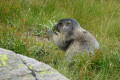
(8) From the Pas de l’Arpette, you leave the restricted area and the use of metal-tipped walking poles is permitted once again. Then descend on the other side of the pass towards the Pont du Countet, where a 1½ to 2-hour descent awaits you! Fortunately, a few chamois will keep you entertained and help you forget your fatigue.
About halfway down the descent, you’ll come to a large green water supply pipe. Follow it for a few dozen metres.
(9) Look out for a passage under the pipe so you can descend to the other side of it.
At the end of the descent, cross the Pont du Countet again to return to the car park at the starting point (S/E).


 Visorando Member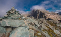

 Difficult