Alpine pastures and woodland above the Vésubie Valley and Valdeblore

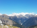
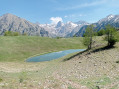
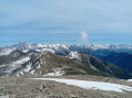
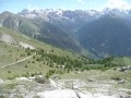
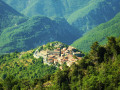
A hike starting from the village of Venanson in the Vésubie Valley; relatively short but with a significant elevation gain. It offers a variety of views over different parts of the region: the Tinée and Vésubie valleys, and the villages in the Valdeblore area. A good mix of wooded and open sections. There are no difficulties with navigation. The paths are clearly visible and the signposts are very helpful.

Details

44736954
Creation:
Last update:
Last review:
  • Walking
    Activity: Walking
  • ↔
    Distance: 6.28 mi
  • ◔
    Average duration: 5h 00 
  • ▲
    Difficulty: Moderate

  • ⚐
    Back to start: Yes
  • ↗
    Ascent: + 2,398 ft
  • ↘
    Descent: - 2,398 ft

  • ▲
    Highest point: 6,250 ft
  • ▼
    Lowest point: 4,485 ft

Description of the walk

The start is near La Vacherie de Salès, also known as Les Colmianes. To get there, head to the village of Venanson from Saint-Martin-Vésubie. In the village, follow the M31 to the 1168-metre mark. A small road branches off to the right: the Route du Relais. Follow this to reach a car park near the Vacherie, where a track begins on the left. Park there: there are around ten spaces available.

(S/E) From the car park, take the path that climbs directly between the track and the access to La Vacherie, and follow it, crossing the track four times.

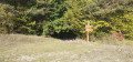
(1) At elevation 1413, continue along the path which climbs steeply through the forest. You’ll reach a junction with a track as you emerge from the forest (watering hole). Continue along the path which climbs steeply, ignoring the track that branches off to the left. You’ll reach a junction at marker 309.

(2) Take the path on the left. Leave the forest and turn right along the path. Join a track and follow it to the left for a few tens of metres. Take the path that climbs to the right. Continue climbing until you reach marker 310 at the Col du Varaire.

(3) Turn left towards the Col des Deux Caïres. Climb, keeping a south-westerly direction, until you reach the pass (view towards the Tinée valley).

(4) Retrace your steps back to the Col du Varaire.

(3) Continue straight on along the ridge (north-east) on the steeply sloping path. You’ll reach the Faut track (water tank).

(5) Cross the track and take the steep path leading uphill opposite (caution: occasional mountain bikes). Reach the Pic de la Colmiane (wooden viewing platform on the left for panoramic views).

(6) Continue eastwards, pass marker 311 and take a wide track that descends towards the Col de Colmiane (marker 312).

(7) Take the second path on the right (north-east) to climb up to Le Conquet. Further on, follow a winding ascent (vegetation may be dense) and pass through some remains of fortifications.

(8) Descend on the other side along a well-marked path, though the first few metres are quite technical. Stay on this path (which is quite exposed) until you reach a track near the top station of a ski lift.

(9) Take the track that branches off to the left at an acute angle (south-west). This will take you to the Col de Colmiane.

(7) Take the second path on the left and descend along the hillside to marker 309, which you saw at the start of the walk.

(2) Turn left and, following the route in reverse to the one taken on the way out, return to the car park where you started (S/E).


Waypoints

  1. S/E : mi 0 - alt. 4,485 ft - Car park in front of the Vacherie de Salès
  2. 1 : mi 0.13 - alt. 4,619 ft - Cross the track. Elevation 1,413
  3. 2 : mi 0.62 - alt. 5,236 ft - Marker 309. Common junction. Return
  4. 3 : mi 1.58 - alt. 5,604 ft - Junction. Round trip - Col du Varaire (1700m)
  5. 4 : mi 2.43 - alt. 6,250 ft - Col des Deux Caïres (1921m)
  6. 5 : mi 3.67 - alt. 5,692 ft - Crossing the track
  7. 6 : mi 3.81 - alt. 5,843 ft - Pic de la Colmiane (1790 m)
  8. 7 : mi 4.39 - alt. 5,387 ft - Junction. Round trip - Col de Colmiane (1641 m)
  9. 8 : mi 4.75 - alt. 5,801 ft - Le Conquet (1776 m)
  10. 9 : mi 4.92 - alt. 5,610 ft - Junction
  11. S/E : mi 6.28 - alt. 4,485 ft - Car park in front of the Vacherie de Salès

Notes

The walk can be shortened by turning immediately right at marker 310. The route over the Col des Deux Caïres is a round trip offering views of the Tinée Valley and Mont Viroulet.

No water source. The restaurant at the Pic de la Colmiane may be open in season. Along the track leading down to the Col Colmiane, there are picnic tables and, a little further down, a covered shelter.

Worth a visit

La Vacherie de Salès sells excellent goat’s and sheep’s cheese in season. You can also find some at the market in Saint Martin Vésubie.

At the summit of the Colmiane, you’ll find the start of the summer toboggan run and the very impressive 1.3 km-long zip line.
From the summit of Le Conquet, there’s a breathtaking view over the Vésubie valley, Roquebillière and beyond.

Reviews and comments

4.7 / 5
Based on 2 reviews

Reliability of the description
5 / 5
Ease of following the route
5 / 5
Route interest
4 / 5
yves.drapp
yves.drapp

Overall rating : 4.7 / 5

Date of your route : Mar 23, 2026
Reliability of the description : ★★★★★ Very good
Ease of following the route : ★★★★★ Very good
Route interest : ★★★★☆ Good
Very busy route : No

We went on this hike whilst there was still snow above 1,800 metres. It wasn’t too difficult, however, apart from the section near the Conquet fortifications, where the snow covered the path. Nevertheless, this hike is varied and offers some lovely views. It’s best to do it in spring when the snow has melted.

Machine-translated

oenolatre
oenolatre

Overall rating : 4.7 / 5

Date of your route : Nov 10, 2025
Reliability of the description : ★★★★★ Very good
Ease of following the route : ★★★★★ Very good
Route interest : ★★★★☆ Good
Very busy route : No

This is a beautiful hike in the hills above La Colmiane, with lovely views of Mont Pétounier and the Vésunie and Tinée valleys. There are no technical difficulties and the paths are well marked. It is a pleasant hike through wooded areas with beautiful autumn colours.

Machine-translated

Other walks in the area

For more walks, use our search engine .

The GPS track and description are the property of this route's author. Please do not copy them without permission.