Country:

 City:
City:


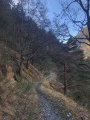
Park in the car park along the road at a place called Ancien Hôtel Auda.
(S/E) Continue along the track to reach marker 142.
(1) Take the path on the left and continue up a gentle slope, following the yellow markings, to reach the junction at marker 143.
(2) Stay on the path on the right, cross several streams, notably those of the Vallons de Cambouti and du Balai, to reach the memorial to Georges-Pierre Lecloux.
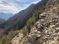
(3) Continue the ascent, skirting the Crête de Verchière, then reach the stream in the Vallon de Cangelard.
(4) Now go round the Crête de Lause. Reach the Vallon de Colle Basse, then follow the left bank of the Ruisseau du Figaret to reach the crossroads at the hamlet of Rimeut, marked by signpost 144.
(5) Continue up a steeper slope towards Les Granges de la Brasque. You will reach another crossroads marked by a cairn.
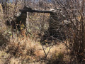
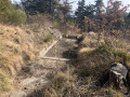
(6) Leave the yellow markings here by turning right. Walk for about fifty metres, passing two ruins. After the second one, head down towards the valley to join an old water channel and follow it. The parallel path is overgrown with dense vegetation. Use the Visorando app if necessary. Once down below, the conduit follows the contour line for a long distance before reaching a bend.
(7) Turn sharply left at a 90° angle from the conduit, which is damaged at this point – take care. Follow the ditch, where there are occasional holes. The conduit resumes further on, leading to a settling tank. Take care here – there is no path. Go to the left of the ditch, which is in line with the settling tank; move to the left and go down the grassy slope. Don’t hesitate to sit on the ground and let yourself slide down. The path is about thirty metres below. Once on it, turn right to reach the junction at marker 150.
(8) Turn right heading due south, following the yellow markings. You’ll reach marker 135, Baisse de Cangelard.
(9) Stay on the path on the right, climbing very slightly until you reach the junction marked with signpost 136.
(10) Turn right again, head due south, passing beneath the Cime du Clot de Raut, then cross the Vallon de Cambouti. You’ll reach the Rastuna junction, marker 138.
(11) Turn right again to reach a wider track.
(12) Continue along the path opposite to cut across the bend in the track. Return to the track, cross it again and rejoin the path opposite. Follow the stream to marker 137.
(13) Turn right onto the track, going round the hamlet of Coupas. Leave the track and take the footpath on the right: there are gates here – make sure you close them properly. Carry on until you reach marker 142, which you passed on the way out.
(1) Turn left and follow the route back in the opposite direction to return to the car park at the hamlet of Ancien Hôtel Auda (S/E).



 But it’s rather strange that this section of the path – even though it was (recently) marked in yellow – isn’t better maintained!
 Visorando Member
 Very difficult
 Association / Club / Walk leader
 Moderate